Area Overview for NN29 7DF
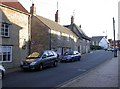
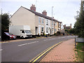
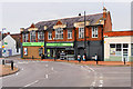
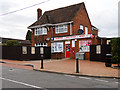
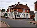
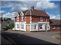
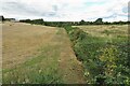
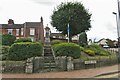
Photos of NN29 7DF


Area Information
Living in NN29 7DF means inhabiting a compact, residential cluster in England that balances quietude with practicality. The area spans just 1.3 hectares, housing 1,658 people across a population density of 237 per square kilometre. This small postcode is defined by its proximity to essential services and its role as a commuter hub. Residents benefit from nearby amenities such as Wellingborough Railway Station, which connects to larger towns, and a selection of retail outlets including Co-op Irchester and Tesco Wellingborough. The area’s character is shaped by its mix of older housing stock and a community profile skewed toward adults aged 30–64. While the environment is not heavily wooded or protected, its low flood risk and absence of planning constraints make it an accessible option for those seeking a stable, low-maintenance lifestyle. For buyers, NN29 7DF offers a snapshot of suburban living with straightforward needs met within a short radius, though its small size means the immediate surroundings are key to its appeal.
- Area Type
- Postcode
- Area Size
- 1.3 hectares
- Population
- 1658
- Population Density
- 237 people/km²
The property market in NN29 7DF is characterised by a 60% home ownership rate, with houses forming the predominant accommodation type. This indicates a market skewed toward owner-occupied properties, though the remaining 40% may include rental units. The focus on houses rather than flats or apartments suggests a preference for single-family living, which is typical in suburban or semi-rural settings. Given the area’s small size—just 1.3 hectares—the housing stock is likely limited, meaning buyers should consider nearby areas for a broader selection. The presence of multiple schools and retail outlets within practical reach also hints at a family-oriented market, where proximity to amenities is a key selling point. However, the compact nature of NN29 7DF means that property availability is constrained, and buyers may need to look beyond the immediate postcode for more options. The market appears to cater to those prioritising stability and established infrastructure over high-value investment properties.
House Prices in NN29 7DF
Showing 27 properties
| Address | Type | Beds | Baths | Last Sale Price | Last Sale Date | |
|---|---|---|---|---|---|---|
| 104 Wollaston Road, Irchester, NN29 7DF | Semi-detached | 3 | 1 | £315,000 | Jun 2024 | |
| 66 Wollaston Road, Irchester, NN29 7DF | Detached | 4 | 1 | £299,000 | Sep 2021 | |
| 120 Wollaston Road, Irchester, NN29 7DF | house | 3 | 1 | £460,000 | Feb 2021 | |
| 84 Wollaston Road, Irchester, NN29 7DF | Terraced | 4 | 1 | £286,900 | Nov 2020 | |
| 102 Wollaston Road, Irchester, NN29 7DF | house | - | - | £275,000 | Nov 2019 | |
| 122 Wollaston Road, Irchester, NN29 7DF | Detached | 4 | 3 | £620,000 | Jun 2019 | |
| 78 Wollaston Road, Irchester, NN29 7DF | house | 4 | - | £145,000 | Jul 2012 | |
| 86 Wollaston Road, Irchester, NN29 7DF | house | - | - | £280,000 | Apr 2012 | |
| 116 Wollaston Road, Irchester, NN29 7DF | house | - | - | £269,000 | Nov 2010 | |
| 76 Wollaston Road, Irchester, NN29 7DF | house | 2 | - | £80,000 | Jun 2010 |
Energy Efficiency in NN29 7DF
The lifestyle in NN29 7DF is shaped by its proximity to retail and transport hubs. Local shops such as Co-op Irchester, Tesco Wellingborough, and Spar provide everyday essentials, reducing the need for long trips to larger centres. The Wellingborough Railway Station adds convenience for commuters, offering access to broader employment and social opportunities. While the area lacks detailed information on parks or leisure facilities, the absence of protected natural sites suggests that residents may need to venture slightly further for recreational spaces. The mix of retail and transport options creates a functional, low-effort lifestyle, ideal for those prioritising convenience over expansive amenities. The compact nature of the area means that daily needs are met within a short radius, though the small size also limits the diversity of venues. For buyers, this translates to a community where practicality and accessibility are key considerations.
Amenities
Schools
Residents of NN29 7DF have access to several primary schools, including Irchester Junior School, Irchester Infant School, and Irchester Community Primary School, which appears listed twice in the data. Knuston Hall is also noted, though its classification as “other” leaves its specific function unclear. The concentration of primary schools suggests that the area is well-suited for families with young children, providing multiple options for education. However, the absence of secondary schools within the postcode means that students may need to travel to nearby towns for further education. The repetition of Irchester Community Primary School in the data may indicate a focus on local schooling, though it could also be an error. Regardless, the presence of multiple primary schools strengthens the area’s appeal for families seeking convenience and choice in early education.
| Rank | School | Type | Entry gender | Ages |
|---|
Explore more schools in this area
Go to Schools tabDemographics
The community in NN29 7DF is predominantly composed of adults aged 30–64, with a median age of 47. This suggests a settled population, likely including families and professionals in mid-career. Home ownership stands at 60%, indicating a mix of owner-occupied properties and rental units, though the exact proportion of renters is not specified. The accommodation type is primarily houses, which aligns with the area’s residential character and suggests a focus on single-family homes. The predominant ethnic group is White, though no data is provided on other demographics. The population density of 237 per square kilometre implies a moderately compact settlement, with enough space to avoid overcrowding. While no deprivation statistics are included, the presence of multiple schools and retail options suggests that basic needs are met. The age profile and home ownership rate together suggest a community that values stability and long-term residence over transient living.
Household Size
Accommodation Type
Tenure
Ethnic Group
Religion
Household Composition
Age
Household Deprivation
NS-SEC
Explore more demographic insights in this area
Go to Demographics tabPlanning
Planning Constraints
- Flood RiskPremium
- Ramsar Wetland SitesPremium
- Area of Outstanding Natural BeautyPremium
- Protected Nature ReservePremium
- Protected WoodlandPremium