Area Overview for NN29 7DA
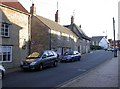
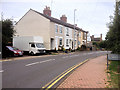
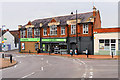
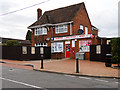
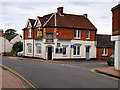
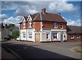
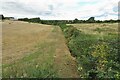
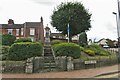
Photos of NN29 7DA


Area Information
NN29 7DA is a compact residential area in England, covering just 1.3 hectares and home to 1,658 residents. Its small size means it is a tightly knit community, with a population density of 237 people per square kilometre. This postcode area is part of a broader rural or semi-rural landscape, with no major urban infrastructure nearby. Daily life here is shaped by its proximity to Wellingborough Railway Station, which provides a direct link to larger towns. The area’s character is defined by its mix of older and newer housing stock, predominantly owner-occupied homes. Residents benefit from nearby retail options, including a Co-op, Spar, and Budgens, though the selection is modest. The area’s appeal lies in its quiet, low-density living, suitable for those seeking a slower pace of life. However, its small size means amenities are limited to immediate surroundings. For buyers, this area offers a snapshot of rural living with minimal urban sprawl, though its isolation may require reliance on nearby towns for more services.
- Area Type
- Postcode
- Area Size
- 1.3 hectares
- Population
- 1658
- Population Density
- 237 people/km²
The property market in NN29 7DA is characterised by a high rate of home ownership—60% of properties are owner-occupied—suggesting a community of long-term residents rather than a transient rental market. The accommodation type is predominantly houses, which is typical of smaller rural or semi-rural areas. This contrasts with urban centres where flats or apartments dominate. The small area size of 1.3 hectares means the housing stock is limited, and the market is likely to be niche, appealing to buyers seeking low-density living. With no data on property prices or recent sales, it is difficult to assess affordability, but the owner-occupied nature of the market implies stability. Buyers should consider the area’s isolation, as nearby amenities are minimal. For those prioritising a quiet, family-friendly environment with a focus on home ownership, NN29 7DA may be attractive, though its small size means competition for properties could be limited.
House Prices in NN29 7DA
Showing 51 properties
| Address | Type | Beds | Baths | Last Sale Price | Last Sale Date | |
|---|---|---|---|---|---|---|
| 87 Wollaston Road, Irchester, NN29 7DA | Terraced | 3 | 1 | £175,000 | Jul 2025 | |
| 3 Wollaston Road, Irchester, NN29 7DA | Terraced | 2 | 1 | £179,000 | May 2024 | |
| 29 Wollaston Road, Irchester, NN29 7DA | Terraced | 3 | 1 | £210,000 | Apr 2024 | |
| 23 Wollaston Road, Irchester, NN29 7DA | house | 3 | 1 | £212,000 | Nov 2023 | |
| 51 Wollaston Road, Irchester, NN29 7DA | house | 3 | 1 | £280,000 | Oct 2022 | |
| 25 Wollaston Road, Irchester, NN29 7DA | house | - | - | £225,000 | Jul 2022 | |
| 5 Wollaston Road, Irchester, NN29 7DA | house | 2 | 1 | £190,000 | Jan 2022 | |
| 85 Wollaston Road, Irchester, NN29 7DA | house | - | - | £155,000 | Jun 2021 | |
| 83 Wollaston Road, Irchester, NN29 7DA | Terraced | 2 | 1 | £185,000 | Dec 2020 | |
| 43 Wollaston Road, Irchester, NN29 7DA | Terraced | 2 | 1 | £177,000 | Jun 2020 |
Energy Efficiency in NN29 7DA
The lifestyle in NN29 7DA is shaped by its proximity to small-scale retail and a single railway station. Within practical reach are five retail outlets, including a Co-op, Spar, and Budgens, offering essentials like groceries and convenience items. These shops cater to daily needs but do not provide the variety found in larger towns. The area lacks major leisure or entertainment venues, with no parks or recreational facilities listed. The railway station provides a link to Wellingborough, enabling access to more extensive amenities. For residents, the lifestyle is simple, with a focus on local services and quiet living. The absence of larger facilities means community life is likely centred around nearby towns, requiring regular travel. The retail options and transport links suggest a practical, no-frills approach to daily life, suitable for those prioritising convenience over urban vibrancy.
Amenities
Schools
Residents of NN29 7DA have access to several primary schools within practical reach. These include Irchester Junior School, Irchester Infant School, and Irchester Community Primary School, which appears listed twice in the data. Knuston Hall is also noted, though its classification as an “other” type school is unclear. The presence of multiple primary schools suggests the area is well-served for families with young children, though no specific Ofsted ratings are provided. The concentration of primary schools indicates a focus on local education, reducing the need for long commutes to larger towns. However, the absence of secondary schools or further education institutions means families may need to travel to nearby centres for older children. The school mix reflects a community prioritising early education, but buyers should verify the quality of these institutions independently, as the data does not include performance metrics.
| Rank | School | Type | Entry gender | Ages |
|---|
Explore more schools in this area
Go to Schools tabDemographics
The population of NN29 7DA has a median age of 47, with the majority of residents aged between 30 and 64. This suggests a community skewed towards middle-aged adults, likely including families and professionals. Home ownership is high at 60%, indicating a stable, long-term resident base. The area is predominantly composed of houses, which aligns with the demographic profile of older, established households. The predominant ethnic group is White, though specific data on diversity is not provided. The age range and home ownership figures suggest a community with a focus on family living and long-term residency. With no data on deprivation levels, it is unclear how this impacts access to services, but the presence of multiple primary schools and retail outlets implies basic needs are met. The population density, while moderate, means the area is neither overly crowded nor sparsely populated, offering a balance for those seeking residential space without urban congestion.
Household Size
Accommodation Type
Tenure
Ethnic Group
Religion
Household Composition
Age
Household Deprivation
NS-SEC
Explore more demographic insights in this area
Go to Demographics tabPlanning
Planning Constraints
- Flood RiskPremium
- Ramsar Wetland SitesPremium
- Area of Outstanding Natural BeautyPremium
- Protected Nature ReservePremium
- Protected WoodlandPremium