Area Overview for NN2 8AL
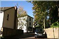
Photos of NN2 8AL


Area Information
NN2 8AL is a compact residential postcode in England, covering just 4.8 hectares yet home to 1641 residents. This small cluster of homes is densely populated, with 33,841 people per square kilometre, reflecting a tightly knit community. The area’s character is defined by its mix of established housing and proximity to key services. With a median age of 47, the population skews towards adults aged 30–64, suggesting a stable, mature demographic. Daily life here is shaped by the availability of nearby amenities, including retail hubs like Heron Kingsthorpe and essential transport links. The low crime risk and absence of environmental constraints such as flood zones or protected landscapes make it an appealing choice for those seeking a safe, practical living environment without the complexities of rural or conservation areas.
- Area Type
- Postcode
- Area Size
- 4.8 hectares
- Population
- 1641
- Population Density
- 4828 people/km²
The property market in NN2 8AL is characterised by a high rate of home ownership (77%), suggesting it is not a rental-heavy area. The accommodation type is predominantly houses, which may appeal to those seeking private, stable living arrangements. Given the area’s small size (4.8 hectares) and high population density, the housing stock is likely limited, making it a niche market with limited availability. Buyers should consider the compact nature of the area, which means properties are closely spaced and surrounded by immediate neighbours. The focus on owner-occupation implies a community of long-term residents, which can contribute to a sense of continuity and local identity. However, the small footprint of the postcode means that expansion or new developments are unlikely, reinforcing the need for buyers to act decisively when opportunities arise.
House Prices in NN2 8AL
Showing 24 properties
| Address | Type | Beds | Baths | Last Sale Price | Last Sale Date | |
|---|---|---|---|---|---|---|
| 158 Welford Road, Northampton, NN2 8AL | house | 3 | 1 | £260,000 | Apr 2025 | |
| 152 Welford Road, Northampton, NN2 8AL | Semi-detached | 4 | 3 | £415,000 | Jan 2025 | |
| 162 Welford Road, Northampton, NN2 8AL | Semi-detached | 3 | - | £289,000 | Jul 2024 | |
| 168 Welford Road, Northampton, NN2 8AL | house | - | - | £210,000 | Nov 2023 | |
| 164 Welford Road, Northampton, NN2 8AL | Semi-detached | 3 | 1 | £260,000 | May 2023 | |
| 174 Welford Road, Northampton, NN2 8AL | Semi-detached | 3 | - | £282,000 | Apr 2022 | |
| 134 Welford Road, Northampton, NN2 8AL | Semi-detached | 3 | - | £350,000 | Aug 2021 | |
| 170 Welford Road, Northampton, NN2 8AL | Semi-detached | 4 | 2 | £297,000 | Jun 2021 | |
| 154 Welford Road, Northampton, NN2 8AL | Semi-detached | 3 | - | £227,500 | Jun 2020 | |
| 146 Welford Road, Northampton, NN2 8AL | Semi-detached | 3 | 1 | £222,500 | Sep 2019 |
Energy Efficiency in NN2 8AL
The lifestyle in NN2 8AL is shaped by its proximity to practical amenities. Retail options include Heron Kingsthorpe, M&S Harborough BP, and Waitrose Kingsthorpe, offering a range of shopping experiences within easy reach. The area’s transport links, including Northampton Bus Interchange and the railway station, facilitate access to broader destinations. While the postcode itself is small, the surrounding area provides a balance of convenience and accessibility. The absence of expansive parks or leisure facilities means residents may need to travel slightly further for recreational activities, but the compact layout ensures daily errands and social interactions remain efficient.
Amenities
Schools
The nearest school to NN2 8AL is Kingsthorpe Middle Community School, a primary institution serving the local area. While no Ofsted rating is provided, the presence of a primary school suggests the area caters to families with younger children. The absence of secondary schools or other educational institutions in the immediate vicinity means parents may need to consider commuting for higher education. However, the proximity of Northampton Railway Station and bus interchanges could ease travel for students. The single primary school reflects the area’s modest scale, offering a straightforward but limited educational landscape for families.
| Rank | School | Type | Entry gender | Ages |
|---|
Explore more schools in this area
Go to Schools tabDemographics
The community in NN2 8AL is predominantly composed of adults aged 30–64, with a median age of 47. This suggests a population that is largely settled, with fewer young families or retirees compared to other areas. Home ownership is high, at 77%, indicating a strong presence of long-term residents. The accommodation type is primarily houses, which aligns with the area’s density and suggests a mix of family homes and smaller properties. The predominant ethnic group is White, though no further breakdown of diversity is provided. The high population density—33,841 people per square kilometre—means the area is compact, with limited space for expansion. This density can influence local dynamics, fostering a close-knit environment but also requiring efficient use of shared spaces and services.
Household Size
Accommodation Type
Tenure
Ethnic Group
Religion
Household Composition
Age
Household Deprivation
NS-SEC
Explore more demographic insights in this area
Go to Demographics tabPlanning
Planning Constraints
- Flood RiskPremium
- Ramsar Wetland SitesPremium
- Area of Outstanding Natural BeautyPremium
- Protected Nature ReservePremium
- Protected WoodlandPremium