Area Overview for NN2 8HJ
Photos of NN2 8HJ


Area Information
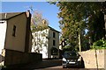
NN2 8HJ is a small, densely populated residential postcode in England, covering just 1.2 hectares. With 1,397 residents packed into this compact area, it reflects a tight-knit community. The population density of 114,297 people per square kilometre highlights its urban character, though the area remains focused on housing rather than commercial development. Most residents are adults aged 30–64, with a median age of 47, suggesting a stable, mature demographic. The high home ownership rate of 89% indicates a community of long-term residents, many of whom live in houses rather than flats. Daily life here is shaped by proximity to essential services, including retail hubs like Tesco Northampton and transport links such as Northampton Railway Station. The area’s safety record is strong, with a crime risk score of 92, and no significant environmental hazards like flood zones or protected landscapes. Living in NN2 8HJ means navigating a densely populated but functional urban environment, where convenience and security are key priorities.
- Area Type
- Postcode
- Area Size
- 1.2 hectares
- Population
- 1397
- Population Density
- 4542 people/km²
The property market in NN2 8HJ is dominated by owner-occupied homes, with 89% of residents living in properties they own. This high rate of home ownership suggests a community of long-term residents rather than a transient rental market. The accommodation type is exclusively houses, which is unusual for a small postcode area and may indicate a mix of family homes and larger properties. Given the area’s limited size and high population density, the housing stock is constrained, meaning buyers may need to consider nearby areas for more options. The focus on owner-occupation implies strong local demand, but the small scale of the area means property availability is likely limited. For buyers, this suggests a need to balance proximity to amenities with the practical realities of a saturated local market.
House Prices in NN2 8HJ
Showing 14 properties
| Address | Type | Beds | Baths | Last Sale Price | Last Sale Date | |
|---|---|---|---|---|---|---|
| 12 North Western Avenue, Northampton, NN2 8HJ | Bungalow | 2 | 1 | £320,000 | Jul 2025 | |
| 16 North Western Avenue, Northampton, NN2 8HJ | Semi-detached | 3 | 1 | £320,000 | Jul 2025 | |
| 8 North Western Avenue, Northampton, NN2 8HJ | Bungalow | 3 | 2 | £410,000 | Feb 2025 | |
| 4A North Western Avenue, Northampton, NN2 8HJ | house | - | - | £200,000 | Feb 2022 | |
| 6 North Western Avenue, Northampton, NN2 8HJ | Bungalow | 3 | - | £342,500 | Apr 2021 | |
| 20 North Western Avenue, Northampton, NN2 8HJ | Bungalow | - | - | £248,000 | Dec 2020 | |
| 24 North Western Avenue, Northampton, NN2 8HJ | Semi-detached | 2 | 1 | £235,000 | Dec 2018 | |
| 14 North Western Avenue, Northampton, NN2 8HJ | Bungalow | - | - | £166,000 | Sep 2014 | |
| 26 North Western Avenue, Northampton, NN2 8HJ | Bungalow | - | - | £405,000 | Dec 2011 | |
| 18 North Western Avenue, Northampton, NN2 8HJ | Bungalow | - | - | £175,000 | Dec 2009 |
Energy Efficiency in NN2 8HJ
Living in NN2 8HJ grants access to a range of nearby amenities, including five retail outlets such as Tesco Northampton and M&S Harborough BP. These shops provide everyday convenience for groceries, clothing, and other essentials. The area’s transport links, including Northampton Bus Interchange and the University Bus Interchange, connect residents to broader networks for work, education, or leisure. While there are no named parks or leisure facilities listed, the proximity to Northampton Railway Station opens access to larger urban amenities. The compact nature of the area means residents can reach essential services quickly, supporting a practical, low-maintenance lifestyle. The presence of multiple retail options and transport hubs enhances the area’s appeal for those prioritising accessibility and convenience.
Amenities
Schools
| Rank | School | Type | Entry gender | Ages |
|---|
Explore more schools in this area
Go to Schools tabDemographics
The community in NN2 8HJ is predominantly composed of adults aged 30–64, with a median age of 47. This suggests a population that is largely established, with fewer young families or elderly residents. Home ownership is exceptionally high at 89%, indicating a strong preference for long-term residency over rental properties. The accommodation type is primarily houses, which aligns with the area’s low population density relative to its size. The predominant ethnic group is White, reflecting a homogenous demographic profile. While no specific data on deprivation is provided, the high home ownership and stable age range suggest a community with relatively consistent access to resources. The absence of significant diversity metrics means the area’s social fabric is largely shaped by its core demographic. This profile may appeal to buyers seeking a settled, low-risk environment with minimal turnover.
Household Size
Accommodation Type
Tenure
Ethnic Group
Religion
Household Composition
Age
Household Deprivation
NS-SEC
Explore more demographic insights in this area
Go to Demographics tabPlanning
Planning Constraints
- Flood RiskPremium
- Ramsar Wetland SitesPremium
- Area of Outstanding Natural BeautyPremium
- Protected Nature ReservePremium
- Protected WoodlandPremium