Area Overview for NN2 8AT
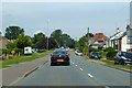
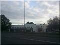
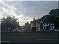
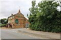
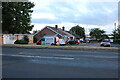
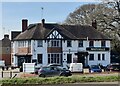
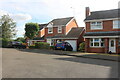
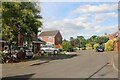
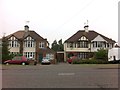
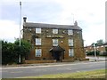
Photos of NN2 8AT


Area Information
NN2 8AT is a compact residential postcode in England, covering just 2.5 hectares and home to 1,641 people. Its high population density of 64,544 people per square kilometre reflects its small, tightly knit character. This area is defined by its residential focus, with most properties being houses rather than flats. The median age of 47 suggests a community of established adults, many in the 30–64 age range. Daily life here is shaped by proximity to essential services, with nearby shops, transport hubs, and schools within easy reach. The area’s small size means it is likely part of a larger town or city, with residents relying on surrounding districts for broader amenities. Despite its density, the low flood risk and absence of environmental constraints make it a practical choice for buyers seeking a stable, well-connected neighbourhood. The high broadband score of 100 ensures seamless digital connectivity, supporting both work and leisure. For those prioritising safety, the area’s below-average crime rate further enhances its appeal.
- Area Type
- Postcode
- Area Size
- 2.5 hectares
- Population
- 1641
- Population Density
- 4828 people/km²
The property market in NN2 8AT is characterised by high home ownership, with 77% of residents owning their homes. This suggests a stable, long-term market with limited rental activity. The predominance of houses over flats indicates a focus on family-friendly, private living spaces. Given the area’s small size—just 2.5 hectares—the housing stock is likely limited, meaning buyers may need to consider nearby areas for additional options. The high ownership rate also implies strong community ties, with many residents having lived in the area for years. For buyers, this means competition for available properties, particularly for those seeking established homes. The absence of planning constraints such as protected woodlands or areas of outstanding natural beauty may make development less restricted, though the small size of the area suggests limited scope for expansion. Prospective buyers should also consider the proximity to transport and amenities when evaluating property value.
House Prices in NN2 8AT
Showing 42 properties
| Address | Type | Beds | Baths | Last Sale Price | Last Sale Date | |
|---|---|---|---|---|---|---|
| 8 Barley Lane, Northampton, NN2 8AT | Detached | 3 | 1 | £305,000 | Jul 2024 | |
| 7 Barley Lane, Northampton, NN2 8AT | Semi-detached | 3 | 1 | £258,000 | May 2024 | |
| 38 Barley Lane, Northampton, NN2 8AT | house | - | - | £260,000 | Oct 2022 | |
| 11 Barley Lane, Northampton, NN2 8AT | house | - | - | £267,000 | Mar 2021 | |
| 15 Barley Lane, Northampton, NN2 8AT | house | - | - | £220,000 | Aug 2020 | |
| 18 Barley Lane, Northampton, NN2 8AT | Semi-detached | 3 | - | £240,000 | Jul 2020 | |
| 12 Barley Lane, Northampton, NN2 8AT | Semi-detached | 3 | - | £193,000 | Oct 2019 | |
| 56 Barley Lane, Northampton, NN2 8AT | Bungalow | 3 | 1 | £215,000 | Dec 2018 | |
| 26 Barley Lane, Northampton, NN2 8AT | Semi-detached | 2 | 1 | £222,500 | Aug 2018 | |
| 20 Barley Lane, Northampton, NN2 8AT | Semi-detached | 3 | - | £219,995 | Jun 2017 |
Energy Efficiency in NN2 8AT
Living in NN2 8AT offers access to a range of essential amenities within practical reach. Retail options include major chains such as Tesco Northampton, M&S Harborough BP, and Morrisons Daily, providing convenience for daily shopping needs. The area’s proximity to the University Bus Interchange and Northampton Bus Interchange ensures easy access to public transport, supporting both local and long-distance travel. The Northampton Railway Station further expands mobility, linking residents to regional destinations. While the data does not mention parks or leisure facilities, the presence of retail and transport hubs suggests a lifestyle focused on practicality and connectivity. The compact nature of the area means residents are likely to rely on nearby districts for more specialised amenities such as gyms, cafes, or cultural venues. Overall, the area balances essential services with accessibility, catering to both everyday needs and broader mobility.
Amenities
Schools
The nearest school to NN2 8AT is Kingsthorpe Middle Community School, a primary institution. While no secondary schools are listed in the data, the presence of a primary school suggests the area is well-served for younger children’s education. Families with older children may need to look further afield for secondary schooling options. The single school listed indicates a focus on primary education, which could be advantageous for parents seeking a strong foundation for their children’s learning. However, the absence of additional schools means the area may not cater to all educational needs without commuting. The quality of the school is not specified, but its existence within practical reach of residents highlights its role in the local community. For families prioritising proximity to schools, this primary institution is a key asset.
| Rank | School | Type | Entry gender | Ages |
|---|
Explore more schools in this area
Go to Schools tabDemographics
The population of NN2 8AT is predominantly adults aged 30–64, with a median age of 47. This suggests a mature, settled community, likely with strong family ties and established careers. Home ownership is high, at 77%, indicating a stable housing market with fewer renters. The majority of properties are houses, reflecting a preference for private, family-oriented living spaces. The predominant ethnic group is White, though no specific diversity statistics are provided. The age profile and ownership figures suggest a low turnover of residents, with many likely to have lived in the area for years. The absence of detailed deprivation data means the quality of life is inferred from the safety, connectivity, and amenities available. The compact nature of the area, combined with its high population density, implies a close-knit community where local services and social networks are likely to be well-developed.
Household Size
Accommodation Type
Tenure
Ethnic Group
Religion
Household Composition
Age
Household Deprivation
NS-SEC
Explore more demographic insights in this area
Go to Demographics tabPlanning
Planning Constraints
- Flood RiskPremium
- Ramsar Wetland SitesPremium
- Area of Outstanding Natural BeautyPremium
- Protected Nature ReservePremium
- Protected WoodlandPremium