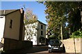
Area Overview for NN2 8AP
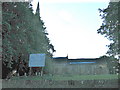
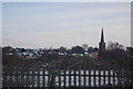
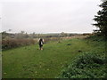
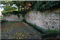
Photos of NN2 8AP


Area Information
Living in NN2 8AP means being part of a tightly knit residential cluster in England, where 1,641 people reside across just 1.6 hectares. The area’s high population density—105,658 people per square kilometre—reflects its compact nature, ideal for those seeking proximity to amenities without sacrificing space. This postcode is characterised by a mature community, with a median age of 47 and a majority of residents aged 30–64. The area’s housing stock is predominantly owner-occupied, with 77% of homes owned by residents, suggesting a stable, long-term demographic. Daily life here is shaped by its strategic location, with nearby retail hubs like M&S Harborough BP and Tesco Northampton within practical reach. The presence of Northampton Railway Station and multiple bus interchanges ensures easy access to the city’s broader networks. While small, the area’s density and connectivity make it a viable choice for those prioritising convenience and a balanced lifestyle.
- Area Type
- Postcode
- Area Size
- 1.6 hectares
- Population
- 1641
- Population Density
- 4828 people/km²
The property market in NN2 8AP is dominated by owner-occupied homes, with 77% of properties owned by residents. This high home ownership rate suggests a community focused on long-term residency rather than transient rental markets. The accommodation type is predominantly houses, which is unusual for areas with high density but aligns with the postcode’s small, residential character. Given the area’s compact size, the housing stock is limited, making it a niche market for buyers seeking proximity to amenities. The prevalence of houses may appeal to those desiring more space, though the small area means immediate surroundings are likely to mirror similar housing types. Buyers should consider the area’s proximity to transport links and retail hubs, which could enhance property value. However, the limited size of NN2 8AP means the market is not expansive, requiring careful consideration of local constraints.
House Prices in NN2 8AP
Showing 27 properties
| Address | Type | Beds | Baths | Last Sale Price | Last Sale Date | |
|---|---|---|---|---|---|---|
| 9 Penfold Close, Northampton, NN2 8AP | house | - | - | £198,972 | Oct 2025 | |
| 1 Penfold Close, Northampton, NN2 8AP | Semi-detached | 3 | 1 | £273,000 | Apr 2025 | |
| 15 Penfold Close, Northampton, NN2 8AP | Semi-detached | 3 | - | £230,000 | Mar 2018 | |
| 30 Penfold Close, Northampton, NN2 8AP | Detached | 4 | - | £1,623,310 | Mar 2018 | |
| 2 Penfold Close, Northampton, NN2 8AP | house | - | - | £269,950 | Nov 2017 | |
| 21 Penfold Close, Northampton, NN2 8AP | Semi-detached | 3 | - | £190,000 | May 2015 | |
| 13 Penfold Close, Northampton, NN2 8AP | house | 3 | - | £142,000 | Apr 2011 | |
| 5 Penfold Close, Northampton, NN2 8AP | house | - | - | £219,950 | Dec 2007 | |
| 7 Penfold Close, Northampton, NN2 8AP | Semi-detached | 3 | - | £173,000 | Sep 2007 | |
| 19 Penfold Close, Northampton, NN2 8AP | Semi-detached | - | - | £185,000 | Jul 2007 |
Energy Efficiency in NN2 8AP
Life in NN2 8AP is shaped by its proximity to retail, dining, and transport hubs. The area’s retail landscape includes M&S Harborough BP, Tesco Northampton, and Heron Kingsthorpe, offering a range of shopping and dining options within easy reach. These venues cater to daily needs, from groceries to leisure spending, reducing the necessity for long commutes. The presence of Northampton Railway Station and multiple bus interchanges enhances mobility, allowing residents to access the city’s cultural and professional centres swiftly. While the data does not specify parks or leisure facilities, the area’s density suggests a focus on urban convenience over expansive green spaces. The mix of retail and transport options creates a lifestyle that balances local amenities with broader connectivity, appealing to those who prioritise accessibility and practicality.
Amenities
Schools
The nearest school to NN2 8AP is Kingsthorpe Middle Community School, a primary institution serving the area. No secondary schools are listed in the data, meaning families may need to look beyond the immediate postcode for comprehensive education. The presence of a primary school suggests the area is suitable for younger children, though parents seeking secondary schooling may need to plan for commuting to nearby towns. The single school type indicates a focus on early education, which could be a consideration for families with older children. While the data does not provide Ofsted ratings, the existence of a community school may imply a locally supported educational environment. Prospective buyers should verify secondary school options in adjacent areas to ensure alignment with their children’s needs.
| Rank | School | Type | Entry gender | Ages |
|---|
Explore more schools in this area
Go to Schools tabDemographics
The community in NN2 8AP is defined by its age profile, with a median age of 47 and 77% of residents falling within the 30–64 age range. This suggests a population skewed towards established adults, likely with families or long-term careers. Home ownership is high at 77%, indicating a preference for settled living over rental tenancies. The accommodation type is predominantly houses, reflecting a more traditional housing stock compared to flats or apartments. The predominant ethnic group is White, which aligns with broader regional trends. The area’s demographic stability—without significant data on deprivation—suggests a consistent quality of life, though the lack of diversity data means the community’s cultural dynamics remain unexplored. The age range implies a balance between active professionals and those nearing retirement, shaping local amenities and services.
Household Size
Accommodation Type
Tenure
Ethnic Group
Religion
Household Composition
Age
Household Deprivation
NS-SEC
Explore more demographic insights in this area
Go to Demographics tabPlanning
Planning Constraints
- Flood RiskPremium
- Ramsar Wetland SitesPremium
- Area of Outstanding Natural BeautyPremium
- Protected Nature ReservePremium
- Protected WoodlandPremium