Area Overview for NN2 6RE
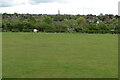
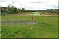
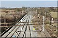
Photos of NN2 6RE


Area Information
NN2 6RE is a compact residential postcode in England, covering just 1172 m² and home to 1587 people. Its high population density of 1.35 million per square kilometre reflects its small, tightly knit character. This area is defined by its proximity to essential services and transport links, making it practical for daily life. Residents benefit from nearby primary schools, retail hubs, and public transport, including Northampton Railway Station and multiple bus interchanges. The community is predominantly middle-aged, with a median age of 47 and a strong presence of adults aged 30–64. Owner-occupation is common, with 70% of homes owned by residents, suggesting a stable, long-term demographic. Daily life here balances convenience with a sense of familiarity, supported by a mix of local amenities and the area’s strategic location. Whether commuting to Northampton or accessing nearby retail, NN2 6RE offers a functional, accessible lifestyle for families and professionals alike.
- Area Type
- Postcode
- Area Size
- 1172 m²
- Population
- 1587
- Population Density
- 2081 people/km²
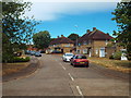
The property market in NN2 6RE is characterised by a high rate of home ownership, with 70% of homes owned by residents. This suggests a predominantly owner-occupied area, which may indicate stability and long-term investment in the community. The accommodation type is primarily houses, reflecting a residential focus rather than flats or apartments. Given the area’s small size of 1172 m², the housing stock is limited, which could mean fewer options for buyers. However, the proximity to Northampton and its transport links may extend the practical reach of the area, offering buyers access to a broader housing market beyond NN2 6RE itself. The compact nature of the postcode also means properties are likely to be closely spaced, which could be a consideration for those seeking larger plots or more space. For buyers, this area presents a mix of established homes in a tightly knit community.
House Prices in NN2 6RE
Showing 5 properties
| Address | Type | Beds | Baths | Last Sale Price | Last Sale Date | |
|---|---|---|---|---|---|---|
| 4 Fremeaux Terrace, Northampton, NN2 6RE | Terraced | 4 | 1 | £325,000 | Dec 2020 | |
| Moorlands, 5 Fremeaux Terrace, Northampton, NN2 6RE | Terraced | 3 | 2 | £365,000 | Nov 2019 | |
| 3 Fremeaux Terrace, Northampton, NN2 6RE | Semi-detached | 3 | - | £249,000 | Apr 2006 | |
| 1 Fremeaux Terrace, Northampton, NN2 6RE | Terraced | 3 | - | £80,000 | Jun 1998 | |
| 2 Fremeaux Terrace, Northampton, NN2 6RE | Terraced | 3 | 1 | - | - |
Energy Efficiency in NN2 6RE
The lifestyle in NN2 6RE is shaped by its proximity to retail, transport, and community hubs. Nearby shops include Cook Kingsthorpe, Waitrose Kingsthorpe, and Heron Kingsthorpe, offering a range of shopping and dining options. These venues contribute to a convenient, walkable environment where residents can access daily essentials without long journeys. The area’s transport links, including Northampton Bus Interchange and the railway station, ensure easy access to broader regional networks. While the data does not mention parks or leisure facilities, the compact layout suggests that local amenities are closely clustered, fostering a sense of community. The presence of schools and retail options indicates a balance between practicality and livability, making daily life in NN2 6RE both efficient and connected.
Amenities
Schools
Residents of NN2 6RE have access to two primary schools: St John the Baptist CofE Lower School and Kingsthorpe Village Primary School. Both cater to younger children, ensuring families have nearby options for early education. Kingsthorpe Village Primary School holds a ‘good’ Ofsted rating, which is a strong indicator of quality. The presence of two primary schools within practical reach suggests a focus on family-friendly infrastructure, supporting parents who prioritise proximity to education. While no secondary schools are listed in the data, the primary options available provide a solid foundation for children’s schooling. This mix of schools, combined with the area’s compact layout, makes NN2 6RE appealing to families seeking convenience and reliable educational provision.
| Rank | School | Type | Entry gender | Ages |
|---|
Explore more schools in this area
Go to Schools tabDemographics
The population of NN2 6RE is 1587, with a median age of 47 and a majority of residents aged 30–64. This suggests a community of established individuals, likely with families, given the presence of primary schools. Home ownership is high at 70%, indicating a preference for long-term residency over rental properties. The area is predominantly composed of houses, reflecting a traditional, family-oriented housing stock. The predominant ethnic group is White, though no specific data on diversity or deprivation is provided. The high population density of 1.35 million per square kilometre implies a compact, closely spaced residential layout. This density, combined with the age profile, points to a mature, stable community where most residents are likely to have been living for many years. The lack of specific diversity data means the demographic picture remains focused on the core statistics provided.
Household Size
Accommodation Type
Tenure
Ethnic Group
Religion
Household Composition
Age
Household Deprivation
NS-SEC
Explore more demographic insights in this area
Go to Demographics tabPlanning
Planning Constraints
- Flood RiskPremium
- Ramsar Wetland SitesPremium
- Area of Outstanding Natural BeautyPremium
- Protected Nature ReservePremium
- Protected WoodlandPremium