Area Overview for NN2 6RA
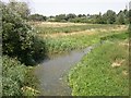
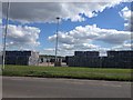
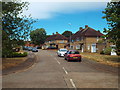
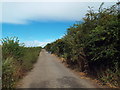
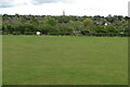
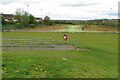
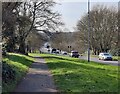
Photos of NN2 6RA


Area Information
NN2 6RA is a small residential cluster in England, home to 1,587 people. This area is characterised by its compact size and established community feel, with a median age of 47 and a population skewed towards adults aged 30–64. The neighbourhood is predominantly composed of owner-occupied homes, with 70% of properties in private ownership. Most residences are houses rather than flats, reflecting a quieter, more traditional living environment. Proximity to St John the Baptist CofE Lower School and Kingsthorpe Village Primary School ensures families have access to quality primary education. The area’s connectivity is strong, with Northampton Railway Station and multiple bus interchanges within reach, while retail options like Waitrose Kingsthorpe and Heron Kingsthorpe provide everyday convenience. Living in NN2 6RA offers a balance of practicality and community, with low flood risk and a straightforward lifestyle. It is a place where stability and accessibility meet, ideal for those seeking a settled, family-oriented environment.
- Area Type
- Postcode
- Area Size
- Not available
- Population
- 1587
- Population Density
- 2081 people/km²
The property market in NN2 6RA is dominated by owner-occupied homes, with 70% of properties in private hands. This contrasts with areas where rental demand drives the market, suggesting a more stable, long-term resident base. The predominant accommodation type is houses, which are typically larger and more suited to families or individuals seeking space. Given the area’s small size, the housing stock is limited, and buyers should consider the immediate surroundings for additional options. The high home ownership rate indicates strong local attachment, which may influence property values and availability. For those seeking a home, the focus on houses rather than flats means buyers should prioritise locations with garden space or outdoor access. The market is unlikely to cater to short-term renters, making it a viable choice for those planning a permanent move.
House Prices in NN2 6RA
No properties found in this postcode.
Energy Efficiency in NN2 6RA
The lifestyle in NN2 6RA is shaped by its proximity to retail, transport, and community hubs. Local shops such as Cook Kingsthorpe, Waitrose Kingsthorpe, and Heron Kingsthorpe offer a range of goods, from groceries to specialty items, reducing the need for long trips. The area’s bus interchanges and railway station provide direct links to Northampton and beyond, facilitating access to cultural, professional, and leisure opportunities. While there is no mention of parks or recreational spaces in the data, the presence of schools and retail suggests a focus on practicality over expansive green areas. The mix of amenities supports a convenient, low-maintenance lifestyle, ideal for those prioritising accessibility over sprawling natural landscapes. The character of the area is defined by its compactness and the ease of navigating daily needs.
Amenities
Schools
Residents of NN2 6RA have access to two primary schools: St John the Baptist CofE Lower School and Kingsthorpe Village Primary School, the latter of which holds an Ofsted rating of ‘good’. These institutions provide a range of educational options for young children, though no secondary schools are listed in the data. The presence of two primary schools within reach suggests a family-friendly environment, reducing the need for long commutes to education. For parents, the ‘good’ rating at Kingsthorpe Village Primary School indicates a reliable standard of teaching and facilities. However, families requiring secondary education may need to look beyond the immediate area. The school mix supports early years education but does not address older children’s needs, which is a practical consideration for prospective buyers.
| Rank | School | Type | Entry gender | Ages |
|---|
Explore more schools in this area
Go to Schools tabDemographics
The population of NN2 6RA is 1,587, with a median age of 47. Over 70% of residents own their homes, and the majority are adults aged 30–64. This suggests a mature, established community with a focus on long-term residency. The area is predominantly White, with no data indicating significant ethnic diversity. The absence of specific deprivation data means the quality of life can be inferred from the high home ownership rate and the presence of essential amenities. The age profile indicates a population likely engaged in professional or semi-retired roles, with a demand for stable housing and accessible services. The lack of younger families or students may reflect a quieter, less transient demographic. This profile shapes a community that prioritises security, convenience, and proximity to key facilities like schools and transport hubs.
Household Size
Accommodation Type
Tenure
Ethnic Group
Religion
Household Composition
Age
Household Deprivation
NS-SEC
Explore more demographic insights in this area
Go to Demographics tabPlanning
Planning Constraints
- Flood RiskPremium
- Ramsar Wetland SitesPremium
- Area of Outstanding Natural BeautyPremium
- Protected Nature ReservePremium
- Protected WoodlandPremium