Area Overview for NN2 6RB
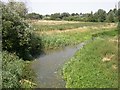
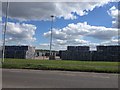
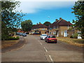
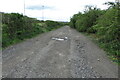
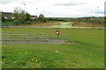
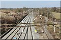
Photos of NN2 6RB


Area Information
Living in NN2 6RB offers a compact, residential experience in a small cluster of homes. With a population of 1,587, the area is defined by its quiet, community-oriented character. The demographic profile suggests a mature population, with a median age of 47 and a majority of residents aged 30–64. This suggests a stable, established community, likely with families and long-term residents. The area is predominantly owner-occupied, with 70% of homes owned by their occupants, and most properties are houses rather than flats. Proximity to Northampton Railway Station and nearby bus interchanges ensures reasonable connectivity, while local shops and schools provide daily convenience. The low flood risk and absence of environmental constraints like AONB or protected woodlands mean development is not restricted, though the area’s small size means it is not densely populated. For those seeking a settled, low-maintenance lifestyle near essential services, NN2 6RB offers a straightforward, practical option.
- Area Type
- Postcode
- Area Size
- Not available
- Population
- 1587
- Population Density
- 2081 people/km²
The property market in NN2 6RB is characterised by a high rate of home ownership, with 70% of properties owned by their occupants. This suggests a stable market with little turnover, as opposed to a rental-heavy area. The accommodation type is predominantly houses, which is typical of smaller, residential postcode areas. Given the small population and limited number of properties, the housing stock is likely to be limited in both quantity and variety. Buyers should consider the area’s proximity to amenities like schools and transport hubs, which may make it attractive for families. However, the small size of NN2 6RB means there is little scope for expansion or new developments, so those seeking a home here should act quickly and be prepared to compete with existing residents. The focus on owner-occupation also implies that rental opportunities may be scarce.
House Prices in NN2 6RB
No properties found in this postcode.
Energy Efficiency in NN2 6RB
The lifestyle in NN2 6RB is shaped by its proximity to retail, transport, and community hubs. Local shops include notable names such as Cook Kingsthorpe, Waitrose Kingsthorpe, and Heron Kingsthorpe, offering a range of shopping and dining options. The area’s bus network connects residents to the University Bus Interchange and Northampton Bus Interchange, facilitating access to larger retail centres, cultural venues, and employment opportunities. The Northampton Railway Station provides a direct link to the city’s amenities, including its shopping centres and transport links to London. While the area itself is small, the surrounding infrastructure ensures residents are not isolated. The mix of retail and transport options contributes to a convenient, self-contained lifestyle, though those seeking more extensive leisure or entertainment options may need to travel further afield.
Amenities
Schools
Residents of NN2 6RB have access to two primary schools: St John the Baptist CofE Lower School and Kingsthorpe Village Primary School. Both institutions cater to younger children, with the latter holding a ‘good’ Ofsted rating, indicating a satisfactory standard of education. The presence of two primary schools within the area suggests that families have options for their children’s early education, though no secondary schools are listed in the data. This mix of schools may be beneficial for parents seeking a range of educational environments, though the absence of secondary school options could be a consideration for those planning long-term family needs. The proximity of these schools to homes in NN2 6RB makes them a practical choice for local families.
| Rank | School | Type | Entry gender | Ages |
|---|
Explore more schools in this area
Go to Schools tabDemographics
The community in NN2 6RB is largely composed of adults aged 30–64, with a median age of 47. This suggests a population that is neither young nor elderly, likely with a focus on family life and long-term stability. Home ownership is high, at 70%, indicating that most residents are settled in their properties rather than renting. The accommodation type is predominantly houses, which aligns with the area’s small, residential nature. The predominant ethnic group is White, though no further breakdown of diversity is provided. The population size of 1,587 means the area is small enough to foster a close-knit community but not so large as to feel anonymous. The absence of specific deprivation data means the quality of life cannot be assessed in that regard, but the demographic profile implies a mature, self-sufficient population with established routines and local ties.
Household Size
Accommodation Type
Tenure
Ethnic Group
Religion
Household Composition
Age
Household Deprivation
NS-SEC
Explore more demographic insights in this area
Go to Demographics tabPlanning
Planning Constraints
- Flood RiskPremium
- Ramsar Wetland SitesPremium
- Area of Outstanding Natural BeautyPremium
- Protected Nature ReservePremium
- Protected WoodlandPremium