Area Overview for NN18 8TZ
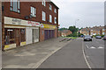
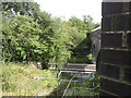
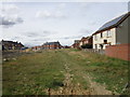
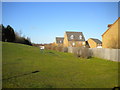
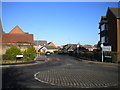
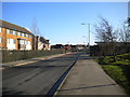
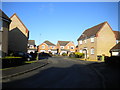
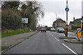
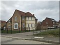
Photos of NN18 8TZ


Area Information
Living in NN18 8TZ means being part of a tightly knit residential cluster in Northamptonshire, a small but densely populated area with 2,727 residents spread over just 1.4 hectares. This postcode falls within Corby, a town designated as a new town in 1950, known for its industrial heritage rooted in iron and steel production. The area’s compact size fosters a sense of community, though its high population density of 196,748 people per square kilometre reflects its residential intensity. Historically, Corby was shaped by the arrival of Stewarts & Lloyds steelworks in 1934, which transformed it from a village into a major industrial hub. Today, the area retains echoes of its past, with the town’s symbol, the raven, and its 1568 charter still celebrated at the Corby Pole Fair every 20 years. NN18 8TZ sits within this legacy, offering a mix of modern living and historical context, though its small footprint means proximity to amenities and transport links is key for residents.
- Area Type
- Postcode
- Area Size
- 1.4 hectares
- Population
- 2727
- Population Density
- 6790 people/km²
The property market in NN18 8TZ is dominated by owner-occupied homes, with 74% of properties owned by residents rather than rented. This suggests a mature market with long-term residents and limited turnover. The accommodation type is primarily houses, which is unusual for a small postcode area and may indicate a mix of family homes and larger properties. Given the area’s compact size, the housing stock is likely limited, making it a niche market for buyers seeking specific property types. The high home ownership rate implies that rental availability is scarce, which could be a consideration for those needing flexibility. Prospective buyers should also note the proximity to transport links and amenities, which may influence property values. The area’s industrial heritage and dense population mean that properties are likely to be in close proximity to each other, prioritising convenience over expansive layouts.
House Prices in NN18 8TZ
Showing 31 properties
| Address | Type | Beds | Baths | Last Sale Price | Last Sale Date | |
|---|---|---|---|---|---|---|
| 30 Speke Close, Corby, NN18 8TZ | Detached | 5 | 2 | £365,000 | Sep 2025 | |
| 5 Speke Close, Corby, NN18 8TZ | Semi-detached | 5 | 2 | £253,750 | Apr 2025 | |
| 18 Speke Close, Corby, NN18 8TZ | Terraced | 3 | 1 | £240,000 | Mar 2025 | |
| 9 Speke Close, Corby, NN18 8TZ | house | - | - | £285,000 | Nov 2024 | |
| 22 Speke Close, Corby, NN18 8TZ | Terraced | 3 | 2 | £245,000 | Apr 2024 | |
| 14 Speke Close, Corby, NN18 8TZ | Retail | 3 | 2 | £285,000 | Aug 2022 | |
| 27 Speke Close, Corby, NN18 8TZ | house | - | - | £270,000 | Sep 2021 | |
| 7 Speke Close, Corby, NN18 8TZ | house | - | - | £220,995 | Nov 2020 | |
| 11 Speke Close, Corby, NN18 8TZ | house | 3 | 2 | £249,995 | Sep 2020 | |
| 1 Speke Close, Corby, NN18 8TZ | house | - | - | £237,995 | Sep 2020 |
Energy Efficiency in NN18 8TZ
Residents of NN18 8TZ have access to a range of nearby amenities, including five retail outlets such as Tesco Oakley, Lidl Central, and Tesco Corby, which cater to everyday shopping needs. The area’s proximity to Corby Railway Station and Kettering Railway Station provides easy access to regional transport networks, while a bus interchange offers additional mobility. Though the data does not mention parks or leisure facilities, the presence of multiple retail options and transport links suggests a practical, convenience-focused lifestyle. The compact nature of the area means amenities are within walking or short driving distance, reducing the need for long commutes. For those prioritising accessibility, the combination of retail, rail, and bus services makes NN18 8TZ a functional choice, though larger leisure or recreational spaces are not detailed in the data.
Amenities
Schools
| Rank | School | Type | Entry gender | Ages |
|---|
Explore more schools in this area
Go to Schools tabDemographics
The community in NN18 8TZ is predominantly middle-aged, with a median age of 47 and the most common age range being 30–64 years. This suggests a stable population with established households. Home ownership is high, at 74%, indicating a strong preference for long-term residency. The area is characterised by houses rather than flats, reflecting a suburban or semi-rural housing stock. The predominant ethnic group is White, though specific data on diversity is not provided. The high population density—196,748 people per square kilometre—means residents live in close proximity, which can foster community ties but may also impact privacy. With 74% of homes owned by residents, the area is less reliant on rental markets, potentially offering more stability for property buyers. However, the data does not specify deprivation levels, so assumptions about quality of life must be made cautiously.
Household Size
Accommodation Type
Tenure
Ethnic Group
Religion
Household Composition
Age
Household Deprivation
NS-SEC
Explore more demographic insights in this area
Go to Demographics tabPlanning
Planning Constraints
- Flood RiskPremium
- Ramsar Wetland SitesPremium
- Area of Outstanding Natural BeautyPremium
- Protected Nature ReservePremium
- Protected WoodlandPremium