Area Overview for NN18 8UA
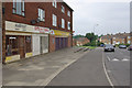
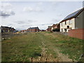
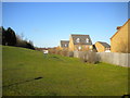
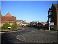
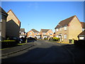
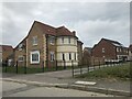
Photos of NN18 8UA


Area Information
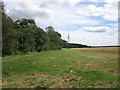
NN18 8UA lies within Corby, a town in Northamptonshire designated as a new town in 1950. This postcode area covers a small residential cluster with a population of 2,727, reflecting a tight-knit community shaped by Corby’s industrial past. The town’s name derives from its historical roots, with the raven as its symbol, a nod to its 11th-century Domesday Book entry. Daily life here is defined by proximity to essential services and a focus on practical living. Corby’s transformation from a village of 1,500 in 1931 to a bustling hub with a steelworks-driven economy has left a legacy of robust infrastructure. Residents benefit from modern connectivity, including excellent broadband and reliable mobile coverage, while the area’s low crime risk and absence of environmental constraints make it a stable place to live. The community is predominantly composed of adults aged 30–64, with a median age of 47, suggesting a mature, settled population. Living in NN18 8UA means navigating a balance between historical character and contemporary convenience, with easy access to retail, transport, and leisure options within the town and surrounding areas.
- Area Type
- Postcode
- Area Size
- Not available
- Population
- 2727
- Population Density
- 6790 people/km²
The property market in NN18 8UA is characterised by a high rate of home ownership (74%) and a predominance of houses as the primary accommodation type. This suggests a market where owner-occupation is the norm, with limited rental activity. The presence of houses rather than flats or apartments implies a focus on family-friendly, private living spaces. Given the area’s small size and the absence of specific data on property prices or turnover, it is reasonable to infer that the housing stock is relatively uniform, with limited scope for high-end or speculative investment. For buyers, this means a stable environment where properties are likely to be held long-term, reducing competition from short-term renters. The lack of planning constraints or environmental restrictions further supports the appeal of NN18 8UA as a reliable, low-risk purchase. However, the small population and limited data suggest that the market may not be highly dynamic, requiring buyers to consider the area’s long-term viability alongside its immediate practicalities.
House Prices in NN18 8UA
No properties found in this postcode.
Energy Efficiency in NN18 8UA
Living in NN18 8UA provides access to a range of local amenities within practical reach. The area is served by five retail outlets, including Tesco Oakley, Lidl Central, and Tesco Corby, offering everyday shopping and convenience. For transport, residents can utilise Corby Railway Station and Kettering Railway Station, which connect to broader networks, while a bus interchange ensures flexible local travel. Though the data does not specify parks or leisure facilities, the absence of planning constraints or environmental restrictions implies that recreational spaces are not limited by protected status. The retail and transport options available suggest a lifestyle that balances practicality with accessibility, allowing residents to meet daily needs without long commutes. The proximity to multiple supermarkets and transport hubs also supports a community-oriented environment where social interaction and convenience are prioritised.
Amenities
Schools
| Rank | School | Type | Entry gender | Ages |
|---|
Explore more schools in this area
Go to Schools tabDemographics
The population of NN18 8UA is 2,727, with a median age of 47, indicating a community skewed toward middle-aged adults. The most common age range is 30–64 years, reflecting a demographic of established professionals and families. Home ownership rates are high at 74%, suggesting a stable, long-term resident base rather than a transient rental market. The accommodation type is predominantly houses, which aligns with the area’s suburban character and lower density compared to urban centres. The predominant ethnic group is White, with no specific data on other demographics provided. This composition implies a cohesive, familiar social fabric. The absence of explicit data on deprivation or diversity means the area’s inclusivity cannot be assessed, but the high home ownership and mature age profile suggest a community prioritising security and continuity. For prospective buyers, this demographic profile indicates a neighbourhood where property values are likely to hold steady, and local amenities cater to the needs of a settled population.
Household Size
Accommodation Type
Tenure
Ethnic Group
Religion
Household Composition
Age
Household Deprivation
NS-SEC
Explore more demographic insights in this area
Go to Demographics tabPlanning
Planning Constraints
- Flood RiskPremium
- Ramsar Wetland SitesPremium
- Area of Outstanding Natural BeautyPremium
- Protected Nature ReservePremium
- Protected WoodlandPremium