Area Overview for NN18 8ED
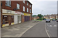
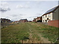
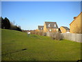
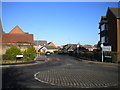
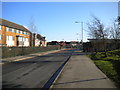
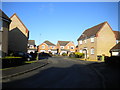
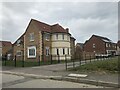
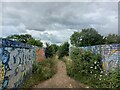
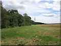
Photos of NN18 8ED


Area Information
NN18 8ED is a compact residential postcode in Corby, Northamptonshire, covering just 1.0 hectares with a population of 1,634. This high population density of 163,035 people per square kilometre reflects its role as a tightly knit community within a town shaped by industrial history. Corby, designated a new town in 1950, has a legacy of steel production, though its modern character is defined by residential clusters like NN18 8ED. The area is served by multiple schools, including primary and academy institutions, and is near retail hubs such as Lidl, Tesco, and Iceland. Daily life here balances proximity to essential services with the town’s historical roots, offering a mix of practical living and local heritage. While the area lacks natural reserves or protected landscapes, its strategic location near Corby Railway Station and a bus interchange ensures connectivity. For buyers, NN18 8ED presents a small, densely populated setting with a focus on family-oriented infrastructure, though its limited size means the immediate surroundings are critical for broader amenities.
- Area Type
- Postcode
- Area Size
- 1.0 hectares
- Population
- 1634
- Population Density
- 4709 people/km²
NN18 8ED is a small, densely populated area where 42% of residents own their homes, suggesting a significant rental market. The accommodation type is predominantly houses, which is unusual for a high-density postcode, indicating a mix of larger properties in a confined space. This could mean limited availability of flats or smaller units, potentially making the area more attractive to families seeking space. However, the area’s size—just 1.0 hectare—means the housing stock is finite, and buyers should consider nearby areas for broader options. The high population density also implies shared infrastructure and services, which may impact property values. For those prioritising proximity to schools and transport, NN18 8ED offers convenience, but its limited size means the surrounding neighbourhoods are crucial for additional amenities.
House Prices in NN18 8ED
Showing 32 properties
| Address | Type | Beds | Baths | Last Sale Price | Last Sale Date | |
|---|---|---|---|---|---|---|
| 32 Blackmoor Avenue, Corby, NN18 8ED | Semi-detached | 2 | 1 | £116,000 | Feb 2025 | |
| 4 Blackmoor Avenue, Corby, NN18 8ED | Terraced | 3 | 1 | £170,000 | Sep 2023 | |
| 6 Blackmoor Avenue, Corby, NN18 8ED | Terraced | 3 | 2 | £168,000 | Jul 2023 | |
| 10 Blackmoor Avenue, Corby, NN18 8ED | house | 3 | 1 | £174,950 | Dec 2022 | |
| 2 Blackmoor Avenue, Corby, NN18 8ED | house | - | - | £2,612 | Dec 2021 | |
| 22 Blackmoor Avenue, Corby, NN18 8ED | house | - | - | £150,000 | Jul 2021 | |
| 38 Blackmoor Avenue, Corby, NN18 8ED | house | - | - | £125,000 | Mar 2021 | |
| 11 Blackmoor Avenue, Corby, NN18 8ED | house | - | - | £147,000 | Jul 2019 | |
| 30 Blackmoor Avenue, Corby, NN18 8ED | Semi-detached | 3 | 1 | £149,950 | Jun 2018 | |
| 3 Blackmoor Avenue, Corby, NN18 8ED | house | - | - | £135,000 | Dec 2017 |
Energy Efficiency in NN18 8ED
Residents of NN18 8ED have access to five retail outlets, including Lidl Central, Tesco Corby, and Iceland Corby, ensuring everyday shopping needs are met within reach. The area’s proximity to Corby Railway Station and a bus interchange enhances mobility, linking residents to broader services and employment opportunities. While parks and leisure facilities are not explicitly listed, the town’s industrial heritage suggests a focus on practical living over expansive green spaces. The retail and transport infrastructure creates a convenient lifestyle, with shops and transport hubs within walking distance. However, the lack of named parks or recreational areas means buyers should investigate nearby locations for outdoor amenities. The mix of retail and transport options supports a practical, community-oriented lifestyle, though the area’s compact nature requires careful consideration of additional needs.
Amenities
Schools
Residents of NN18 8ED have access to multiple schools, including Exeter Primary School, Exeter Junior School, Queen Elizabeth School, and Corby Community College, all of which are primary institutions. Additionally, Exeter - A Learning Community Academy, an academy school, provides secondary education. This mix of primary and academy schools offers families a range of educational options, from early years to secondary-level learning. The presence of multiple schools in close proximity suggests a focus on local education, which is beneficial for families with children. However, the absence of specific Ofsted ratings means the quality of these institutions cannot be assessed here. The concentration of schools also indicates a community prioritising family needs, with educational infrastructure forming a key part of daily life.
| Rank | School | Type | Entry gender | Ages |
|---|
Explore more schools in this area
Go to Schools tabDemographics
The median age in NN18 8ED is 47, with the majority of residents aged 30–64. This suggests a community skewed towards middle-aged adults, likely including families and professionals. Home ownership stands at 42%, indicating that nearly half of residents rent their homes, which may reflect the area’s role as a secondary housing market. The predominant accommodation type is houses, which, combined with the high population density, implies compact living spaces. The predominant ethnic group is White, though no specific data on diversity or deprivation is provided. The age profile and ownership rates suggest a stable, established population with a focus on long-term residency. However, the lack of data on deprivation or household composition means the full picture of quality of life remains partially obscured.
Household Size
Accommodation Type
Tenure
Ethnic Group
Religion
Household Composition
Age
Household Deprivation
NS-SEC
Explore more demographic insights in this area
Go to Demographics tabPlanning
Planning Constraints
- Flood RiskPremium
- Ramsar Wetland SitesPremium
- Area of Outstanding Natural BeautyPremium
- Protected Nature ReservePremium
- Protected WoodlandPremium