Area Overview for NN18 8EB
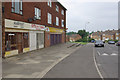
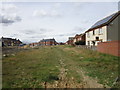
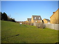
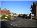
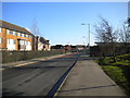
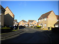
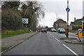
Photos of NN18 8EB

Area Information
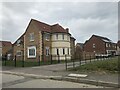
NN18 8EB is a small, densely populated residential cluster in Northamptonshire, part of the town of Corby. With 1,634 residents spread across 3,800 square metres, the area has a population density of 429,980 people per square kilometre, reflecting its compact nature. Corby itself was designated a new town in 1950, evolving from a small village into a hub of industrial activity. The area’s history is tied to the steelworks built by Stewarts & Lloyds in 1934, which transformed it into a major settlement. Today, NN18 8EB is characterised by its mature demographic, with a median age of 47 and a majority of residents aged 30–64. Daily life here is shaped by proximity to local amenities, schools, and transport links, though the area’s small size means it is tightly integrated with surrounding neighbourhoods.
- Area Type
- Postcode
- Area Size
- 3800 m²
- Population
- 1634
- Population Density
- 4709 people/km²
The property market in NN18 8EB is defined by a 42% home ownership rate, with houses forming the primary accommodation type. This suggests a balance between owner-occupied homes and rental properties, though the relatively low home ownership percentage may indicate a significant portion of the housing stock is rented. Given the area’s small size and high population density, the housing stock is limited, and buyers should consider the competitive nature of the local market. The prevalence of houses over flats or apartments may appeal to those seeking larger living spaces, though the immediate surroundings may offer more variety. Prospective buyers should also be mindful of the area’s compactness, which may mean limited options for expansion or redevelopment.
House Prices in NN18 8EB
Showing 11 properties
| Address | Type | Beds | Baths | Last Sale Price | Last Sale Date | |
|---|---|---|---|---|---|---|
| 38 Burghley Drive, Corby, NN18 8EB | Maisonette | - | - | £145,000 | Feb 2006 | |
| 36 Burghley Drive, Corby, NN18 8EB | Flat | - | - | £20,000 | Apr 2003 | |
| 34 Burghley Drive, Corby, NN18 8EB | Flat | - | - | £20,000 | Apr 2003 | |
| 42 Burghley Drive, Corby, NN18 8EB | Flat | - | - | £32,000 | Feb 2002 | |
| 40A Burghley Drive, Corby, NN18 8EB | Flat | - | - | - | - | |
| 70 Burghley Drive, Corby, NN18 8EB | house | - | - | - | - | |
| 40 Burghley Drive, Corby, NN18 8EB | Flat | - | - | - | - | |
| 68 Burghley Drive, Corby, NN18 8EB | house | - | - | - | - | |
| 72 Burghley Drive, Corby, NN18 8EB | house | - | - | - | - | |
| Bin Store For 36 To 42, Burghley Drive, Corby, NN18 8EB | Industrial | - | - | - | - |
Energy Efficiency in NN18 8EB
Residents of NN18 8EB benefit from nearby retail options, including Lidl Central, Tesco Corby, and Iceland Corby, which provide essential shopping and grocery services. The area’s proximity to Corby Railway Station and the bus interchange enhances mobility, while the compact layout ensures that daily needs are within practical reach. Although the data does not mention parks or leisure facilities, the presence of multiple schools and retail outlets suggests a community-oriented lifestyle. The high population density may contribute to a sense of closeness, though it also means limited space for expansive recreational areas.
Amenities
Schools
Residents of NN18 8EB have access to several primary schools, including Exeter Primary School, Exeter Junior School, Queen Elizabeth School, and Corby Community College, though the latter’s classification as a primary school appears inconsistent with its name. Additionally, Exeter - A Learning Community Academy provides an alternative educational option. The presence of multiple primary schools suggests a strong focus on early education, while the inclusion of an academy may offer specialized curricula or governance structures. Families seeking a range of schooling options will find the area well-served, though the absence of secondary schools nearby may require commuting for older students.
| Rank | School | Type | Entry gender | Ages |
|---|
Explore more schools in this area
Go to Schools tabDemographics
The community in NN18 8EB is predominantly middle-aged, with a median age of 47 and the largest age group being adults aged 30–64. Home ownership stands at 42%, indicating a mix of owner-occupied and rental properties. The area is primarily composed of houses, reflecting a traditional residential layout. The predominant ethnic group is White, though specific data on diversity is not provided. The high population density of 429,980 people per square kilometre suggests a tightly packed community, which may influence social dynamics and access to shared resources. For those considering the area, the demographic profile suggests a stable, established population with a focus on family-oriented living.
Household Size
Accommodation Type
Tenure
Ethnic Group
Religion
Household Composition
Age
Household Deprivation
NS-SEC
Explore more demographic insights in this area
Go to Demographics tabPlanning
Planning Constraints
- Flood RiskPremium
- Ramsar Wetland SitesPremium
- Area of Outstanding Natural BeautyPremium
- Protected Nature ReservePremium
- Protected WoodlandPremium