Area Overview for NN18 8BL
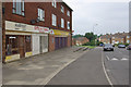
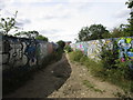
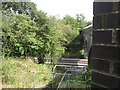
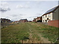
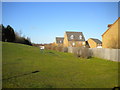
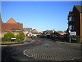
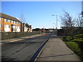
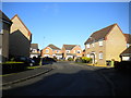
Photos of NN18 8BL
Area Information
NN18 8BL is a small, densely populated residential cluster in Corby, Northamptonshire, a town designated as a new town in 1950. Covering 3,464 square metres, the area is home to 1,355 residents, making it one of the most densely populated zones in the region. Corby’s history as an industrial hub, shaped by the steelworks established in 1935, still influences its character today. The area’s median age of 47 suggests a mature population, with the majority aged 30–64, reflecting a community rooted in stability and experience. Living here means proximity to Corby’s historical and modern infrastructure, from its 1568 charter celebrations to contemporary retail and transport links. The postcode’s compact size means amenities are within practical reach, though the area’s small footprint limits expansion. For those seeking a quiet, established neighbourhood with a mix of historical legacy and modern convenience, NN18 8BL offers a distinct blend of residential simplicity and industrial heritage.
- Area Type
- Postcode
- Area Size
- 3464 m²
- Population
- 1355
- Population Density
- 5341 people/km²
The property market in NN18 8BL is characterised by a 48% home ownership rate, suggesting a balance between owner-occupied and rental properties. With houses as the predominant accommodation type, the area likely features traditional family homes rather than high-density housing. This makes it an attractive option for buyers seeking spacious, stable properties in a small, established community. However, the area’s limited size means the housing stock is finite, potentially leading to competition among buyers. The relatively low home ownership percentage also implies a significant portion of the market is rental-based, which could affect property values and investment potential. For those considering purchasing, the focus on houses may appeal to families or individuals prioritising privacy and space over urban convenience.
House Prices in NN18 8BL
Showing 16 properties
| Address | Type | Beds | Baths | Last Sale Price | Last Sale Date | |
|---|---|---|---|---|---|---|
| 67 Counts Farm Road, Corby, NN18 8BL | Semi-detached | - | - | £85,000 | Dec 2006 | |
| 79 Counts Farm Road, Corby, NN18 8BL | Flat | - | - | £10,800 | Aug 2004 | |
| 87 Counts Farm Road, Corby, NN18 8BL | Flat | - | - | - | - | |
| 65 Counts Farm Road, Corby, NN18 8BL | house | - | - | - | - | |
| 73 Counts Farm Road, Corby, NN18 8BL | Flat | - | - | - | - | |
| 71 Counts Farm Road, Corby, NN18 8BL | Flat | - | - | - | - | |
| 69 Counts Farm Road, Corby, NN18 8BL | Flat | - | - | - | - | |
| 75 Counts Farm Road, Corby, NN18 8BL | Flat | - | - | - | - | |
| 89 Counts Farm Road, Corby, NN18 8BL | Flat | - | - | - | - | |
| 77 Counts Farm Road, Corby, NN18 8BL | Flat | - | - | - | - |
Energy Efficiency in NN18 8BL
Living in NN18 8BL offers access to essential amenities within close proximity. The area is served by five retail outlets, including Lidl Central, Tesco Corby, and Iceland Corby, providing convenient shopping options for daily needs. Corby Railway Station and the nearby bus interchange enhance mobility, linking residents to broader regional networks. While the area’s compact size means a limited range of leisure facilities, the presence of these key amenities ensures a practical lifestyle. The retail options cater to both essentials and convenience, while transport links facilitate access to larger towns for additional services. For residents prioritising simplicity and accessibility, NN18 8BL’s amenities strike a balance between local convenience and regional connectivity.
Amenities
Schools
| Rank | School | Type | Entry gender | Ages |
|---|
Explore more schools in this area
Go to Schools tabDemographics
The population of NN18 8BL is predominantly composed of adults aged 30–64, with a median age of 47. This suggests a community focused on middle-aged households, likely with established careers and families. Home ownership in the area stands at 48%, slightly below the national average, indicating a mix of owner-occupied properties and rental homes. The accommodation type is primarily houses, reflecting a preference for single-family dwellings over flats or apartments. The predominant ethnic group is White, though specific diversity statistics are not provided. The high population density of 391,189 people per square kilometre underscores the area’s compact nature, which may influence social dynamics and access to shared resources. For residents, this density means a tightly knit community but also potential challenges in terms of space and infrastructure strain.
Household Size
Accommodation Type
Tenure
Ethnic Group
Religion
Household Composition
Age
Household Deprivation
NS-SEC
Explore more demographic insights in this area
Go to Demographics tabPlanning
Planning Constraints
- Flood RiskPremium
- Ramsar Wetland SitesPremium
- Area of Outstanding Natural BeautyPremium
- Protected Nature ReservePremium
- Protected WoodlandPremium