Area Overview for NN17 1JY
Photos of NN17 1JY
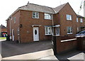
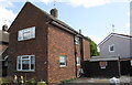
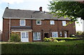
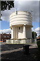
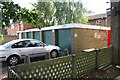
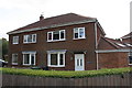
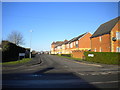
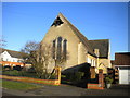
38 photos from this area
Area Information
Key information about the NN17 1JY including its size, population, and administrative classification.
- Area Type
- Postcode
- Area Size
- 6049 m²
- Population
- 1839
- Population Density
- 5807 people/km²
House Prices in NN17 1JY
20
Properties
£107,225
Average Sold Price
£50,995
Lowest Price
£170,000
Highest Price
Showing 20 properties
| Address | Type | Beds | Baths | Last Sale Price | Last Sale Date | |
|---|---|---|---|---|---|---|
| 9 Grays Close, Corby, NN17 1JY | Terraced | 2 | 1 | £170,000 | Nov 2022 | |
| 22 Grays Close, Corby, NN17 1JY | house | - | - | £137,000 | Jan 2021 | |
| 14 Grays Close, Corby, NN17 1JY | house | - | - | £157,000 | Oct 2020 | |
| 3 Grays Close, Corby, NN17 1JY | house | - | - | £130,000 | Jun 2018 | |
| 4 Grays Close, Corby, NN17 1JY | Semi-detached | 2 | - | £138,000 | Jul 2017 | |
| 10 Grays Close, Corby, NN17 1JY | house | - | - | £88,250 | Jun 2013 | |
| 6 Grays Close, Corby, NN17 1JY | Terraced | - | - | £126,950 | Nov 2007 | |
| 24 Grays Close, Corby, NN17 1JY | Terraced | - | - | £94,000 | Oct 2005 | |
| 11 Grays Close, Corby, NN17 1JY | Terraced | 3 | 1 | £71,000 | Feb 2004 | |
| 16 Grays Close, Corby, NN17 1JY | house | - | - | £71,000 | Sep 2003 |
Page 1 of 2
Energy Efficiency in NN17 1JY
Amenities
Schools
| Rank | School | Type | Entry gender | Ages |
|---|
Explore more schools in this area
Go to Schools tabDemographics
Household Size
Family (3-5 people)
most common
Accommodation Type
Houses
most common
Tenure
56
majority
Ethnic Group
White
most common
Religion
N/A
most common
Household Composition
N/A
most common
Age
47
median
Adults (30-64 years)
most common
Household Deprivation
N/A
with no deprivation
NS-SEC
18
in Lower managerial occupations
Explore more demographic insights in this area
Go to Demographics tabPlanning
Planning Constraints
- Flood RiskPremium
- Ramsar Wetland SitesPremium
- Area of Outstanding Natural BeautyPremium
- Protected Nature ReservePremium
- Protected WoodlandPremium