Area Overview for NN17 1HG
Photos of NN17 1HG
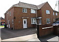
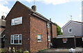
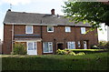
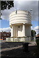
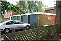
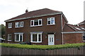
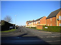
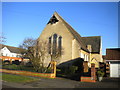
38 photos from this area
Area Information
Key information about the NN17 1HG including its size, population, and administrative classification.
- Area Type
- Postcode
- Area Size
- 1.1 hectares
- Population
- 1839
- Population Density
- 5807 people/km²
House Prices in NN17 1HG
32
Properties
£96,908
Average Sold Price
£28,000
Lowest Price
£200,000
Highest Price
Showing 32 properties
| Address | Type | Beds | Baths | Last Sale Price | Last Sale Date | |
|---|---|---|---|---|---|---|
| 134 Westfields Road, Corby, NN17 1HG | Terraced | 3 | 2 | £200,000 | Aug 2024 | |
| 89 Westfields Road, Corby, NN17 1HG | Semi-detached | 3 | 1 | £185,000 | Oct 2023 | |
| 102 Westfields Road, Corby, NN17 1HG | Semi-detached | 2 | 1 | £152,000 | Nov 2019 | |
| 126 Westfields Road, Corby, NN17 1HG | house | - | - | £139,000 | Nov 2019 | |
| 73 Westfields Road, Corby, NN17 1HG | Terraced | 3 | - | £82,000 | Jul 2013 | |
| 118 Westfields Road, Corby, NN17 1HG | house | - | - | £75,000 | Mar 2013 | |
| 81 Westfields Road, Corby, NN17 1HG | house | 3 | - | £95,000 | Apr 2012 | |
| 124 Westfields Road, Corby, NN17 1HG | house | - | - | £105,000 | Apr 2007 | |
| 85 Westfields Road, Corby, NN17 1HG | Semi-detached | - | - | £84,995 | Nov 2006 | |
| 130 Westfields Road, Corby, NN17 1HG | house | - | - | £103,000 | Oct 2006 |
Page 1 of 4
Energy Efficiency in NN17 1HG
Amenities
Schools
| Rank | School | Type | Entry gender | Ages |
|---|
Explore more schools in this area
Go to Schools tabDemographics
Household Size
Family (3-5 people)
most common
Accommodation Type
Houses
most common
Tenure
56
majority
Ethnic Group
White
most common
Religion
N/A
most common
Household Composition
N/A
most common
Age
47
median
Adults (30-64 years)
most common
Household Deprivation
N/A
with no deprivation
NS-SEC
18
in Lower managerial occupations
Explore more demographic insights in this area
Go to Demographics tabPlanning
Planning Constraints
- Flood RiskPremium
- Ramsar Wetland SitesPremium
- Area of Outstanding Natural BeautyPremium
- Protected Nature ReservePremium
- Protected WoodlandPremium