Area Overview for NN12 8PW
Photos of NN12 8PW
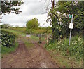
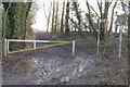
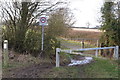
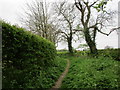
10 photos from this area
Area Information
Key information about the NN12 8PW including its size, population, and administrative classification.
- Area Type
- Postcode
- Area Size
- 11.3 hectares
- Population
- 1784
- Population Density
- 37 people/km²
House Prices in NN12 8PW
9
Properties
£471,250
Average Sold Price
£190,000
Lowest Price
£650,000
Highest Price
Showing 9 properties
| Address | Type | Beds | Baths | Last Sale Price | Last Sale Date | |
|---|---|---|---|---|---|---|
| Stable Cottage, 1A Kettle End, Weedon Lois, NN12 8PW | Cottage | 4 | 3 | £500,000 | Dec 2025 | |
| Owls Hoot, 5 Kettle End, Weedon Lois, NN12 8PW | Terraced | 3 | 2 | £650,000 | Oct 2021 | |
| 1 Kettle End, Weedon Lois, NN12 8PW | Cottage | 4 | 2 | £545,000 | May 2016 | |
| Primrose Cottage, 3 Kettle End, Weedon Lois, NN12 8PW | house | 2 | 1 | £190,000 | Dec 2012 | |
| 1B Kettle End, Weedon Lois, NN12 8PW | Terraced | 2 | 1 | - | - | |
| Brambly Cottage, 2 Kettle End, Weedon Lois, NN12 8PW | Terraced | 4 | - | - | - | |
| Boarding Kennels, Owls Hoot, 5 Kettle End, Weedon Lois, NN12 8PW | commercial | - | - | - | - | |
| 4 Kettle End, Weedon Lois, NN12 8PW | Terraced | - | - | - | - | |
| The Annexe At, Stable Cottage, 1A Kettle End, Weedon Lois, NN12 8PW | Flat | - | - | - | - |
Energy Efficiency in NN12 8PW
Amenities
Schools
| Rank | School | Type | Entry gender | Ages |
|---|
Explore more schools in this area
Go to Schools tabDemographics
Household Size
Two person
most common
Accommodation Type
Houses
most common
Tenure
80
majority
Ethnic Group
White
most common
Religion
N/A
most common
Household Composition
N/A
most common
Age
47
median
Adults (30-64 years)
most common
Household Deprivation
N/A
with no deprivation
NS-SEC
46
in Lower managerial occupations
Explore more demographic insights in this area
Go to Demographics tabPlanning
Planning Constraints
- Flood RiskPremium
- Ramsar Wetland SitesPremium
- Area of Outstanding Natural BeautyPremium
- Protected Nature ReservePremium
- Protected WoodlandPremium