Area Overview for NG9 1FP
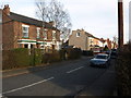
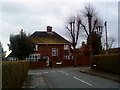
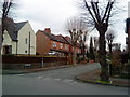
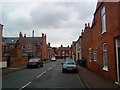
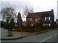
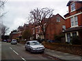
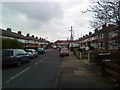
Photos of NG9 1FP
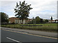

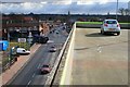
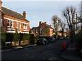
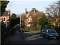
Area Information
Living in NG9 1FP offers a distinct experience for those seeking a compact residential cluster defined by specific boundaries. This postcode covers exactly 3845 square metres, creating a tightly knit environment where neighbours know one another. The neighbourhood hosts 1552 residents, generating a population density of 403671 people per square kilometre. Such high density indicates an urban pocket rather than a sprawling suburb, meaning daily life revolves around close proximity to local services. You will find that space is at a premium, and the architecture reflects the constraints of this small footprint. The layout supports a community where footsteps replace car journeys for many routine tasks. This area sits within the broader Nottingham context, offering a slice of city life without the sprawling commute of outer districts. The character here is shaped by the sheer concentration of households in a limited square kilometre. For buyers, understanding this density is crucial when evaluating your daily routine. You are living in a place where convenience is a structural feature, not just a marketing slogan. Being surrounded by 1552 people in such a small space ensures that you will rarely be far from your needs.
- Area Type
- Postcode
- Area Size
- 3845 m²
- Population
- 1552
- Population Density
- 4954 people/km²
The property market in NG9 1FP is characterised by a strong leaning towards owner-occupancy rather than renting. With 64% of residents owning their homes, the area is primarily a buy-to-live market. This high ownership rate usually correlates with stable estate values and a community focused on long-term improvement rather than short-term flips. The predominant accommodation type is houses, which shapes the visual character of the streets within this postcode. Buyers should note that finding freehold homes with gardens or private space may be the primary goal given the house-heavy stock. Having a 64% ownership rate means you will likely meet owners on the street rather than meeting a landlord or agent during your day. This dynamic often fosters a quieter atmosphere where neighbours look out for one another. The market here is not driven by short-term lets or student housing pressures common in university towns. Instead, the demand comes from those seeking stability in a dense urban setting. If you are considering a purchase, you are entering a market where residents have a stake in their local environment. The housing stock reflects this maturity, favouring family-sized properties over micro-studios or student rooms.
House Prices in NG9 1FP
Showing 22 properties
| Address | Type | Beds | Baths | Last Sale Price | Last Sale Date | |
|---|---|---|---|---|---|---|
| 40 Gladstone Street, Beeston, NG9 1FP | Terraced | 3 | 1 | £260,000 | Dec 2024 | |
| 30 Gladstone Street, Beeston, NG9 1FP | Terraced | 3 | 1 | £300,000 | Apr 2024 | |
| 69 Gladstone Street, Beeston, NG9 1FP | Terraced | 2 | 1 | £127,500 | Mar 2020 | |
| 38 Gladstone Street, Beeston, NG9 1FP | Terraced | 3 | 1 | £188,000 | Nov 2019 | |
| 71 Gladstone Street, Beeston, NG9 1FP | Terraced | 2 | 1 | £144,000 | Mar 2017 | |
| 73 Gladstone Street, Beeston, NG9 1FP | Terraced | 2 | 1 | £125,000 | May 2016 | |
| 34 Gladstone Street, Beeston, NG9 1FP | house | - | - | £80,000 | Jun 2003 | |
| 67A Gladstone Street, Beeston, NG9 1FP | house | - | - | £73,000 | Nov 1999 | |
| 36 Gladstone Street, Beeston, NG9 1FP | Terraced | - | - | £49,500 | Jan 1998 | |
| 42 Gladstone Street, Beeston, NG9 1FP | Terraced | - | - | £39,950 | May 1995 |
Energy Efficiency in NG9 1FP
Your lifestyle in NG9 1FP benefits from immediate access to essential services and transport hubs. You are within practical reach of Chilwell Road, High Road, and a Tram and Bus Interchange, ensuring quick access to wider Nottingham. For shopping, Co-op Beeston, Tesco Nottingham, and Lidl Beeston are nearby, providing ample choice for groceries and essentials. Rail travel is convenient with Beeston Railway Station, Attenborough Railway Station, and Nottingham Railway Station all accessible. This transport network allows you to commute to central Nottingham or reach the airport at Nottingham Airport easily. Your daily errands require minimal planning as major retailers and transport nodes are just outside your doorstep. You can walk or cycle to the supermarket or catch a tram without needing a car for minor trips. The proximity to these venues means the area functions as a well-connected dormitory and leisure mix. Dining and leisure options cluster around these transport points, offering variety for weekends. You do not need to travel far for a meal or a commute. The location supports a balanced life where work, school runs, and shopping intersect easily.
Amenities
Schools
| Rank | School | Type | Entry gender | Ages |
|---|
Explore more schools in this area
Go to Schools tabDemographics
The community in NG9 1FP reflects a mature residential settlement with clear demographic markers. The median age for residents is 47, indicating that the most common age range falls between 30 and 64 years. This data suggests a population later in life, likely consisting of families, couples, and empty nesters. Home ownership stands at 64%, meaning nearly two-thirds of residents own their property outright or have a mortgage. The remaining accommodation is rented or shared. Houses form the predominant accommodation type, aligning with the older demographic profile. The resident base identifies primarily as White, consistent with the broader national trend for this region. These figures paint a picture of stability. With a majority of households being owner-occupied, the area maintains a sense of long-term investment rather than transient renting. You are looking at a community where residents have likely stayed for years. The age profile suggests a low level of single-parent households compared to younger areas. Deprivation indicators are not explicitly detailed in the provided breakdowns, so focusing on the age and ownership data provides the clearest insight into daily life. These numbers confirm a traditional family-oriented neighbourhood structure.
Household Size
Accommodation Type
Tenure
Ethnic Group
Religion
Household Composition
Age
Household Deprivation
NS-SEC
Explore more demographic insights in this area
Go to Demographics tabPlanning
Planning Constraints
- Flood RiskPremium
- Ramsar Wetland SitesPremium
- Area of Outstanding Natural BeautyPremium
- Protected Nature ReservePremium
- Protected WoodlandPremium