Area Overview for NG9 1EP
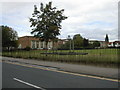
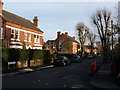
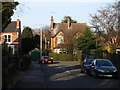
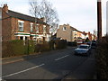
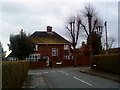
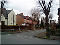
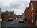
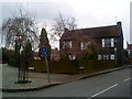
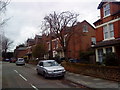
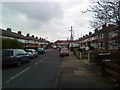
Photos of NG9 1EP
Area Information
Living in NG9 1EP offers a stark contrast to the sprawling suburbs often sought by families. This postcode covers a very specific residential cluster measuring just 9770 square metres. With a population of 1552 people, the area commands an exceptionally high density of 158854 people per square kilometre. You are placing yourself in a tightly packed environment rather than a secluded estate. The sheer concentration of residents within such a small footprint defines the daily rhythm of life here. Neighbours are always nearby, and the sense of place is shaped by immediate proximity rather than expansive green buffers around the housing. This location sits within the NG9 sector of Nottingham, offering a distinct urban living experience. The compact nature of the postcode means you do not need to travel far for essentials, but you must appreciate the close quarters. Daily life revolves around shared access to limited local resources and a community where everyone is literally next door. The area is not designed for those seeking spacious gardens or isolation; it is built for density. When considering homes in NG9 1EP, you are buying into a micro-community defined by its tight boundaries and high resident throughput. The character of the neighbourhood is formed entirely by the 1552 individuals sharing this specific space.
- Area Type
- Postcode
- Area Size
- 9770 m²
- Population
- 1552
- Population Density
- 4954 people/km²
The property market in NG9 1EP is heavily weighted towards owner-occupiers. With a home ownership rate of 64 per cent, the majority of residences are held by residents rather than landlords. This high level of ownership typically results in a slower turnover rate compared to rental-heavy districts. The vast majority of the housing stock comprises houses, consistent with the area's median age of 47 and the predominant demographic of adults aged 30 to 64 years. You are unlikely to find purpose-built high-density flats or modern conversion projects in this specific cluster. This postcode covers 9770 square metres and is home to 1552 people. Such a small area with 64 per cent home ownership suggests a mature market where sellers may hold properties for extended periods. If you are looking at homes in NG9 1EP, expect a range of established houses rather than new-build developments or private rentals. The fact that houses are the standard accommodation type means gardens and single-family structures are the norm. The low rental proportion often indicates that mortgage products geared towards first-time buyers are less prevalent than traditional mortgages for existing owners. For investors or movers, the barrier to entry involves navigating a market where few properties change hands. The density of 158854 people per square kilometre means competition for the limited available stock can be fierce. However, the stability of the 64 per cent owner-occupied base offers security to new buyers who do not find their way onto the ladder. When viewing properties, focus on the condition of the houses as there are few alternatives to the standard stock available. This area does not cater to a transient population, making it ideal for those seeking a settled domestic life.
House Prices in NG9 1EP
Showing 22 properties
| Address | Type | Beds | Baths | Last Sale Price | Last Sale Date | |
|---|---|---|---|---|---|---|
| 3 Ellis Grove, Beeston, NG9 1EP | Terraced | 2 | 1 | £210,000 | Jul 2023 | |
| 9 Ellis Grove, Beeston, NG9 1EP | Terraced | 3 | 1 | £215,000 | Mar 2022 | |
| 11 Ellis Grove, Beeston, NG9 1EP | Flat | - | - | £95,000 | Jun 2017 | |
| 1B Ellis Grove, Beeston, NG9 1EP | Terraced | 2 | 3 | £157,000 | May 2015 | |
| 1C Ellis Grove, Beeston, NG9 1EP | Terraced | 2 | 2 | £105,000 | Dec 2013 | |
| 1D Ellis Grove, Beeston, NG9 1EP | Terraced | 2 | 2 | £137,000 | Sep 2013 | |
| 1A Ellis Grove, Beeston, NG9 1EP | Terraced | 2 | 2 | £125,000 | Aug 2013 | |
| 4 Ellis Grove, Beeston, NG9 1EP | house | - | - | £70,000 | Sep 2010 | |
| 6 Ellis Grove, Beeston, NG9 1EP | Terraced | 2 | 1 | £58,000 | Jun 2010 | |
| 5 Ellis Grove, Beeston, NG9 1EP | house | - | - | £72,000 | May 2009 |
Energy Efficiency in NG9 1EP
Life in NG9 1EP is defined by immediate access to a wide array of services within practical reach. You have five notable retail options, including Co-op Beeston, Tesco Nottingham, and Co-op Queens, all located within a short journey. These five venues cater to daily shopping needs from groceries to household essentials without requiring a long drive. Five metro connections along Chilwell Road and High Road ensure you can reach major employment hubs quickly. For travel beyond the city, five rail stations including Beeston and Nottingham Railway Stations stand ready for your commute. One airport, Nottingham Airport, is also noted within the practical reach of residents. Your daily walk could take you to five leisure facilities or parks if they are clustered within the 9770 square metre area, though specific names for parks are not listed in the immediate amenity data. The presence of five bus and tram interchanges means you can integrate Nottingham's wider transport network into your routine. Residents do not need to navigate the city centre for basic provisions because Co-op Beeston and Tesco Nottingham are nearby. The diversity of five transport nodes and five retail outlets creates a self-contained lifestyle. With 158854 people per square kilometre, the sheer volume of activity supports these amenities. You will find that the five railway stations allow for flexible travel to towns or the airport when needed. This density of services makes NG9 1EP a highly convenient location for those who value time spent near amenities over distance travelled.
Amenities
Schools
| Rank | School | Type | Entry gender | Ages |
|---|
Explore more schools in this area
Go to Schools tabDemographics
The community in NG9 1EP presents a mature profile suited to established residents. The median age stands at 47 years, indicating that adults between the ages of 30 and 64 years are the most common demographic. You will find that this area attracts individuals who have likely settled down with careers and families rather than those just entering the market. Sixty-four per cent of households in this postcode already own their homes, suggesting a settled population with strong roots in the locality. The prevailing accommodation type consists of houses, fitting the older demographic structure often found in areas with a median age nearing 48. Ethnically, White residents form the predominant group in accordance with national trends for this specific demographic slice. Deprivation data is not included in the current assessment for this postcode, which means you rely on housing tenure and age to gauge the area's character. The high home ownership rate of 64 per cent typically correlates with lower levels of financial stress and greater stability among residents. This profile suggests a neighbourhood where children are being raised by parents who own their properties rather than renters constantly moving. The combination of a high median age and significant owner occupancy creates a stable environment where long-term neighbours usually remain in place for years. When looking at homes in NG9 1EP, you are entering an area defined by middle-aged families and staff who belong here.
Household Size
Accommodation Type
Tenure
Ethnic Group
Religion
Household Composition
Age
Household Deprivation
NS-SEC
Explore more demographic insights in this area
Go to Demographics tabPlanning
Planning Constraints
- Flood RiskPremium
- Ramsar Wetland SitesPremium
- Area of Outstanding Natural BeautyPremium
- Protected Nature ReservePremium
- Protected WoodlandPremium