Area Overview for NG9 1DZ
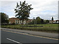
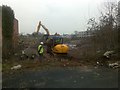
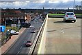
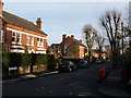
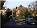
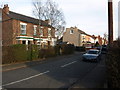
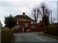
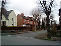
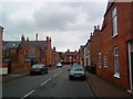
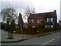
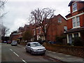
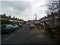
Photos of NG9 1DZ
Area Information
Living in NG9 1DZ offers a secluded residential experience within a very compact footprint. This specific postcode covers only 8,113 square metres, creating a tightly clustered neighbourhood that feels intimate yet complete. With a total population of 1,552 people, the area maintains a small-town atmosphere without the isolation of a rural hamlet. The density reaches 191,298 people per square kilometre, which indicates a high concentration of dwellings within this limited space. Despite the small size, the cluster functions as a distinct domestic zone with established services nearby. You will find a community defined by its exclusivity and proximity to wider Nottinghamshire transport links. Daily life here revolves around the convenience of being close to major roads while retaining a quiet, residential character. The area serves as a practical choice for those seeking a specific location in Nottinghamshire without the sprawl of larger council estate areas. It is a place where the local identity is strong and the immediate surroundings are fully realised.
- Area Type
- Postcode
- Area Size
- 8113 m²
- Population
- 1552
- Population Density
- 4954 people/km²
The housing stock in NG9 1DZ is defined by a strong owner-occupier base. A clear majority of the residents own their homes, a figure that stands at 64 per cent. This statistic alone tells a story of a market where people settle down rather than viewing properties as short-term investments. The predominant accommodation type is houses, meaning you will not find a high-rise block or a dormitory estate here. Instead, the landscape is made up of standard family homes suitable for the local age profile. This concentration of homeownership suggests that supply chains are stable and that buying a home here involves dealing with established estates rather than speculative developments. For buyers, this means the area offers security of tenure for the majority of its inhabitants. The small physical size of the postcode cluster means the variety of property styles is limited, promoting uniformity in the streetscape. Anyone looking at homes in this area should expect traditional detached or semi-detached structures aligned with the local suburban aesthetic.
House Prices in NG9 1DZ
Showing 21 properties
| Address | Type | Beds | Baths | Last Sale Price | Last Sale Date | |
|---|---|---|---|---|---|---|
| 21 Lacemaker Road, Chilwell, NG9 1DZ | house | - | - | £331,995 | Jul 2021 | |
| 10 Lacemaker Road, Chilwell, NG9 1DZ | house | - | - | £325,995 | Jun 2021 | |
| 2 Lacemaker Road, Chilwell, NG9 1DZ | house | - | - | £379,995 | Mar 2021 | |
| 1 Lacemaker Road, Chilwell, NG9 1DZ | house | - | - | £366,995 | Feb 2021 | |
| 8 Lacemaker Road, Chilwell, NG9 1DZ | house | - | - | £374,995 | Jan 2021 | |
| 7 Lacemaker Road, Chilwell, NG9 1DZ | house | - | - | £369,995 | Jan 2021 | |
| 11 Lacemaker Road, Chilwell, NG9 1DZ | house | - | - | £325,995 | Jan 2021 | |
| 13 Lacemaker Road, Chilwell, NG9 1DZ | house | - | - | £369,995 | Jan 2021 | |
| 9 Lacemaker Road, Chilwell, NG9 1DZ | Flat | 2 | 2 | £334,995 | Jan 2021 | |
| 12 Lacemaker Road, Chilwell, NG9 1DZ | house | - | - | £369,995 | Dec 2020 |
Energy Efficiency in NG9 1DZ
Your daily life in NG9 1DZ is supported by a practical network of nearby amenities. Retail options are well represented, with five major outlets including Co-op Beeston, Co-op Queens, and Tesco Nottingham within easy reach. These supermarkets cover all grocery and general shopping needs without requiring extensive travel. Transport links are equally convenient, with access to Chilwell Road, High Road, and the Tram and Bus Interchange. This transport hub facilitates quick trips into the city centre or to adjacent towns. For rail travel, Beeston Railway Station, Attenborough Railway Station, and Nottingham Railway Station are all available nearby, offering numerous daily connections. Nottingham Airport sits approximately one mile away, providing regional flight options. The combination of these services means you rarely need to leave the immediate vicinity for essential errands. You can complete your weekly shop, commute to work, and catch a train or plane without the hassle of navigating unfamiliar streets.
Amenities
Schools
| Rank | School | Type | Entry gender | Ages |
|---|
Explore more schools in this area
Go to Schools tabDemographics
The community in NG9 1DZ reflects a mature and stable household population. The median age is 47 years, confirming that most residents are adults aged between 30 and 64. This age profile suggests a neighbourhood dominated by families with older children or empty-nesters rather than young professionals or students. Homeownership is firmly established, with 64 per cent of residents owning their properties outright or with a mortgage. The remaining residents likely comprise long-term renters or those approaching retirement. Houses form the primary accommodation type, indicating a stock designed for families rather than flat-pack urban living. The predominant ethnic group is White, which aligns with the broader demographic trends of Nottinghamshire suburbs. There are no large student populations or transient worker housing mixes in this cluster. The demographic structure points to a settled, reliable community where neighbours have lived in the area for many years. This stability often translates to tighter community bonds and lower turnover rates compared to new developments.
Household Size
Accommodation Type
Tenure
Ethnic Group
Religion
Household Composition
Age
Household Deprivation
NS-SEC
Explore more demographic insights in this area
Go to Demographics tabPlanning
Planning Constraints
- Flood RiskPremium
- Ramsar Wetland SitesPremium
- Area of Outstanding Natural BeautyPremium
- Protected Nature ReservePremium
- Protected WoodlandPremium