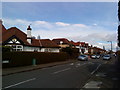
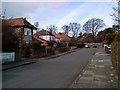
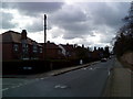
Area Overview for NG9 1DP
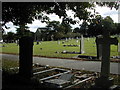
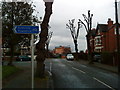
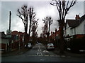
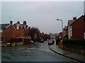
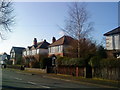
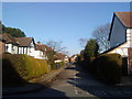
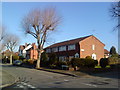
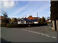
Photos of NG9 1DP

Area Information
Living in NG9 1DP offers immediate access to a compact residential cluster defined by its specific postcode boundaries. This area spans 3,109 square metres and supports a population of 1,747 people, creating a tight-knit community atmosphere. The density stands at 561,998 people per square kilometre according to the recorded figures, emphasising the focused nature of this postcode. Residents here enjoy a straightforward living environment within the East Midlands, specifically serving the Beeston and Nottingham region. The location sits close to significant transport hubs, including Chilwell Road and Beeston Centre Tram Stop, which facilitate easy movement across the city. You are situated less than five minutes from Beeston Railway Station, providing rapid rail links to Nottingham Railway Station and Attenborough Railway Station. The presence of Nottingham Airport within practical reach adds a further layer of connectivity for travellers or those working from the region. Daily life revolves around the immediate availability of essential services, with five retail outlets and five metro stops located nearby. The area functions as a practical residential base for professionals and families requiring access to the wider Nottingham commute network without travelling far from their doorstep.
- Area Type
- Postcode
- Area Size
- 3109 m²
- Population
- 1747
- Population Density
- 5814 people/km²
The property market in NG9 1DP is characterised predominantly by single-family homes rather than shared living spaces. With 85% home ownership, the area functions as a settled residential zone where residents have a direct stake in their neighbourhood. You are looking primarily at houses, as flats and other accommodation types do not exist within this 3,109 square metre postcode. This distinction is vital for buyers who specifically require a standalone home with its own garden and outdoor space. The high rate of ownership suggests that most transactions involve transfers between existing owners or family members moving up or down the property ladder, rather than institutional landlords entering the market. Potential buyers can expect a market where properties have been lived in for extended periods, often resulting in well-maintained interiors and exteriors. The lack of rental accommodation in the local cluster means the supply is almost entirely owner-occupied. This dynamic typically stabilises prices and reduces the volatility often seen in heavily rented districts. When purchasing homes in this area, you are joining a cohort of neighbours who value property as a primary asset.
House Prices in NG9 1DP
Showing 7 properties
| Address | Type | Beds | Baths | Last Sale Price | Last Sale Date | |
|---|---|---|---|---|---|---|
| 48 Cromwell Road, Beeston, NG9 1DP | Semi-detached | - | - | £224,000 | Jul 2009 | |
| 43 Cromwell Road, Beeston, NG9 1DP | Bungalow | - | - | £195,000 | Jul 2006 | |
| 52 Cromwell Road, Beeston, NG9 1DP | house | - | - | £249,950 | Apr 2006 | |
| 50 Cromwell Road, Beeston, NG9 1DP | Semi-detached | - | - | £220,000 | Aug 2004 | |
| 45 Cromwell Road, Beeston, NG9 1DP | Bungalow | 3 | 1 | - | - | |
| 46 Cromwell Road, Beeston, NG9 1DP | Semi-detached | - | - | - | - | |
| 54 Cromwell Road, Beeston, NG9 1DP | Detached | - | - | - | - |
Energy Efficiency in NG9 1DP
Your daily lifestyle in NG9 1DP centres around immediate access to five key retail outlets and five major transport interchange points. You can shop at Lidl Beeston, Sainsburys Beeston, and Co-op Beeston, which are all within practical reach of the postcode area. These specific venues provide all necessary groceries and general merchandise without the need for lengthy journeys. Transport options are robust, with five metro stops including Beeston Centre Tram Stop and the Bus & Tram Interchange offering direct links to the city centre. For rail commuters, Beeston Railway Station provides direct access to Nottingham Railway Station. The proximity to Nottingham Airport remains a significant advantage for business travellers or those with frequent flight requirements. You do not need a car for essential trips, as the surrounding amenities cover groceries, dining, and public transit needs effectively. The area functions as a self-sufficient hub where you can run errands, catch a tram, or visit a railway station with minimal travel time. This density of services ensures a convenient living experience centred on the core registry of Beeston.
Amenities
Schools
| Rank | School | Type | Entry gender | Ages |
|---|
Explore more schools in this area
Go to Schools tabDemographics
The community in NG9 1DP reflects a mature and established neighbourhood with a median age of 47 years. You will find the majority of residents fall into the adults category, specifically those aged between 30 and 64 years. This age profile suggests a population that has likely settled in the area and built strong local roots. Home ownership is the prevailing housing arrangement, with 85% of households owning their property outright or with a mortgage. This high ownership rate indicates long-term stability and a community invested in the longevity of local homes. The accommodation type is exclusively houses, meaning you will not find flats or terraced apartments within this specific postcode boundary. The predominant ethnic group in the area is White, mirroring broader regional and national demographics for this specific locality. These tight demographic lines create a predictable and familiar environment where neighbours often know each other well. The prevalence of household ownership correlates with a low transient population, fostering a sense of continuity. For families or individuals seeking a stable home base, the metric of 85% ownership provides a clear indicator of the area's settlement patterns.
Household Size
Accommodation Type
Tenure
Ethnic Group
Religion
Household Composition
Age
Household Deprivation
NS-SEC
Explore more demographic insights in this area
Go to Demographics tabPlanning
Planning Constraints
- Flood RiskPremium
- Ramsar Wetland SitesPremium
- Area of Outstanding Natural BeautyPremium
- Protected Nature ReservePremium
- Protected WoodlandPremium