Area Overview for NG9 1DL
Photos of NG9 1DL
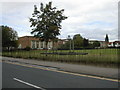
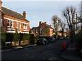
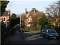
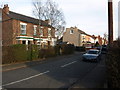
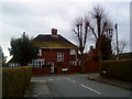
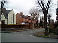
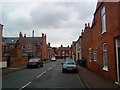
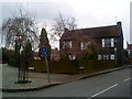
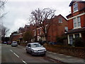
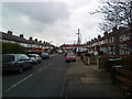
100 photos from this area
Area Information
Key information about the NG9 1DL including its size, population, and administrative classification.
- Area Type
- Postcode
- Area Size
- 5444 m²
- Population
- 1747
- Population Density
- 5814 people/km²
House Prices in NG9 1DL
19
Properties
£221,071
Average Sold Price
£93,500
Lowest Price
£385,000
Highest Price
Showing 19 properties
| Address | Type | Beds | Baths | Last Sale Price | Last Sale Date | |
|---|---|---|---|---|---|---|
| 44 Enfield Street, Beeston, NG9 1DL | Semi-detached | 3 | 1 | £320,000 | Feb 2024 | |
| 51 Enfield Street, Beeston, NG9 1DL | Semi-detached | 3 | - | £310,000 | Apr 2022 | |
| 1, Ashley Court, Enfield Street, Beeston, NG9 1DL | Flat | - | - | £120,000 | Mar 2019 | |
| 43 Enfield Street, Beeston, NG9 1DL | Semi-detached | 2 | 1 | £284,000 | Oct 2018 | |
| 57 Enfield Street, Beeston, NG9 1DL | Terraced | 3 | 2 | £223,000 | Dec 2016 | |
| 52 Enfield Street, Beeston, NG9 1DL | Detached | 4 | - | £385,000 | Mar 2016 | |
| 3, Ashley Court, Enfield Street, Beeston, NG9 1DL | Flat | - | - | £113,500 | Mar 2016 | |
| 55 Enfield Street, Beeston, NG9 1DL | house | 3 | 2 | £197,000 | Nov 2014 | |
| 4, Ashley Court, Enfield Street, Beeston, NG9 1DL | Maisonette | 2 | 1 | £93,500 | May 2014 | |
| 48 Enfield Street, Beeston, NG9 1DL | house | - | - | £210,000 | Mar 2014 |
Page 1 of 2
Energy Efficiency in NG9 1DL
Amenities
Schools
| Rank | School | Type | Entry gender | Ages |
|---|
Explore more schools in this area
Go to Schools tabDemographics
Household Size
Two person
most common
Accommodation Type
Houses
most common
Tenure
85
majority
Ethnic Group
White
most common
Religion
N/A
most common
Household Composition
N/A
most common
Age
47
median
Adults (30-64 years)
most common
Household Deprivation
N/A
with no deprivation
NS-SEC
54
in Lower managerial occupations
Explore more demographic insights in this area
Go to Demographics tabPlanning
Planning Constraints
- Flood RiskPremium
- Ramsar Wetland SitesPremium
- Area of Outstanding Natural BeautyPremium
- Protected Nature ReservePremium
- Protected WoodlandPremium