Area Overview for NG9 1DE
Photos of NG9 1DE
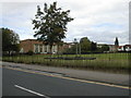
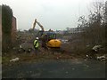
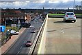
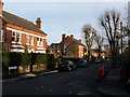
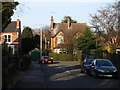
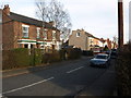
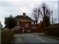
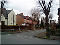
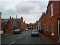
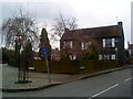
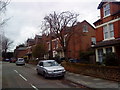
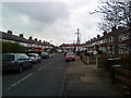
100 photos from this area
Area Information
Key information about the NG9 1DE including its size, population, and administrative classification.
- Area Type
- Postcode
- Area Size
- 1.2 hectares
- Population
- Not available
- Population Density
- Not available
House Prices in NG9 1DE
26
Properties
£337,529
Average Sold Price
£89,000
Lowest Price
£780,000
Highest Price
Showing 26 properties
| Address | Type | Beds | Baths | Last Sale Price | Last Sale Date | |
|---|---|---|---|---|---|---|
| 6 Cromwell Road, Beeston, NG9 1DE | Semi-detached | 3 | 2 | £500,000 | Jun 2024 | |
| 26 Cromwell Road, Beeston, NG9 1DE | Semi-detached | 4 | 2 | £596,450 | Aug 2023 | |
| 33 Cromwell Road, Beeston, NG9 1DE | Semi-detached | 3 | 1 | £436,000 | Dec 2022 | |
| 7 Cromwell Road, Beeston, NG9 1DE | Retail | 4 | 2 | £425,000 | Apr 2022 | |
| 30 Cromwell Road, Beeston, NG9 1DE | Detached | 6 | 3 | £780,000 | Sep 2020 | |
| 35 Cromwell Road, Beeston, NG9 1DE | Semi-detached | 3 | - | £310,000 | Oct 2016 | |
| 14 Cromwell Road, Beeston, NG9 1DE | Semi-detached | 3 | 1 | £276,000 | Jan 2016 | |
| 12 Cromwell Road, Beeston, NG9 1DE | house | - | - | £215,000 | Jun 2010 | |
| 11 Cromwell Road, Beeston, NG9 1DE | Detached | - | - | £415,000 | Oct 2007 | |
| 28 Cromwell Road, Beeston, NG9 1DE | house | - | - | £325,000 | Jul 2007 |
Page 1 of 3
Energy Efficiency in NG9 1DE
Amenities
Schools
| Rank | School | Type | Entry gender | Ages |
|---|
Explore more schools in this area
Go to Schools tabDemographics
Household Size
Two person
most common
Accommodation Type
Houses
most common
Tenure
51
majority
Ethnic Group
White
most common
Religion
N/A
most common
Household Composition
N/A
most common
Age
47
median
Adults (30-64 years)
most common
Household Deprivation
N/A
with no deprivation
NS-SEC
44
in Lower managerial occupations
Explore more demographic insights in this area
Go to Demographics tabPlanning
Planning Constraints
- Flood RiskPremium
- Ramsar Wetland SitesPremium
- Area of Outstanding Natural BeautyPremium
- Protected Nature ReservePremium
- Protected WoodlandPremium