Area Overview for NG9 1FF
Photos of NG9 1FF
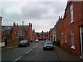
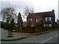
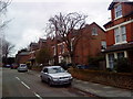
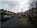
100 photos from this area
Area Information
Key information about the NG9 1FF including its size, population, and administrative classification.
- Area Type
- Postcode
- Area Size
- 5427 m²
- Population
- Not available
- Population Density
- Not available
House Prices in NG9 1FF
12
Properties
£267,979
Average Sold Price
£91,000
Lowest Price
£435,000
Highest Price
Showing 12 properties
| Address | Type | Beds | Baths | Last Sale Price | Last Sale Date | |
|---|---|---|---|---|---|---|
| 6 North Street, Beeston, NG9 1FF | Detached | 3 | 1 | £435,000 | Jun 2024 | |
| 2 North Street, Beeston, NG9 1FF | Semi-detached | 3 | 2 | £315,000 | Aug 2020 | |
| 12 North Street, Beeston, NG9 1FF | house | - | - | £370,000 | Sep 2019 | |
| 18 North Street, Beeston, NG9 1FF | Bungalow | 4 | 1 | £340,000 | Dec 2017 | |
| 24 North Street, Beeston, NG9 1FF | Bungalow | 3 | - | £360,000 | Sep 2015 | |
| 16 North Street, Beeston, NG9 1FF | house | 5 | - | £410,000 | Nov 2011 | |
| 8 North Street, Beeston, NG9 1FF | house | - | - | £305,000 | Nov 2011 | |
| 20 North Street, Beeston, NG9 1FF | Semi-detached | - | - | £217,000 | Aug 2003 | |
| 22 North Street, Beeston, NG9 1FF | Semi-detached | 3 | 1 | £127,500 | Sep 2001 | |
| 14 North Street, Beeston, NG9 1FF | house | - | - | £130,000 | Feb 2000 |
Page 1 of 2
Energy Efficiency in NG9 1FF
Amenities
Schools
| Rank | School | Type | Entry gender | Ages |
|---|
Explore more schools in this area
Go to Schools tabDemographics
Household Size
Two person
most common
Accommodation Type
Houses
most common
Tenure
51
majority
Ethnic Group
White
most common
Religion
N/A
most common
Household Composition
N/A
most common
Age
47
median
Adults (30-64 years)
most common
Household Deprivation
N/A
with no deprivation
NS-SEC
44
in Lower managerial occupations
Explore more demographic insights in this area
Go to Demographics tabPlanning
Planning Constraints
- Flood RiskPremium
- Ramsar Wetland SitesPremium
- Area of Outstanding Natural BeautyPremium
- Protected Nature ReservePremium
- Protected WoodlandPremium