Area Overview for NG5 4EF
Photos of NG5 4EF
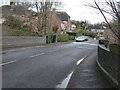
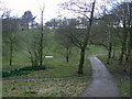
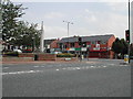
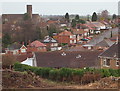
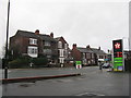
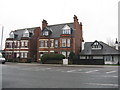
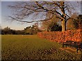

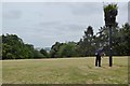
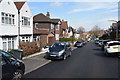
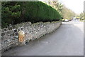
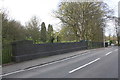
64 photos from this area
Area Information
Key information about the NG5 4EF including its size, population, and administrative classification.
- Area Type
- Postcode
- Area Size
- 1.3 hectares
- Population
- 1464
- Population Density
- 3801 people/km²
House Prices in NG5 4EF
20
Properties
£147,264
Average Sold Price
£51,500
Lowest Price
£264,000
Highest Price
Showing 20 properties
| Address | Type | Beds | Baths | Last Sale Price | Last Sale Date | |
|---|---|---|---|---|---|---|
| 4 Manthorpe Crescent, Nottingham, NG5 4EF | Semi-detached | 3 | 1 | £264,000 | Jan 2025 | |
| 8 Manthorpe Crescent, Nottingham, NG5 4EF | Semi-detached | 3 | 1 | £220,000 | Feb 2024 | |
| 5 Manthorpe Crescent, Nottingham, NG5 4EF | Semi-detached | 3 | 1 | £230,000 | Feb 2023 | |
| 3 Manthorpe Crescent, Nottingham, NG5 4EF | Semi-detached | 3 | 1 | £232,000 | Jun 2022 | |
| 2 Manthorpe Crescent, Nottingham, NG5 4EF | Semi-detached | - | - | £149,950 | May 2007 | |
| 23 Manthorpe Crescent, Nottingham, NG5 4EF | Semi-detached | - | - | £160,000 | Mar 2006 | |
| 19 Manthorpe Crescent, Nottingham, NG5 4EF | Semi-detached | - | - | £98,000 | Mar 2003 | |
| 15 Manthorpe Crescent, Nottingham, NG5 4EF | Land | - | - | £99,950 | May 2002 | |
| 29 Manthorpe Crescent, Nottingham, NG5 4EF | Semi-detached | - | - | £56,000 | Dec 1998 | |
| 21 Manthorpe Crescent, Nottingham, NG5 4EF | Semi-detached | - | - | £58,500 | Sep 1998 |
Page 1 of 2
Energy Efficiency in NG5 4EF
Amenities
Schools
| Rank | School | Type | Entry gender | Ages |
|---|
Explore more schools in this area
Go to Schools tabDemographics
Household Size
Two person
most common
Accommodation Type
Houses
most common
Tenure
72
majority
Ethnic Group
White
most common
Religion
N/A
most common
Household Composition
N/A
most common
Age
47
median
Adults (30-64 years)
most common
Household Deprivation
N/A
with no deprivation
NS-SEC
38
in Lower managerial occupations
Explore more demographic insights in this area
Go to Demographics tabPlanning
Planning Constraints
- Flood RiskPremium
- Ramsar Wetland SitesPremium
- Area of Outstanding Natural BeautyPremium
- Protected Nature ReservePremium
- Protected WoodlandPremium