Area Overview for NG5 4EB
Photos of NG5 4EB
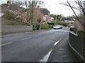
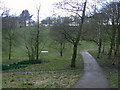
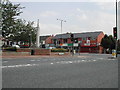
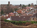
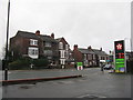
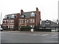
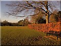
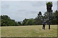
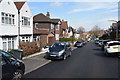
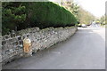
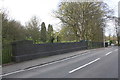
64 photos from this area
Area Information
Key information about the NG5 4EB including its size, population, and administrative classification.
- Area Type
- Postcode
- Area Size
- 7.1 hectares
- Population
- 1348
- Population Density
- 2546 people/km²
House Prices in NG5 4EB
44
Properties
£200,581
Average Sold Price
£60,000
Lowest Price
£350,000
Highest Price
Showing 44 properties
| Address | Type | Beds | Baths | Last Sale Price | Last Sale Date | |
|---|---|---|---|---|---|---|
| 63 Sherwood Vale, Nottingham, NG5 4EB | Semi-detached | 3 | 1 | £226,000 | Dec 2024 | |
| 89 Sherwood Vale, Nottingham, NG5 4EB | Semi-detached | 4 | 2 | £348,000 | Oct 2024 | |
| 113 Sherwood Vale, Nottingham, NG5 4EB | Detached | 3 | 1 | £350,000 | May 2024 | |
| 67 Sherwood Vale, Nottingham, NG5 4EB | Semi-detached | 3 | 1 | £245,000 | Jun 2023 | |
| 119 Sherwood Vale, Nottingham, NG5 4EB | Detached | 3 | - | £304,000 | Mar 2021 | |
| 49 Sherwood Vale, Nottingham, NG5 4EB | house | - | - | £232,500 | Oct 2020 | |
| 45 Sherwood Vale, Nottingham, NG5 4EB | house | 3 | - | £257,000 | Jun 2020 | |
| 79 Sherwood Vale, Nottingham, NG5 4EB | Semi-detached | 3 | 1 | £235,000 | Feb 2019 | |
| 97 Sherwood Vale, Nottingham, NG5 4EB | Detached | 3 | 1 | £280,000 | Sep 2018 | |
| 65 Sherwood Vale, Nottingham, NG5 4EB | Semi-detached | 3 | 1 | £195,000 | Aug 2018 |
Page 1 of 5
Energy Efficiency in NG5 4EB
Amenities
Schools
| Rank | School | Type | Entry gender | Ages |
|---|
Explore more schools in this area
Go to Schools tabDemographics
Household Size
One person
most common
Accommodation Type
Houses
most common
Tenure
60
majority
Ethnic Group
White
most common
Religion
N/A
most common
Household Composition
N/A
most common
Age
47
median
Adults (30-64 years)
most common
Household Deprivation
N/A
with no deprivation
NS-SEC
47
in Lower managerial occupations
Explore more demographic insights in this area
Go to Demographics tabPlanning
Planning Constraints
- Flood RiskPremium
- Ramsar Wetland SitesPremium
- Area of Outstanding Natural BeautyPremium
- Protected Nature ReservePremium
- Protected WoodlandPremium