Area Overview for NG5 4GZ
Photos of NG5 4GZ
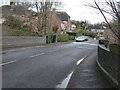
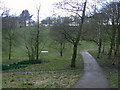
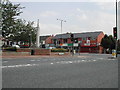
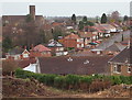
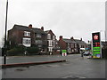
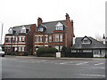
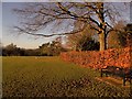

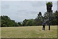
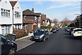
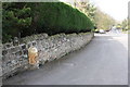
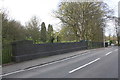
64 photos from this area
Area Information
Key information about the NG5 4GZ including its size, population, and administrative classification.
- Area Type
- Postcode
- Area Size
- 1.8 hectares
- Population
- 1348
- Population Density
- 2546 people/km²
House Prices in NG5 4GZ
10
Properties
£430,700
Average Sold Price
£189,000
Lowest Price
£630,000
Highest Price
Showing 10 properties
| Address | Type | Beds | Baths | Last Sale Price | Last Sale Date | |
|---|---|---|---|---|---|---|
| 78 Woodthorpe Drive, Nottingham, NG5 4GZ | Detached | 6 | 4 | £630,000 | Dec 2022 | |
| Maple Cottage, Woodthorpe Drive, Nottingham, NG5 4GZ | Bungalow | 3 | 2 | £412,500 | Sep 2020 | |
| West Lodge, Woodthorpe Drive, Nottingham, NG5 4GZ | Detached | 4 | 1 | £519,000 | Jun 2019 | |
| Pelham House, Woodthorpe Drive, Nottingham, NG5 4GZ | Retail | 6 | 4 | £403,000 | Feb 2006 | |
| Hazlemere, Woodthorpe Drive, Nottingham, NG5 4GZ | Detached | - | - | £189,000 | Jun 1998 | |
| The Nursery House, Woodthorpe Park, Woodthorpe Drive, Nottingham, NG5 4GZ | house | - | - | - | - | |
| Street Scene Training Centre, Woodthorpe Park, Woodthorpe Drive, Nottingham, NG5 4GZ | Office | - | - | - | - | |
| White Cottage, Woodthorpe Drive, Nottingham, NG5 4GZ | house | - | - | - | - | |
| 80 Woodthorpe Drive, Nottingham, NG5 4GZ | Detached | - | - | - | - | |
| Plant Shop, Woodthorpe Park, Woodthorpe Drive, Nottingham, NG5 4GZ | shop | - | - | - | - |
Energy Efficiency in NG5 4GZ
Amenities
Schools
| Rank | School | Type | Entry gender | Ages |
|---|
Explore more schools in this area
Go to Schools tabDemographics
Household Size
One person
most common
Accommodation Type
Houses
most common
Tenure
60
majority
Ethnic Group
White
most common
Religion
N/A
most common
Household Composition
N/A
most common
Age
47
median
Adults (30-64 years)
most common
Household Deprivation
N/A
with no deprivation
NS-SEC
47
in Lower managerial occupations
Explore more demographic insights in this area
Go to Demographics tabPlanning
Planning Constraints
- Flood RiskPremium
- Ramsar Wetland SitesPremium
- Area of Outstanding Natural BeautyPremium
- Protected Nature ReservePremium
- Protected WoodlandPremium