Area Overview for NG22 8QD
Photos of NG22 8QD
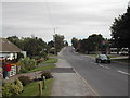
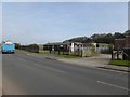
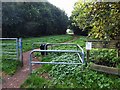

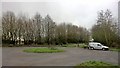

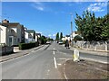
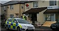
18 photos from this area
Area Information
Key information about the NG22 8QD including its size, population, and administrative classification.
- Area Type
- Postcode
- Area Size
- 1.7 hectares
- Population
- 1987
- Population Density
- 1395 people/km²
House Prices in NG22 8QD
37
Properties
£95,803
Average Sold Price
£29,100
Lowest Price
£155,000
Highest Price
Showing 37 properties
| Address | Type | Beds | Baths | Last Sale Price | Last Sale Date | |
|---|---|---|---|---|---|---|
| 84 Savile Road, Bilsthorpe, NG22 8QD | Terraced | 2 | 1 | £88,000 | Jul 2025 | |
| 94 Savile Road, Bilsthorpe, NG22 8QD | Semi-detached | 3 | 1 | £147,000 | Dec 2024 | |
| 75 Savile Road, Bilsthorpe, NG22 8QD | Semi-detached | 3 | 1 | £155,000 | May 2024 | |
| 71 Savile Road, Bilsthorpe, NG22 8QD | Semi-detached | 3 | 1 | £155,000 | Apr 2024 | |
| 64 Savile Road, Bilsthorpe, NG22 8QD | Semi-detached | 3 | 1 | £132,500 | May 2022 | |
| 82 Savile Road, Bilsthorpe, NG22 8QD | house | 3 | 1 | £125,000 | Sep 2020 | |
| 65 Savile Road, Bilsthorpe, NG22 8QD | house | - | - | £81,000 | Feb 2020 | |
| 81 Savile Road, Bilsthorpe, NG22 8QD | Semi-detached | 3 | 1 | £108,600 | Dec 2018 | |
| 85 Savile Road, Bilsthorpe, NG22 8QD | Semi-detached | 2 | 2 | £100,000 | May 2017 | |
| 90 Savile Road, Bilsthorpe, NG22 8QD | Semi-detached | 3 | 1 | £96,500 | Jan 2017 |
Page 1 of 4
Energy Efficiency in NG22 8QD
Amenities
Schools
| Rank | School | Type | Entry gender | Ages |
|---|
Explore more schools in this area
Go to Schools tabDemographics
Household Size
Two person
most common
Accommodation Type
Houses
most common
Tenure
53
majority
Ethnic Group
White
most common
Religion
N/A
most common
Household Composition
N/A
most common
Age
47
median
Adults (30-64 years)
most common
Household Deprivation
N/A
with no deprivation
NS-SEC
17
in Lower managerial occupations
Explore more demographic insights in this area
Go to Demographics tabPlanning
Planning Constraints
- Flood RiskPremium
- Ramsar Wetland SitesPremium
- Area of Outstanding Natural BeautyPremium
- Protected Nature ReservePremium
- Protected WoodlandPremium