Area Overview for NG22 8PT
Photos of NG22 8PT
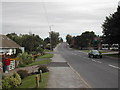
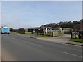
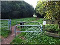

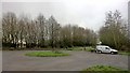

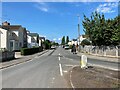

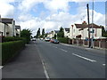
18 photos from this area
Area Information
Key information about the NG22 8PT including its size, population, and administrative classification.
- Area Type
- Postcode
- Area Size
- 2.0 hectares
- Population
- 1901
- Population Density
- 50 people/km²
House Prices in NG22 8PT
46
Properties
£85,874
Average Sold Price
£19,950
Lowest Price
£160,000
Highest Price
Showing 46 properties
| Address | Type | Beds | Baths | Last Sale Price | Last Sale Date | |
|---|---|---|---|---|---|---|
| 19 Savile Road, Bilsthorpe, NG22 8PT | Semi-detached | 2 | 1 | £160,000 | Mar 2025 | |
| 41 Savile Road, Bilsthorpe, NG22 8PT | Terraced | 3 | 1 | £140,000 | Nov 2024 | |
| 48 Savile Road, Bilsthorpe, NG22 8PT | Terraced | 3 | 2 | £148,000 | Aug 2023 | |
| 38 Savile Road, Bilsthorpe, NG22 8PT | Semi-detached | 3 | 1 | £150,000 | Jul 2023 | |
| 21 Savile Road, Bilsthorpe, NG22 8PT | house | - | - | £97,500 | Jan 2023 | |
| 13 Savile Road, Bilsthorpe, NG22 8PT | house | 3 | 1 | £144,000 | Sep 2022 | |
| 33 Savile Road, Bilsthorpe, NG22 8PT | house | 3 | 1 | £95,000 | Feb 2022 | |
| 52 Savile Road, Bilsthorpe, NG22 8PT | Semi-detached | - | - | £120,000 | Jan 2022 | |
| 14 Savile Road, Bilsthorpe, NG22 8PT | house | - | - | £107,000 | Jan 2021 | |
| 47 Savile Road, Bilsthorpe, NG22 8PT | Semi-detached | 3 | 1 | £100,000 | Jul 2019 |
Page 1 of 5
Energy Efficiency in NG22 8PT
Amenities
Schools
| Rank | School | Type | Entry gender | Ages |
|---|
Explore more schools in this area
Go to Schools tabDemographics
Household Size
Two person
most common
Accommodation Type
Houses
most common
Tenure
86
majority
Ethnic Group
White
most common
Religion
N/A
most common
Household Composition
N/A
most common
Age
47
median
Adults (30-64 years)
most common
Household Deprivation
N/A
with no deprivation
NS-SEC
34
in Lower managerial occupations
Explore more demographic insights in this area
Go to Demographics tabPlanning
Planning Constraints
- Flood RiskPremium
- Ramsar Wetland SitesPremium
- Area of Outstanding Natural BeautyPremium
- Protected Nature ReservePremium
- Protected WoodlandPremium