Area Overview for NG16 6JS
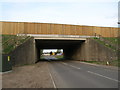
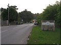
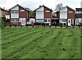
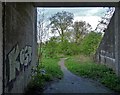
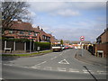
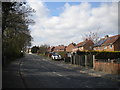
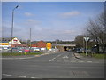
Photos of NG16 6JS


Area Information
Living in NG16 6JS offers a compact, residential experience within a small cluster of 7.6 hectares. With a population of 1,492 people, the area is densely populated at 765 people per square kilometre, creating a tight-knit community feel. The median age of 47 suggests a mature demographic, with most residents aged 30–64. This makes NG16 6JS a place where families and established locals coexist, often in family-sized homes. Daily life here is shaped by proximity to nearby amenities, including retail outlets and rail stations. The area’s small size means residents are likely to know their neighbours, though the limited space also means housing options are focused on single-family homes rather than larger developments. For those seeking a quiet, stable environment with practical access to services, NG16 6JS balances residential comfort with functional connectivity. Its position near Pinxton and surrounding towns ensures it is neither isolated nor overly urban, offering a middle ground for those prioritising community over city life.
- Area Type
- Postcode
- Area Size
- 7.6 hectares
- Population
- 1492
- Population Density
- 765 people/km²
The property market in NG16 6JS is characterised by a 55% home ownership rate, indicating a mix of owner-occupied and rental properties. Given the accommodation type is primarily houses, the area likely consists of semi-detached or detached homes, catering to families or individuals seeking private living spaces. As a small postcode area, the housing stock is limited, meaning buyers may find fewer options compared to larger towns. The compact size also means properties are likely to be in close proximity to local amenities, reducing the need for long commutes. However, the focus on owner-occupation suggests a stable market with less turnover. For buyers, this could mean competition for available homes, though the area’s proximity to rail stations and schools may offset its smaller size.
House Prices in NG16 6JS
Showing 70 properties
| Address | Type | Beds | Baths | Last Sale Price | Last Sale Date | |
|---|---|---|---|---|---|---|
| 130 Woodfield Road, Pinxton, NG16 6JS | Semi-detached | 3 | 1 | £182,000 | Jun 2023 | |
| 62 Woodfield Road, Pinxton, NG16 6JS | Semi-detached | 3 | - | £160,000 | Feb 2023 | |
| 116 Woodfield Road, Pinxton, NG16 6JS | Semi-detached | 3 | 1 | £103,000 | Aug 2022 | |
| 12 Woodfield Road, Pinxton, NG16 6JS | house | - | - | £152,000 | Dec 2021 | |
| 44 Woodfield Road, Pinxton, NG16 6JS | Semi-detached | 3 | - | £110,000 | Aug 2019 | |
| 48 Woodfield Road, Pinxton, NG16 6JS | Terraced | 3 | 1 | £117,000 | Sep 2017 | |
| 64 Woodfield Road, Pinxton, NG16 6JS | house | - | - | £117,000 | Aug 2017 | |
| 138 Woodfield Road, Pinxton, NG16 6JS | house | - | - | £120,000 | May 2015 | |
| 34 Woodfield Road, Pinxton, NG16 6JS | Semi-detached | 3 | - | £75,000 | Jan 2015 | |
| 58 Woodfield Road, Pinxton, NG16 6JS | house | 3 | - | £103,500 | Mar 2012 |
Energy Efficiency in NG16 6JS
The lifestyle in NG16 6JS is shaped by its proximity to retail and transport hubs. Nearby shops include Co-op Pinxton, M&S Mansfield, and Spar, offering essential goods and services within practical reach. The rail stations listed—Alfreton, Kirkby in Ashfield, and Sutton Parkway—provide access to broader regional networks, enhancing mobility for commuters and shoppers. While the area itself is small, its connection to surrounding towns means residents can enjoy a wider range of amenities without long journeys. The presence of schools, retail, and transport links creates a functional daily life, with convenience prioritised over sprawling leisure options. This makes NG16 6JS suitable for those who value accessibility over expansive recreational spaces.
Amenities
Schools
Residents of NG16 6JS have access to a range of educational institutions, including Pinxton Nursery School for early years education and Pinxton Kirkstead Junior School for primary-level learning. For secondary education, Kirkstead Junior Academy serves the area with an Ofsted rating of ‘good’. This mix of nursery, primary, and academy schools provides continuity for families, ensuring children can progress through the education system without long commutes. The presence of a ‘good’-rated academy is a notable advantage, as it suggests a commitment to quality teaching and resources. For parents prioritising school standards, this combination of options offers both convenience and reassurance about their children’s academic development.
| Rank | School | Type | Entry gender | Ages |
|---|
Explore more schools in this area
Go to Schools tabDemographics
The community in NG16 6JS is predominantly composed of adults aged 30–64, with a median age of 47. This suggests a stable, mature population with strong family ties, as 55% of homes are owner-occupied. The accommodation type is primarily houses, reflecting a preference for private, larger living spaces. The predominant ethnic group is White, which aligns with broader regional trends. With a population density of 765 people per square kilometre, the area is moderately crowded but not overwhelming, allowing for a balance between communal interaction and personal space. The demographic profile indicates a community that values stability, with fewer young families or elderly residents compared to other areas. This makes NG16 6JS appealing to professionals or retirees seeking a settled environment, though the limited diversity may affect cultural vibrancy.
Household Size
Accommodation Type
Tenure
Ethnic Group
Religion
Household Composition
Age
Household Deprivation
NS-SEC
Explore more demographic insights in this area
Go to Demographics tabPlanning
Planning Constraints
- Flood RiskPremium
- Ramsar Wetland SitesPremium
- Area of Outstanding Natural BeautyPremium
- Protected Nature ReservePremium
- Protected WoodlandPremium