Area Overview for NG16 6HN
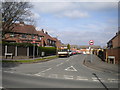
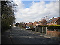
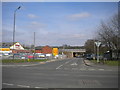
Photos of NG16 6HN

Area Information
Living in NG16 6HN means being part of a small, tightly knit residential cluster in England. The area spans 5,775 square metres and is home to 1,492 people, giving it a population density of 765 people per square kilometre. This compact community is characterised by its mix of older and newer housing stock, with a strong emphasis on family-oriented living. The median age of 47 suggests a mature population, with most residents aged between 30 and 64. Proximity to essential amenities like Co-op Pinxton and nearby railway stations makes daily life convenient. The area’s small size means it is not densely built-up, offering a quieter, more intimate environment compared to larger urban centres. Residents benefit from access to a range of schools, including both primary and academy institutions, which supports families with children. While the area lacks major landmarks or commercial hubs, its charm lies in its simplicity and accessibility to surrounding towns. For those seeking a balance between suburban comfort and practical connectivity, NG16 6HN offers a straightforward, no-frills lifestyle.
- Area Type
- Postcode
- Area Size
- 5775 m²
- Population
- 1492
- Population Density
- 765 people/km²
The property market in NG16 6HN is defined by its focus on owner-occupied homes, with 55% of properties owned by residents rather than rented. The area’s housing stock is predominantly composed of houses, which is typical for smaller, suburban postcode areas. This suggests a market that caters to families and individuals seeking more space than a flat would provide. Given the area’s small size, the housing stock is likely limited, meaning buyers should consider nearby regions for more options. The concentration of houses rather than apartments or terraced properties indicates a preference for private, standalone living. For those interested in purchasing, the market may offer fewer properties but with potentially higher individual value due to the area’s compact nature. The lack of large-scale developments or commercial zones means property prices are unlikely to be influenced by speculative investment, keeping the market grounded in local demand.
House Prices in NG16 6HN
Showing 14 properties
| Address | Type | Beds | Baths | Last Sale Price | Last Sale Date | |
|---|---|---|---|---|---|---|
| 56 Town Street, Pinxton, NG16 6HN | Semi-detached | 4 | 2 | £288,000 | Oct 2025 | |
| 52 Town Street, Pinxton, NG16 6HN | Bungalow | 3 | 2 | £105,000 | Nov 2019 | |
| 76 Town Street, Pinxton, NG16 6HN | Bungalow | 2 | 2 | £98,000 | May 2017 | |
| 64 Town Street, Pinxton, NG16 6HN | Flat | - | - | £105,000 | Jul 2006 | |
| 66 Town Street, Pinxton, NG16 6HN | Flat | 3 | 1 | - | - | |
| Living Accommodation, The Three Horseshoes Inn, 78 Town Street, Pinxton, NG16 6HN | Land | - | - | - | - | |
| 60 Town Street, Pinxton, NG16 6HN | Land | - | - | - | - | |
| 76A Town Street, Pinxton, NG16 6HN | Bungalow | 2 | 1 | - | - | |
| 68 Town Street, Pinxton, NG16 6HN | Flat | - | - | - | - | |
| 70 Town Street, Pinxton, NG16 6HN | Flat | - | - | - | - |
Energy Efficiency in NG16 6HN
The lifestyle in NG16 6HN is shaped by its proximity to essential amenities such as Co-op Pinxton, M&S Mansfield, and Morrisons Daily, offering a range of retail and grocery options. These stores provide convenience for daily shopping, reducing the need to travel further afield. The area’s railway stations connect residents to nearby towns, enhancing access to broader leisure and employment opportunities. While the data does not specify parks or recreational facilities, the absence of planning constraints like protected woodlands or AONB areas suggests space for informal outdoor activities. The small size of the area means that most amenities are within walking or short driving distance, fostering a sense of local community. The mix of retail and transport options supports a balanced lifestyle, though residents may need to venture further for cultural or entertainment venues.
Amenities
Schools
Residents of NG16 6HN have access to a range of educational institutions, including Pinxton Nursery School, which provides early years education, and Pinxton Kirkstead Junior School, a primary school serving younger children. For older students, Kirkstead Junior Academy offers a secondary-level education and holds an Ofsted rating of ‘good’. This mix of nursery, primary, and academy schools ensures a comprehensive educational pathway for families. The presence of a rated academy suggests a commitment to quality education, though no data on pupil performance or school size is provided. The proximity of these schools to the area means parents can avoid long commutes, which is a significant advantage for families. The availability of both state and academy institutions allows parents to choose between traditional and potentially more specialised educational environments.
| Rank | School | Type | Entry gender | Ages |
|---|
Explore more schools in this area
Go to Schools tabDemographics
The community in NG16 6HN is predominantly composed of adults aged 30 to 64, with a median age of 47. This suggests a population that is largely established in careers and family life, with fewer young children or retirees. Home ownership rates stand at 55%, indicating a mix of owner-occupied properties and rental units. The area is primarily composed of houses rather than flats, reflecting a traditional suburban layout. The predominant ethnic group is White, though no specific data on diversity or deprivation is provided. The population density of 765 people per square kilometre means the area is neither overcrowded nor sparse, offering a moderate level of social interaction without urban congestion. This demographic profile suggests a stable, low-turnover community where long-term residency is common. The absence of specific data on deprivation or income levels means the quality of life can only be inferred from the available statistics, such as the balanced mix of age groups and housing types.
Household Size
Accommodation Type
Tenure
Ethnic Group
Religion
Household Composition
Age
Household Deprivation
NS-SEC
Explore more demographic insights in this area
Go to Demographics tabPlanning
Planning Constraints
- Flood RiskPremium
- Ramsar Wetland SitesPremium
- Area of Outstanding Natural BeautyPremium
- Protected Nature ReservePremium
- Protected WoodlandPremium