Area Overview for NG16 5QZ
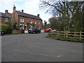
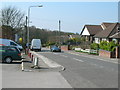
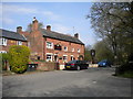
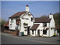
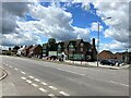
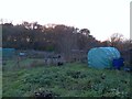
Photos of NG16 5QZ
Area Information
Living in NG16 5QZ means being part of a small, tightly knit residential cluster in England, covering 6,709 square metres and home to 1,455 residents. The area’s compact size fosters a close-knit community, with a population density of 273 people per square kilometre. Most residents are adults aged 30–64, with a median age of 47, suggesting a mature, stable demographic. The area is predominantly owner-occupied, with 88% of homes owned by residents, and the housing stock is largely composed of traditional houses. This mix of low population density and high home ownership creates a quiet, residential atmosphere. The area’s low flood risk and below-average crime rates further enhance its appeal, offering a safe environment with minimal environmental constraints. For those seeking a peaceful, family-oriented setting without the pressures of urban density, NG16 5QZ provides a balanced blend of security, space, and community cohesion.
- Area Type
- Postcode
- Area Size
- 6709 m²
- Population
- 1455
- Population Density
- 273 people/km²
The property market in NG16 5QZ is characterised by high home ownership (88%) and a predominance of houses over flats, reflecting a suburban, family-oriented environment. With only 1,455 residents spread across 6,709 square metres, the area is small and densely populated in terms of housing stock, suggesting limited scope for new developments. This makes the market highly competitive for buyers seeking a home in a low-density, secure area. The focus on owner-occupied properties indicates a community of long-term residents, with little presence of rental properties. For buyers, this means limited availability of new builds or investment opportunities, but a stable market with potential for appreciation. The compact size of the area also means that properties are likely to be in close proximity to amenities, rail links, and schools, enhancing their appeal for families.
House Prices in NG16 5QZ
Showing 9 properties
| Address | Type | Beds | Baths | Last Sale Price | Last Sale Date | |
|---|---|---|---|---|---|---|
| 3 Lawrence Park, Underwood, NG16 5QZ | house | - | - | £450,000 | Sep 2022 | |
| 4 Lawrence Park, Underwood, NG16 5QZ | Detached | 4 | - | £300,000 | Jun 2014 | |
| 2 Lawrence Park, Underwood, NG16 5QZ | Detached | - | - | £310,000 | Dec 2009 | |
| 1 Lawrence Park, Underwood, NG16 5QZ | house | - | - | £237,500 | Dec 2003 | |
| 8 Lawrence Park, Underwood, NG16 5QZ | Detached | 4 | 2 | £180,000 | May 2002 | |
| 5 Lawrence Park, Underwood, NG16 5QZ | Bungalow | 3 | - | - | - | |
| 6 Lawrence Park, Underwood, NG16 5QZ | Detached | - | - | - | - | |
| 7 Lawrence Park, Underwood, NG16 5QZ | Bungalow | - | - | - | - | |
| Caravan, 7 Lawrence Park, Underwood, NG16 5QZ | Mobile Home | - | - | - | - |
Energy Efficiency in NG16 5QZ
Daily life in NG16 5QZ is shaped by its proximity to a range of amenities within practical reach. The area’s retail options include five Co-op stores, notably in Selston, Skegby, and Jacksdale, offering convenience for grocery shopping and everyday needs. For transport, residents have access to five rail stations and five metro stops, including Newstead Railway Station and Butler’s Hill Tram Stop, ensuring easy travel to nearby towns and cities. While the data does not specify parks or leisure facilities, the low population density and absence of environmental constraints suggest space for outdoor activities. The combination of retail, transport, and community-focused infrastructure creates a lifestyle that balances convenience with a relaxed, suburban rhythm, ideal for those prioritising accessibility without urban overcrowding.
Amenities
Schools
Residents of NG16 5QZ have access to two primary schools within practical reach: Bagthorpe Primary School and Underwood Church of England Primary School. Both institutions hold a ‘good’ Ofsted rating, ensuring a solid foundation for early education. The presence of two primary schools suggests a focus on local schooling, which is particularly beneficial for families with young children. While no secondary schools are listed in the data, the proximity to rail and metro stations may provide access to larger educational hubs in nearby towns. The mix of school types—both state and church-affiliated—offers families a choice of educational philosophies, though the lack of secondary options means parents may need to consider commuting for older children. Overall, the primary schools in the area are a strong asset for families prioritising local education.
| Rank | School | Type | Entry gender | Ages |
|---|
Explore more schools in this area
Go to Schools tabDemographics
The community in NG16 5QZ is defined by its mature age profile, with a median age of 47 and the majority of residents falling within the 30–64 age range. This suggests a population largely composed of working-age adults and older families, contributing to a stable, established community. Home ownership is high, with 88% of properties owned by residents, reflecting a preference for long-term residency over rental living. The area is dominated by houses rather than flats, aligning with its suburban character. The predominant ethnic group is White, though no specific diversity statistics are provided. The population density of 273 people per square kilometre ensures a low-pressure environment, where residents can expect a quieter, less congested lifestyle. This demographic profile supports a community focused on family living and long-term stability, with minimal turnover of residents.
Household Size
Accommodation Type
Tenure
Ethnic Group
Religion
Household Composition
Age
Household Deprivation
NS-SEC
Explore more demographic insights in this area
Go to Demographics tabPlanning
Planning Constraints
- Flood RiskPremium
- Ramsar Wetland SitesPremium
- Area of Outstanding Natural BeautyPremium
- Protected Nature ReservePremium
- Protected WoodlandPremium