Area Overview for NG16 5FG
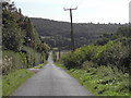
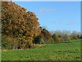
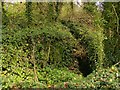
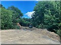
Photos of NG16 5FG


Area Information
Living in NG16 5FG means being part of a small, tightly knit residential cluster in England. The area covers 35.1 hectares and is home to 1,455 residents, giving it a population density of 273 people per square kilometre. This compact postcode area is defined by its residential character, with 88% of homes owned by residents rather than rented. The community is predominantly composed of adults aged 30–64, reflecting a mature, stable demographic. Daily life here is shaped by proximity to local amenities and transport links, with a low crime risk score of 79 and no significant environmental constraints. The area’s safety and lack of planning restrictions make it appealing for families and retirees alike. Its small size means the neighbourhood feels cohesive, with a focus on private housing rather than high-density living. For those seeking a quiet, secure place to live without sacrificing access to services, NG16 5FG offers a straightforward, practical alternative to larger urban centres.
- Area Type
- Postcode
- Area Size
- 35.1 hectares
- Population
- 1455
- Population Density
- 273 people/km²
The property market in NG16 5FG is characterised by high home ownership, with 88% of residents owning their homes. This contrasts with areas where rental demand drives the market, suggesting a community focused on long-term stability rather than transient populations. The accommodation type is predominantly houses, with no indication of flats or shared housing. This makes NG16 5FG a niche area for buyers seeking traditional, owner-occupied properties. Given the postcode’s small size, the housing stock is limited, meaning buyers may need to look beyond the immediate area for more options. The lack of planning constraints, such as protected woodlands or AONBs, also means development restrictions are minimal, potentially offering flexibility for future property value growth. For those prioritising security and a mature demographic, this area’s property market aligns with practical, family-oriented needs.
House Prices in NG16 5FG
Showing 3 properties
| Address | Type | Beds | Baths | Last Sale Price | Last Sale Date | |
|---|---|---|---|---|---|---|
| Felley View, Felley Mill Lane North, Underwood, NG16 5FG | Detached | 6 | 3 | - | - | |
| 1 Felley Mill Lane North, Underwood, NG16 5FG | undefined | - | - | - | - | |
| Felley House, 1 Felley Mill Lane North, Underwood, NG16 5FG | storage_distribution | - | - | - | - |
Energy Efficiency in NG16 5FG
The lifestyle in NG16 5FG is shaped by its proximity to essential retail and transport hubs. Nearby Co-ops in Selston, Skegby, and Jacksdale provide grocery and daily shopping convenience. Rail and metro stations offer easy access to larger towns, while the absence of major leisure facilities means residents may need to travel for entertainment. The area’s small size fosters a sense of simplicity, with amenities focused on practicality rather than luxury. The low population density and mature demographic suggest a quiet, low-traffic environment. While the lack of parks or cultural venues may limit leisure options, the area’s strength lies in its reliability and ease of access to services. This makes NG16 5FG ideal for those prioritising stability over urban vibrancy.
Amenities
Schools
Residents of NG16 5FG have access to two primary schools within practical reach: Bagthorpe Primary School and Underwood Church of England Primary School. Both institutions hold a ‘good’ Ofsted rating, reflecting a baseline standard of education for younger children. The presence of two primary schools suggests a focus on early education, though no secondary schools are listed in the data. This makes NG16 5FG suitable for families with young children but may require longer commutes for older students. The dual availability of state and church-affiliated schools offers parents a choice between secular and faith-based education. However, the absence of secondary school options means families should consider proximity to larger towns for secondary education.
| Rank | School | Type | Entry gender | Ages |
|---|
Explore more schools in this area
Go to Schools tabDemographics
The population of NG16 5FG is 1,455, with a median age of 47 and a majority of residents falling within the 30–64 age range. This suggests a community of established adults, likely with families or long-term local ties. Home ownership is exceptionally high at 88%, indicating a strong preference for private property over rental housing. The area is composed almost entirely of houses, with no mention of flats or other accommodation types. The predominant ethnic group is White, though specific diversity data is not provided. The population density of 273 people per square kilometre is moderate, balancing privacy with community interaction. This demographic profile implies a stable, low-turnover neighbourhood where residents are likely to have built long-term connections. The absence of significant deprivation data suggests a generally consistent quality of life, though this area’s small size means it lacks the diversity of larger towns.
Household Size
Accommodation Type
Tenure
Ethnic Group
Religion
Household Composition
Age
Household Deprivation
NS-SEC
Explore more demographic insights in this area
Go to Demographics tabPlanning
Planning Constraints
- Flood RiskPremium
- Ramsar Wetland SitesPremium
- Area of Outstanding Natural BeautyPremium
- Protected Nature ReservePremium
- Protected WoodlandPremium