Area Overview for NG16 5FE
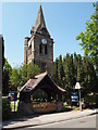
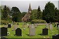
Photos of NG16 5FE

Area Information
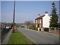
Living in NG16 5FE offers a compact, tightly knit residential experience. This small postcode area covers just 12.6 hectares, housing 1,380 people in a densely populated setting of 10,958 people per square kilometre. The community is predominantly composed of adults aged 30–64, with a median age of 47, suggesting a stable, mature demographic. Most residents own their homes, with 78% of properties being owner-occupied. The area’s size means it is a focused cluster of housing, likely centred around local amenities and transport links. Daily life here is shaped by proximity to shops, rail services, and public transport, with the high broadband score of 99 ensuring seamless digital connectivity. While the population density is high, the area’s small footprint means it is likely a quiet, low-traffic environment. For buyers, NG16 5FE presents a mix of practicality and convenience, with limited space but well-connected infrastructure. The low crime risk score of 86 adds to its appeal as a safe, secure place to live.
- Area Type
- Postcode
- Area Size
- 12.6 hectares
- Population
- 1380
- Population Density
- 2407 people/km²
The property market in NG16 5FE is characterised by a strong owner-occupied presence, with 78% of homes owned by residents rather than rented. The accommodation type is predominantly houses, which is unusual for areas with high population density, suggesting a mix of family homes and smaller properties. This small postcode area likely has limited housing stock, meaning buyers may need to consider nearby regions for more options. The high home ownership rate implies a community of long-term residents, which can stabilise property values but may also limit turnover. For buyers, the focus on houses means a preference for traditional, perhaps larger properties, though the area’s compact size may restrict availability. The proximity to rail and metro stations could enhance property appeal, as transport links are a key factor in housing desirability. However, the small footprint of NG16 5FE means buyers should approach the market with realistic expectations about space and availability.
House Prices in NG16 5FE
Showing 32 properties
| Address | Type | Beds | Baths | Last Sale Price | Last Sale Date | |
|---|---|---|---|---|---|---|
| 118 Mansfield Road, Underwood, NG16 5FE | house | - | - | £200,000 | May 2025 | |
| 98 Mansfield Road, Underwood, NG16 5FE | Semi-detached | 2 | 1 | £202,000 | Jun 2024 | |
| 136 Mansfield Road, Underwood, NG16 5FE | Semi-detached | 3 | - | £235,000 | Feb 2024 | |
| 142 Mansfield Road, Underwood, NG16 5FE | Semi-detached | 2 | 1 | £150,000 | Apr 2023 | |
| 132 Mansfield Road, Underwood, NG16 5FE | Semi-detached | 2 | 1 | £168,000 | Oct 2020 | |
| 112 Mansfield Road, Underwood, NG16 5FE | Semi-detached | 2 | 1 | £157,000 | Jan 2019 | |
| 134 Mansfield Road, Underwood, NG16 5FE | Semi-detached | 2 | - | £124,950 | Mar 2016 | |
| 84 Mansfield Road, Underwood, NG16 5FE | Semi-detached | 2 | 1 | £108,500 | Dec 2015 | |
| 122 Mansfield Road, Underwood, NG16 5FE | house | - | - | £108,000 | Nov 2015 | |
| 90 Mansfield Road, Underwood, NG16 5FE | house | - | - | £115,000 | Aug 2014 |
Energy Efficiency in NG16 5FE
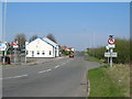
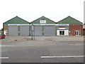
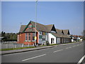
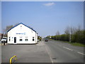
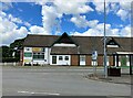
Daily life in NG16 5FE is shaped by its proximity to essential amenities. Local shops include Co-op stores in Selston, Jacksdale, and Skegby, providing access to groceries, household goods, and other necessities. The area’s rail and metro stations—Langley Mill, Newstead, Kirkby in Ashfield, Butler’s Hill, Moor Bridge, and Bulwell Forest—offer easy access to nearby towns, shopping centres, and cultural hubs. While the data does not specify parks or leisure facilities, the presence of multiple transport links suggests a well-integrated location for both local and regional activities. The compact nature of the area means residents can reach these amenities without long commutes. The combination of retail options and transport infrastructure supports a practical, convenient lifestyle, ideal for those prioritising accessibility over expansive green spaces. For families or commuters, the balance of local shops and public transport makes NG16 5FE a functional, if modest, place to live.
Amenities
Schools
| Rank | School | Type | Entry gender | Ages |
|---|
Explore more schools in this area
Go to Schools tabDemographics
The community in NG16 5FE is defined by its age profile and home ownership rates. With a median age of 47 and 78% of residents owning their homes, the area is largely populated by adults aged 30–64, suggesting a stable, long-term demographic. The predominant ethnic group is White, and the accommodation type is primarily houses, reflecting a residential focus rather than flats or apartments. The high population density of 10,958 people per square kilometre is notable given the small area size, indicating a compact, closely packed community. This density does not necessarily equate to overcrowding but highlights the area’s efficiency in housing a significant population within a limited space. The absence of specific deprivation data means quality of life is inferred from factors like safety, connectivity, and amenities. The low crime risk and proximity to essential services suggest a functional, if modest, quality of life for residents.
Household Size
Accommodation Type
Tenure
Ethnic Group
Religion
Household Composition
Age
Household Deprivation
NS-SEC
Explore more demographic insights in this area
Go to Demographics tabPlanning
Planning Constraints
- Flood RiskPremium
- Ramsar Wetland SitesPremium
- Area of Outstanding Natural BeautyPremium
- Protected Nature ReservePremium
- Protected WoodlandPremium