Area Overview for NG10 2BT
Photos of NG10 2BT
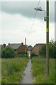
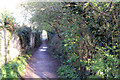
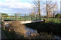
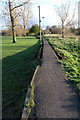
100 photos from this area
Area Information
Key information about the NG10 2BT including its size, population, and administrative classification.
- Area Type
- Postcode
- Area Size
- 3.2 hectares
- Population
- 1946
- Population Density
- 4639 people/km²
House Prices in NG10 2BT
44
Properties
£202,514
Average Sold Price
£31,500
Lowest Price
£500,000
Highest Price
Showing 44 properties
| Address | Type | Beds | Baths | Last Sale Price | Last Sale Date | |
|---|---|---|---|---|---|---|
| 1A Cleveland Avenue, Long Eaton, NG10 2BT | Bungalow | 3 | 2 | £260,000 | Apr 2024 | |
| 75 Cleveland Avenue, Long Eaton, NG10 2BT | Terraced | 3 | 1 | £188,500 | Aug 2023 | |
| 2 Cleveland Avenue, Long Eaton, NG10 2BT | house | - | - | £500,000 | Apr 2023 | |
| 7 Cleveland Avenue, Long Eaton, NG10 2BT | Detached | 4 | 2 | £395,000 | Feb 2023 | |
| 12 Cleveland Avenue, Long Eaton, NG10 2BT | Retail | 2 | 1 | £270,000 | Nov 2022 | |
| 25 Cleveland Avenue, Long Eaton, NG10 2BT | Detached | 3 | 2 | £367,500 | Oct 2022 | |
| 74 Cleveland Avenue, Long Eaton, NG10 2BT | house | - | - | £175,000 | Nov 2021 | |
| 71 Cleveland Avenue, Long Eaton, NG10 2BT | house | - | - | £159,522 | Nov 2021 | |
| 82 Cleveland Avenue, Long Eaton, NG10 2BT | house | 4 | - | £249,950 | Nov 2021 | |
| 80 Cleveland Avenue, Long Eaton, NG10 2BT | Terraced | 3 | 2 | £195,000 | May 2021 |
Page 1 of 5
Energy Efficiency in NG10 2BT
Amenities
Schools
| Rank | School | Type | Entry gender | Ages |
|---|
Explore more schools in this area
Go to Schools tabDemographics
Household Size
Family (3-5 people)
most common
Accommodation Type
Houses
most common
Tenure
79
majority
Ethnic Group
White
most common
Religion
N/A
most common
Household Composition
N/A
most common
Age
47
median
Adults (30-64 years)
most common
Household Deprivation
N/A
with no deprivation
NS-SEC
38
in Lower managerial occupations
Explore more demographic insights in this area
Go to Demographics tabPlanning
Planning Constraints
- Flood RiskPremium
- Ramsar Wetland SitesPremium
- Area of Outstanding Natural BeautyPremium
- Protected Nature ReservePremium
- Protected WoodlandPremium