Area Overview for NG9 6FB
Photos of NG9 6FB
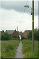
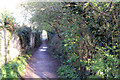
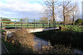
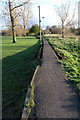
100 photos from this area
Area Information
Key information about the NG9 6FB including its size, population, and administrative classification.
- Area Type
- Postcode
- Area Size
- 4.6 hectares
- Population
- 1412
- Population Density
- 3151 people/km²
House Prices in NG9 6FB
28
Properties
£210,833
Average Sold Price
£40,000
Lowest Price
£370,000
Highest Price
Showing 28 properties
| Address | Type | Beds | Baths | Last Sale Price | Last Sale Date | |
|---|---|---|---|---|---|---|
| 38A Carrfield Avenue, Toton, NG9 6FB | Detached | 2 | 1 | £178,000 | Jan 2024 | |
| 68 Carrfield Avenue, Toton, NG9 6FB | Retail | 3 | 1 | £295,000 | Jun 2022 | |
| 70 Carrfield Avenue, Toton, NG9 6FB | Semi-detached | 3 | 1 | £228,000 | Dec 2021 | |
| 66 Carrfield Avenue, Toton, NG9 6FB | house | - | - | £270,000 | May 2021 | |
| 110 Carrfield Avenue, Toton, NG9 6FB | Semi-detached | 2 | 2 | £325,000 | Feb 2021 | |
| 40 Carrfield Avenue, Toton, NG9 6FB | Semi-detached | 3 | - | £162,000 | Feb 2021 | |
| 114 Carrfield Avenue, Toton, NG9 6FB | house | 3 | 1 | £267,000 | Mar 2020 | |
| 54 Carrfield Avenue, Toton, NG9 6FB | Detached | 3 | 1 | £260,000 | Oct 2018 | |
| 120 Carrfield Avenue, Toton, NG9 6FB | house | - | - | £370,000 | Apr 2018 | |
| 60 Carrfield Avenue, Toton, NG9 6FB | Semi-detached | 3 | - | £169,000 | Jun 2014 |
Page 1 of 3
Energy Efficiency in NG9 6FB
Amenities
Schools
| Rank | School | Type | Entry gender | Ages |
|---|
Explore more schools in this area
Go to Schools tabDemographics
Household Size
Two person
most common
Accommodation Type
Houses
most common
Tenure
85
majority
Ethnic Group
White
most common
Religion
N/A
most common
Household Composition
N/A
most common
Age
47
median
Adults (30-64 years)
most common
Household Deprivation
N/A
with no deprivation
NS-SEC
45
in Lower managerial occupations
Explore more demographic insights in this area
Go to Demographics tabPlanning
Planning Constraints
- Flood RiskPremium
- Ramsar Wetland SitesPremium
- Area of Outstanding Natural BeautyPremium
- Protected Nature ReservePremium
- Protected WoodlandPremium