Area Overview for NG10 2BH
Photos of NG10 2BH
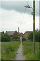
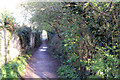
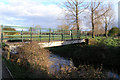
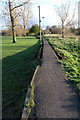
100 photos from this area
Area Information
Key information about the NG10 2BH including its size, population, and administrative classification.
- Area Type
- Postcode
- Area Size
- 8890 m²
- Population
- 1645
- Population Density
- 3576 people/km²
House Prices in NG10 2BH
45
Properties
£84,665
Average Sold Price
£17,026
Lowest Price
£174,000
Highest Price
Showing 45 properties
| Address | Type | Beds | Baths | Last Sale Price | Last Sale Date | |
|---|---|---|---|---|---|---|
| 60 Landsdown Grove, Long Eaton, NG10 2BH | Terraced | 2 | 1 | £160,000 | Sep 2025 | |
| 51 Landsdown Grove, Long Eaton, NG10 2BH | Terraced | 2 | 1 | £174,000 | Nov 2024 | |
| 34 Landsdown Grove, Long Eaton, NG10 2BH | Terraced | 2 | 1 | £140,000 | Mar 2024 | |
| 44 Landsdown Grove, Long Eaton, NG10 2BH | Terraced | 2 | 2 | £150,000 | Apr 2023 | |
| 49 Landsdown Grove, Long Eaton, NG10 2BH | house | - | - | £133,800 | Jul 2021 | |
| 45 Landsdown Grove, Long Eaton, NG10 2BH | house | 2 | 1 | £100,000 | Mar 2021 | |
| 33 Landsdown Grove, Long Eaton, NG10 2BH | house | - | - | £114,000 | Dec 2020 | |
| 31 Landsdown Grove, Long Eaton, NG10 2BH | Terraced | 2 | 1 | £107,000 | Nov 2020 | |
| 38 Landsdown Grove, Long Eaton, NG10 2BH | Terraced | 2 | 1 | £77,500 | Apr 2020 | |
| 39 Landsdown Grove, Long Eaton, NG10 2BH | Terraced | 2 | 1 | £112,500 | Mar 2018 |
Page 1 of 5
Energy Efficiency in NG10 2BH
Amenities
Schools
| Rank | School | Type | Entry gender | Ages |
|---|
Explore more schools in this area
Go to Schools tabDemographics
Household Size
Two person
most common
Accommodation Type
Houses
most common
Tenure
65
majority
Ethnic Group
White
most common
Religion
N/A
most common
Household Composition
N/A
most common
Age
47
median
Adults (30-64 years)
most common
Household Deprivation
N/A
with no deprivation
NS-SEC
27
in Lower managerial occupations
Explore more demographic insights in this area
Go to Demographics tabPlanning
Planning Constraints
- Flood RiskPremium
- Ramsar Wetland SitesPremium
- Area of Outstanding Natural BeautyPremium
- Protected Nature ReservePremium
- Protected WoodlandPremium