Area Overview for NG10 1EA
Photos of NG10 1EA
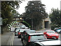
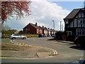
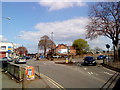
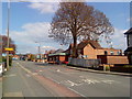


100 photos from this area
Area Information
Key information about the NG10 1EA including its size, population, and administrative classification.
- Area Type
- Postcode
- Area Size
- 2.4 hectares
- Population
- 1695
- Population Density
- 2870 people/km²
House Prices in NG10 1EA
66
Properties
£166,509
Average Sold Price
£56,000
Lowest Price
£292,500
Highest Price
Showing 66 properties
| Address | Type | Beds | Baths | Last Sale Price | Last Sale Date | |
|---|---|---|---|---|---|---|
| 33 Bosworth Way, Long Eaton, NG10 1EA | Semi-detached | 3 | 1 | £235,000 | May 2025 | |
| 8 Bosworth Way, Long Eaton, NG10 1EA | Detached | 2 | 1 | £217,030 | Mar 2025 | |
| 2 Bosworth Way, Long Eaton, NG10 1EA | Bungalow | 2 | 1 | £225,000 | Mar 2025 | |
| 4A Bosworth Way, Long Eaton, NG10 1EA | Bungalow | 2 | 1 | £215,500 | Nov 2024 | |
| 4 Bosworth Way, Long Eaton, NG10 1EA | Bungalow | 2 | 1 | £200,000 | Jan 2024 | |
| 71 Bosworth Way, Long Eaton, NG10 1EA | Semi-detached | 3 | 1 | £245,000 | Oct 2023 | |
| 43 Bosworth Way, Long Eaton, NG10 1EA | house | 3 | 1 | £268,950 | Oct 2023 | |
| 63 Bosworth Way, Long Eaton, NG10 1EA | Semi-detached | 3 | 1 | £248,000 | May 2023 | |
| 37 Bosworth Way, Long Eaton, NG10 1EA | Semi-detached | 3 | 1 | £262,000 | Jan 2023 | |
| 87 Bosworth Way, Long Eaton, NG10 1EA | Semi-detached | 3 | 1 | £220,000 | Oct 2022 |
Page 1 of 7
Energy Efficiency in NG10 1EA
Amenities
Schools
| Rank | School | Type | Entry gender | Ages |
|---|
Explore more schools in this area
Go to Schools tabDemographics
Household Size
Two person
most common
Accommodation Type
Houses
most common
Tenure
73
majority
Ethnic Group
White
most common
Religion
N/A
most common
Household Composition
N/A
most common
Age
47
median
Adults (30-64 years)
most common
Household Deprivation
N/A
with no deprivation
NS-SEC
34
in Lower managerial occupations
Explore more demographic insights in this area
Go to Demographics tabPlanning
Planning Constraints
- Flood RiskPremium
- Ramsar Wetland SitesPremium
- Area of Outstanding Natural BeautyPremium
- Protected Nature ReservePremium
- Protected WoodlandPremium