Area Overview for LN6 4RX
Photos of LN6 4RX
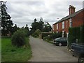
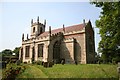

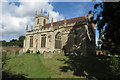
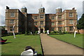
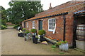
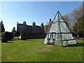
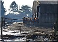
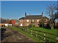
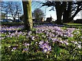
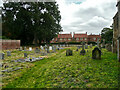
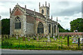
65 photos from this area
Area Information
Key information about the LN6 4RX including its size, population, and administrative classification.
- Area Type
- Postcode
- Area Size
- 51.7 hectares
- Population
- 2588
- Population Density
- 54 people/km²
House Prices in LN6 4RX
14
Properties
£385,913
Average Sold Price
£9,000
Lowest Price
£700,000
Highest Price
Showing 14 properties
| Address | Type | Beds | Baths | Last Sale Price | Last Sale Date | |
|---|---|---|---|---|---|---|
| Woodsnook, Kennel Lane, Doddington, Lincoln, LN6 4RX | Bungalow | 3 | 2 | £510,000 | Jul 2025 | |
| The Ridings, Kennel Lane, Doddington, Lincoln, LN6 4RX | Detached | 5 | 2 | £700,000 | Aug 2024 | |
| Church Farmhouse, Kennel Lane, Doddington, Lincoln, LN6 4RX | Detached | 4 | 2 | £470,000 | Dec 2019 | |
| Biokova, Kennel Lane, Doddington, Lincoln, LN6 4RX | Detached | - | - | £9,000 | May 2019 | |
| Church View, Kennel Lane, Doddington, Lincoln, LN6 4RX | house | - | - | £395,000 | Aug 2017 | |
| Hailwood, Kennel Lane, Doddington, Lincoln, LN6 4RX | Detached | 3 | 2 | £310,000 | Aug 2017 | |
| Tweenwalls, Kennel Lane, Doddington, Lincoln, LN6 4RX | Detached | - | - | £305,000 | Jul 2008 | |
| The Limes, Kennel Lane, Doddington, Lincoln, LN6 4RX | Detached | - | - | £388,300 | Mar 2007 | |
| The Old Bull Pens, Kennel Lane, Doddington, Lincoln, LN6 4RX | Detached | 4 | 2 | - | - | |
| Bencathra, Kennel Lane, Doddington, Lincoln, LN6 4RX | Detached | 4 | 1 | - | - |
Page 1 of 2
Energy Efficiency in LN6 4RX
Amenities
Schools
| Rank | School | Type | Entry gender | Ages |
|---|
Explore more schools in this area
Go to Schools tabDemographics
Household Size
Two person
most common
Accommodation Type
Houses
most common
Tenure
81
majority
Ethnic Group
White
most common
Religion
N/A
most common
Household Composition
N/A
most common
Age
47
median
Adults (30-64 years)
most common
Household Deprivation
N/A
with no deprivation
NS-SEC
36
in Lower managerial occupations
Explore more demographic insights in this area
Go to Demographics tabPlanning
Planning Constraints
- Flood RiskPremium
- Ramsar Wetland SitesPremium
- Area of Outstanding Natural BeautyPremium
- Protected Nature ReservePremium
- Protected WoodlandPremium