Area Overview for LN6 4RT
Photos of LN6 4RT


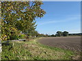
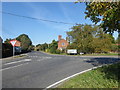

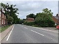
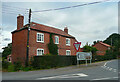
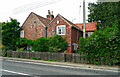

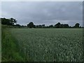
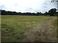
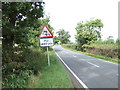
15 photos from this area
Area Information
Key information about the LN6 4RT including its size, population, and administrative classification.
- Area Type
- Postcode
- Area Size
- 16.5 hectares
- Population
- 2588
- Population Density
- 54 people/km²
House Prices in LN6 4RT
18
Properties
£152,360
Average Sold Price
£36,720
Lowest Price
£268,000
Highest Price
Showing 18 properties
| Address | Type | Beds | Baths | Last Sale Price | Last Sale Date | |
|---|---|---|---|---|---|---|
| Rose Cottage, Main Street, Doddington, Lincoln, LN6 4RT | house | - | - | £36,720 | Jul 2003 | |
| Forresters Cottage, Main Street, Doddington, Lincoln, LN6 4RT | Detached | - | - | £268,000 | Apr 2003 | |
| Home Farm South, Main Street, Doddington, Lincoln, LN6 4RT | Semi-detached | - | - | - | - | |
| 3, Teachers House, Main Street, Doddington, Lincoln, LN6 4RT | house | - | - | - | - | |
| 2, Teachers House, Main Street, Doddington, Lincoln, LN6 4RT | house | - | - | - | - | |
| 1, Teachers House, Main Street, Doddington, Lincoln, LN6 4RT | house | - | - | - | - | |
| Farm Shop And Cafe, Doddington Hall, Hall Yard, Doddington, Lincoln, LN6 4RT | shop | - | - | - | - | |
| The Scolds Bridle, Main Street, Doddington, Lincoln, LN6 4RT | Semi-detached | - | - | - | - | |
| The Cottage, Main Street, Doddington, Lincoln, LN6 4RT | house | - | - | - | - | |
| 2, Paradise Row, Main Street, Doddington, Lincoln, LN6 4RT | house | - | - | - | - |
Page 1 of 2
Energy Efficiency in LN6 4RT
Amenities
Schools
| Rank | School | Type | Entry gender | Ages |
|---|
Explore more schools in this area
Go to Schools tabDemographics
Household Size
Two person
most common
Accommodation Type
Houses
most common
Tenure
81
majority
Ethnic Group
White
most common
Religion
N/A
most common
Household Composition
N/A
most common
Age
47
median
Adults (30-64 years)
most common
Household Deprivation
N/A
with no deprivation
NS-SEC
36
in Lower managerial occupations
Explore more demographic insights in this area
Go to Demographics tabPlanning
Planning Constraints
- Flood RiskPremium
- Ramsar Wetland SitesPremium
- Area of Outstanding Natural BeautyPremium
- Protected Nature ReservePremium
- Protected WoodlandPremium