Area Overview for LN6 4RY
Photos of LN6 4RY


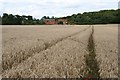


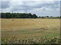

51 photos from this area
Area Information
Key information about the LN6 4RY including its size, population, and administrative classification.
- Area Type
- Postcode
- Area Size
- 4.1 km²
- Population
- 2588
- Population Density
- 54 people/km²
House Prices in LN6 4RY
20
Properties
£237,333
Average Sold Price
£147,000
Lowest Price
£415,000
Highest Price
Showing 20 properties
| Address | Type | Beds | Baths | Last Sale Price | Last Sale Date | |
|---|---|---|---|---|---|---|
| 2 Saxilby Road, Doddington, Lincoln, LN6 4RY | house | - | - | £150,000 | Jul 2023 | |
| Lingwood, Carr Lane, Broadholme, Lincoln, LN6 4RY | Bungalow | 3 | 1 | £415,000 | Nov 2019 | |
| 1 Saxilby Road, Doddington, Lincoln, LN6 4RY | house | 3 | - | £147,000 | Jun 2013 | |
| Elmtree Cottage, Saxilby Road, Doddington, Lincoln, LN6 4RY | Detached | 3 | 1 | - | - | |
| SANBYS DRIVE, SAXILBY ROAD, Doddington, Lincoln, LN6 4RY | Detached | - | - | - | - | |
| Treehouse General Trading Company, Suite 1, Old Hagg Farm, Saxilby Road, Doddington, Lincoln, LN6 4RY | Office | - | - | - | - | |
| Rudd Retreat, Wallrudding Farm, Tom Otters Lane, Harby, LN6 4RY | hotel | - | - | - | - | |
| Carp Cottage, Wallrudding Farm, Tom Otters Lane, Harby, LN6 4RY | hotel | - | - | - | - | |
| Koi Keep, Wallrudding Farm, Tom Otters Lane, Harby, LN6 4RY | hotel | - | - | - | - | |
| Roach Rest, Wallrudding Farm, Tom Otters Lane, Harby, LN6 4RY | hotel | - | - | - | - |
Page 1 of 2
Energy Efficiency in LN6 4RY
Amenities
Schools
| Rank | School | Type | Entry gender | Ages |
|---|
Explore more schools in this area
Go to Schools tabDemographics
Household Size
Two person
most common
Accommodation Type
Houses
most common
Tenure
81
majority
Ethnic Group
White
most common
Religion
N/A
most common
Household Composition
N/A
most common
Age
47
median
Adults (30-64 years)
most common
Household Deprivation
N/A
with no deprivation
NS-SEC
36
in Lower managerial occupations
Explore more demographic insights in this area
Go to Demographics tabPlanning
Planning Constraints
- Flood RiskPremium
- Ramsar Wetland SitesPremium
- Area of Outstanding Natural BeautyPremium
- Protected Nature ReservePremium
- Protected WoodlandPremium