Area Overview for LN2 4BT
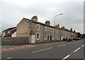
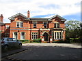
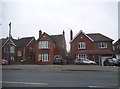
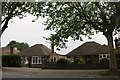
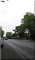
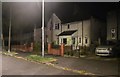
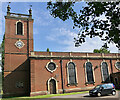
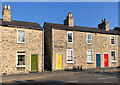
Photos of LN2 4BT


Area Information
LN2 4BT is a compact residential postcode in England, covering just 9,813 square metres and home to 1,295 residents. Its high population density of 131,968 people per square kilometre reflects a tightly knit community, though the area’s small size means it’s a focused cluster rather than a sprawling suburb. Living here offers proximity to essential services, with three railway stations—Lincoln Central, Hykeham, and Saxilby—within reach, linking residents to nearby cities. The area is also near RAF Scampton and RAF Waddington, adding a strategic dimension to its location. Daily life here is shaped by its mix of local retail, including Aldi, Waitrose, and Tesco, and the predominantly older demographic, with a median age of 47. While the area is not expansive, its density and connectivity make it a practical choice for those prioritising convenience over space.
- Area Type
- Postcode
- Area Size
- 9813 m²
- Population
- 1295
- Population Density
- 5723 people/km²
The property market in LN2 4BT is characterised by a 50% home ownership rate, with houses being the primary accommodation type. This suggests a mix of owner-occupied homes and rental properties, though the small area size—just 9,813 square metres—means the housing stock is limited. The predominance of houses over flats or apartments may appeal to those seeking traditional family homes, but the compact nature of the postcode could restrict availability. Buyers should consider that the area is not a large suburb but a focused cluster, which may mean fewer property options. The 50% ownership rate also implies that half the housing is likely in the rental market, potentially offering opportunities for investors. However, the small size of LN2 4BT means buyers must look closely at the immediate surroundings for more options.
House Prices in LN2 4BT
Showing 21 properties
| Address | Type | Beds | Baths | Last Sale Price | Last Sale Date | |
|---|---|---|---|---|---|---|
| 94 Ruskin Avenue, Lincoln, LN2 4BT | Semi-detached | 4 | 1 | £250,000 | Nov 2024 | |
| 68 Ruskin Avenue, Lincoln, LN2 4BT | Semi-detached | 4 | 2 | £240,000 | Aug 2024 | |
| 70 Ruskin Avenue, Lincoln, LN2 4BT | house | - | - | £221,000 | Nov 2021 | |
| 90 Ruskin Avenue, Lincoln, LN2 4BT | Detached | 3 | 3 | £290,000 | Oct 2020 | |
| 74 Ruskin Avenue, Lincoln, LN2 4BT | Semi-detached | 3 | 1 | £200,000 | Apr 2017 | |
| 84 Ruskin Avenue, Lincoln, LN2 4BT | house | - | - | £91,500 | Oct 2016 | |
| 78 Ruskin Avenue, Lincoln, LN2 4BT | Semi-detached | 3 | 1 | £150,000 | Sep 2015 | |
| 88 Ruskin Avenue, Lincoln, LN2 4BT | Semi-detached | 3 | 1 | £161,500 | Mar 2015 | |
| 80 Ruskin Avenue, Lincoln, LN2 4BT | house | 3 | - | £125,000 | Mar 2012 | |
| 82 Ruskin Avenue, Lincoln, LN2 4BT | house | 3 | - | £128,000 | Dec 2011 |
Energy Efficiency in LN2 4BT
Living in LN2 4BT provides access to a range of nearby amenities, including retail outlets such as Aldi, Waitrose, and Tesco, which cater to everyday shopping needs. The area’s proximity to three railway stations—Lincoln Central, Hykeham, and Saxilby—ensures convenient travel to larger urban centres, while the presence of RAF Scampton and RAF Waddington adds a unique local character. Though the area is small, its retail and transport options offer a practical lifestyle, blending local convenience with regional connectivity. The absence of major leisure or entertainment venues within the postcode itself means residents may need to travel slightly further for dining or cultural activities. Nonetheless, the combination of accessible shopping, rail links, and strategic location makes LN2 4BT a functional choice for those prioritising connectivity over sprawling amenities.
Amenities
Schools
| Rank | School | Type | Entry gender | Ages |
|---|
Explore more schools in this area
Go to Schools tabDemographics
The community in LN2 4BT is predominantly composed of adults aged 30–64, with a median age of 47. This suggests a mature population, likely with established careers and families. Home ownership stands at 50%, indicating a balance between owner-occupied properties and rentals. The accommodation type is primarily houses, reflecting a more traditional housing stock compared to flats or apartments. The predominant ethnic group is White, though specific data on diversity or deprivation is not provided. The high population density—131,968 people per square kilometre—implies a compact, possibly multi-generational living environment. For residents, this density may translate to shared community spaces but could also mean limited private outdoor areas. The age profile suggests a stable, long-term resident base, though the lack of younger demographics may influence local amenities and services.
Household Size
Accommodation Type
Tenure
Ethnic Group
Religion
Household Composition
Age
Household Deprivation
NS-SEC
Explore more demographic insights in this area
Go to Demographics tabPlanning
Planning Constraints
- Flood RiskPremium
- Ramsar Wetland SitesPremium
- Area of Outstanding Natural BeautyPremium
- Protected Nature ReservePremium
- Protected WoodlandPremium