Area Overview for LN2 2EQ
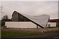
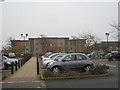
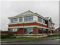
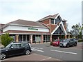
Photos of LN2 2EQ


Area Information
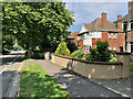
Living in LN2 2EQ means being part of a tightly knit residential cluster in England, where 1,567 people inhabit just 1,871 square metres. This small area, though densely populated at 837,563 people per square kilometre, offers a compact, community-oriented lifestyle. The postcode covers a mix of housing types, with 80% of homes owned by residents rather than rented out. Daily life here is shaped by proximity to amenities such as Waitrose Lincoln and Lincoln Central Railway Station, which provide retail and transport links. The area’s compact size means residents are close to essential services, though its limited geographical spread means it’s best suited for those prioritising convenience over expansive living space. With a median age of 47 and a majority of adults aged 30–64, the community leans towards established households. The presence of Bishop Grosseteste University nearby adds a layer of academic activity, though no primary or secondary schools are listed in the immediate vicinity. For buyers, LN2 2EQ offers a blend of practicality and accessibility, ideal for those seeking a manageable, well-connected residential environment.
- Area Type
- Postcode
- Area Size
- 1871 m²
- Population
- 1567
- Population Density
- 3114 people/km²
The property market in LN2 2EQ is characterised by high home ownership—80% of residents own their homes—suggesting a stable, long-term demographic. The accommodation type is predominantly houses, which is unusual for a small postcode area but may reflect the presence of larger residential plots. Given the limited size of the area (1,871 m²), the housing stock is constrained, making it a niche market for buyers seeking specific properties. The high ownership rate indicates a lack of rental activity, which could be due to the area’s compact nature or its appeal to established households. Buyers should consider the proximity to amenities such as Lincoln Central Railway Station and nearby retail outlets, which enhance the area’s practicality. However, the small footprint of LN2 2EQ means that property availability is limited, and those seeking larger homes or more space may need to look beyond the immediate postcode.
House Prices in LN2 2EQ
Showing 40 properties
| Address | Type | Beds | Baths | Last Sale Price | Last Sale Date | |
|---|---|---|---|---|---|---|
| Room 36, Longdales Lodge, 1 Longdales Road, Lincoln, LN2 2EQ | Semi-detached | 3 | 1 | - | - | |
| Longdales Lodge, 1 Longdales Road, Lincoln, LN2 2EQ | Detached | 4 | 1 | - | - | |
| Room 8, Longdales Lodge, 1 Longdales Road, Lincoln, LN2 2EQ | Unknown | - | - | - | - | |
| Room 14, Longdales Lodge, 1 Longdales Road, Lincoln, LN2 2EQ | Unknown | - | - | - | - | |
| Room 19, Longdales Lodge, 1 Longdales Road, Lincoln, LN2 2EQ | Unknown | - | - | - | - | |
| Room 1, Longdales Lodge, 1 Longdales Road, Lincoln, LN2 2EQ | Flat | - | - | - | - | |
| Room 25, Longdales Lodge, 1 Longdales Road, Lincoln, LN2 2EQ | Unknown | - | - | - | - | |
| Room 22, Longdales Lodge, 1 Longdales Road, Lincoln, LN2 2EQ | Unknown | - | - | - | - | |
| Room 24, Longdales Lodge, 1 Longdales Road, Lincoln, LN2 2EQ | Unknown | - | - | - | - | |
| Room 27, Longdales Lodge, 1 Longdales Road, Lincoln, LN2 2EQ | Unknown | - | - | - | - |
Energy Efficiency in LN2 2EQ
Residents of LN2 2EQ have access to a range of nearby amenities, including five retail outlets such as Waitrose Lincoln, Lincolnshire Co-operative Co, and Iceland Nettleham. These shops provide convenience for daily shopping, though the variety is limited by the area’s small size. The proximity to three railway stations—Lincoln Central, Hykeham, and Saxilby—offers easy access to regional transport, enhancing mobility for commuting or leisure. Nearby airports, RAF Scampton and RAF Waddington, cater to military and specialist travel but are not typically used for general civilian purposes. The area’s compact nature means amenities are within walking or short driving distance, fostering a sense of convenience. However, the absence of parks or leisure facilities in the data suggests that outdoor recreation may require travel beyond the immediate postcode. The mix of retail and transport options supports a functional lifestyle, though residents may need to look further for broader leisure opportunities.
Amenities
Schools
The nearest educational institution to LN2 2EQ is Bishop Grosseteste University, categorised as an ‘other’ type in the data. No primary or secondary schools are listed within the area, which may require families to seek options further afield. The absence of schools within the postcode itself could impact the appeal for households with children, though the university’s presence might offer opportunities for higher education or part-time study. The lack of specific Ofsted ratings or school types means the quality and range of educational provision in the immediate vicinity remain unclear. For families prioritising convenience, the absence of local schools may necessitate a broader search for nearby institutions, potentially affecting the area’s attractiveness to certain buyers.
| Rank | School | Type | Entry gender | Ages |
|---|
Explore more schools in this area
Go to Schools tabDemographics
The population of LN2 2EQ is 1,567, with a median age of 47, indicating a mature demographic. The majority of residents fall within the 30–64 age range, suggesting a stable community of working-age adults and families. Home ownership is high at 80%, reflecting a preference for long-term residency over rental properties. The accommodation type is predominantly houses, which aligns with the area’s compact layout and residential character. The predominant ethnic group is White, though no specific data on diversity or deprivation levels is provided. The high population density—837,563 people per square kilometre—suggests a tightly packed living environment, which may influence the pace of life and availability of private space. For residents, this density means proximity to neighbours and services, but it also underscores the area’s small scale, where community interaction is frequent. The lack of detailed diversity statistics means broader social dynamics remain unexplored in the data.
Household Size
Accommodation Type
Tenure
Ethnic Group
Religion
Household Composition
Age
Household Deprivation
NS-SEC
Explore more demographic insights in this area
Go to Demographics tabPlanning
Planning Constraints
- Flood RiskPremium
- Ramsar Wetland SitesPremium
- Area of Outstanding Natural BeautyPremium
- Protected Nature ReservePremium
- Protected WoodlandPremium