Area Overview for LN2 4EE
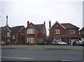
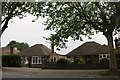
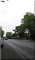
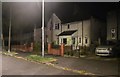
Photos of LN2 4EE


Area Information
LN2 4EE is a small, densely populated residential area in England, covering just 1.1 hectares and home to 1,295 people. Its compact size means it feels like a tight-knit community, with a population density of 117,060 people per square kilometre. This is a place where daily life is shaped by proximity—shops, transport hubs, and local amenities are all within easy reach. The area’s residents are predominantly adults aged 30–64, with a median age of 47, suggesting a mix of established families and long-term residents. While the housing stock is primarily owner-occupied, with 50% of homes owned by residents, the area’s small footprint means every property is part of a closely connected network. Living here offers convenience but also a sense of limitation, as the space is defined by its immediate surroundings. The lack of natural constraints like protected woodlands or AONB designations means development is unencumbered, though the high density ensures a lively, if compact, urban atmosphere.
- Area Type
- Postcode
- Area Size
- 1.1 hectares
- Population
- 1295
- Population Density
- 5723 people/km²
The property market in LN2 4EE is characterised by a 50% home ownership rate, indicating a balance between owner-occupied and rental properties. The accommodation type is predominantly houses, which suggests the area is not dominated by flats or apartments. This mix may appeal to families seeking more space, though the small area size means housing options are limited. With only 1.1 hectares of land, the market is constrained, and properties are likely to be in close proximity to one another. For buyers, this could mean competition for available homes, particularly as the area’s high density means every property is part of a tightly packed network. The presence of rail stations nearby may also influence property desirability, offering commuters access to nearby cities. However, the lack of planning constraints, such as protected woodlands or AONB designations, means development is not restricted, potentially affecting future property values.
House Prices in LN2 4EE
Showing 27 properties
| Address | Type | Beds | Baths | Last Sale Price | Last Sale Date | |
|---|---|---|---|---|---|---|
| 31 Macaulay Drive, Lincoln, LN2 4EE | Terraced | 3 | 1 | £136,000 | Nov 2020 | |
| 47 Macaulay Drive, Lincoln, LN2 4EE | Semi-detached | - | - | £100,000 | Feb 2019 | |
| 27 Macaulay Drive, Lincoln, LN2 4EE | Terraced | 3 | 1 | £128,000 | Sep 2017 | |
| 50 Macaulay Drive, Lincoln, LN2 4EE | Terraced | 3 | - | £104,000 | Jun 2014 | |
| 72 Macaulay Drive, Lincoln, LN2 4EE | house | - | - | £60,000 | Sep 2012 | |
| 43 Macaulay Drive, Lincoln, LN2 4EE | Terraced | - | - | £110,000 | Dec 2007 | |
| 29 Macaulay Drive, Lincoln, LN2 4EE | house | - | - | £83,000 | Aug 2007 | |
| 46 Macaulay Drive, Lincoln, LN2 4EE | Terraced | - | - | £43,000 | Apr 2002 | |
| 70 Macaulay Drive, Lincoln, LN2 4EE | Terraced | - | - | £43,000 | Nov 2001 | |
| 52 Macaulay Drive, Lincoln, LN2 4EE | house | - | - | £35,000 | Apr 2000 |
Energy Efficiency in LN2 4EE
Living in LN2 4EE offers access to a range of nearby amenities, including five retail outlets such as Aldi St, Tesco Lincoln, and Lidl Deacon Road. These shops provide everyday essentials, making it convenient for residents to manage household needs without venturing far. The area’s three railway stations—Lincoln Central, Hykeham, and Saxilby—offer regular services to nearby towns and cities, facilitating both commuting and leisure travel. Two nearby airports, RAF Scampton and RAF Waddington, cater to those requiring air travel, though they may not serve general public passengers. While the area lacks large parks or leisure facilities, the compact layout ensures that shops, transport, and local services are all within practical reach. This proximity to amenities contributes to a functional, if modest, lifestyle, where daily routines are efficient but the space for expansion is limited.
Amenities
Schools
| Rank | School | Type | Entry gender | Ages |
|---|
Explore more schools in this area
Go to Schools tabDemographics
The community in LN2 4EE is predominantly composed of adults aged 30–64, with a median age of 47. This suggests a population that is largely settled, with families and professionals making up the majority. Home ownership stands at 50%, meaning half the properties are owner-occupied, while the other half are likely rented. The accommodation type is primarily houses, which, combined with the high population density, indicates a mix of family homes and smaller dwellings. The predominant ethnic group is White, reflecting a homogenous demographic profile. The area’s density—117,060 people per square kilometre—means living spaces are closely packed, which can foster a sense of community but also limit private outdoor space. For buyers, this density may influence property values and the availability of larger homes, though the small area size means the housing stock is finite.
Household Size
Accommodation Type
Tenure
Ethnic Group
Religion
Household Composition
Age
Household Deprivation
NS-SEC
Explore more demographic insights in this area
Go to Demographics tabPlanning
Planning Constraints
- Flood RiskPremium
- Ramsar Wetland SitesPremium
- Area of Outstanding Natural BeautyPremium
- Protected Nature ReservePremium
- Protected WoodlandPremium