Area Overview for LN13 9SQ
Photos of LN13 9SQ
Area Information
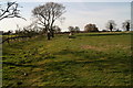
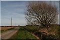
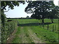
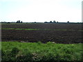
LN13 9SQ is a small, low-density residential area in England, spanning 45.5 hectares and home to 1977 people. With a population density of just 28 people per square kilometre, it offers a quiet, spacious living environment. The area is characterised by a predominantly older demographic, with a median age of 47 and most residents falling within the 30–64 age range. This suggests a community of established adults, many of whom are homeowners. The area’s compact size means it is likely to feel intimate, with homes and amenities closely clustered. Nearby, St Helena’s Church of England Primary School in Willoughby provides a local educational option, while five retail outlets, including Morrisons Daily and a Spar, cater to daily needs. Though small, LN13 9SQ blends practicality with a sense of stability, making it appealing to those seeking a manageable, community-focused lifestyle.
- Area Type
- Postcode
- Area Size
- 45.5 hectares
- Population
- 1977
- Population Density
- 28 people/km²
LN13 9SQ is a predominantly owner-occupied area, with 78% of residents living in homes they own. The accommodation type is exclusively houses, which is unusual for areas with higher population densities. This suggests a market skewed towards detached or semi-detached properties, likely catering to families or individuals seeking space. Given the small size of the area—45.5 hectares—and the high home ownership rate, the housing stock is limited. Buyers should consider nearby areas for more options, though the existing properties may offer a stable, long-term investment. The lack of flats or apartments indicates a market less focused on rental demand, prioritising private ownership.
House Prices in LN13 9SQ
Showing 1 properties
| Address | Type | Beds | Baths | Last Sale Price | Last Sale Date | |
|---|---|---|---|---|---|---|
| Oxleigh, Langham Road, Mumby, LN13 9SQ | Detached | 5 | 3 | - | - |
Energy Efficiency in LN13 9SQ
LN13 9SQ offers a selection of retail amenities within practical reach, including five venues such as Spar, Lincolnshire Co-operative, and Morrisons Daily. These shops provide essential services for daily living, from groceries to general retail. The area lacks specific references to parks, leisure facilities, or dining options in the provided data, but the presence of multiple retail outlets suggests a basic level of convenience. For residents prioritising practicality over extensive leisure options, the nearby shops may suffice. The low population density implies a slower pace of life, with fewer crowds and a focus on local, community-based amenities.
Amenities
Schools
The nearest school to LN13 9SQ is St Helena’s Church of England Primary School in Willoughby, which serves the local community. It is a primary school with an Ofsted rating of satisfactory, indicating it meets basic standards but may have room for improvement. The absence of secondary schools in the immediate area means families may need to look further afield for comprehensive education. However, the presence of a primary school suggests the area is family-friendly, with amenities catering to children’s needs. The single school listed reflects the small size of the area, but its adequacy for primary education could be a key draw for prospective buyers with young children.
| Rank | School | Type | Entry gender | Ages |
|---|
Explore more schools in this area
Go to Schools tabDemographics
The population of LN13 9SQ is predominantly composed of adults aged 30–64, with a median age of 47. This indicates a mature, settled community, likely with strong family ties. Home ownership is high, at 78%, reflecting a preference for long-term residency over rental properties. The area is largely composed of houses rather than flats, which aligns with the demographic profile of older, established residents. The predominant ethnic group is White, though no specific data on diversity or deprivation is provided. The low population density of 28 people per square kilometre suggests a spread-out, possibly rural or semi-rural setting, which may contribute to a quieter, less congested lifestyle.
Household Size
Accommodation Type
Tenure
Ethnic Group
Religion
Household Composition
Age
Household Deprivation
NS-SEC
Explore more demographic insights in this area
Go to Demographics tabPlanning
Planning Constraints
- Flood RiskPremium
- Ramsar Wetland SitesPremium
- Area of Outstanding Natural BeautyPremium
- Protected Nature ReservePremium
- Protected WoodlandPremium