Area Overview for LN13 9SJ
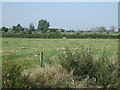
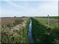
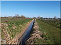
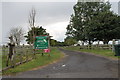
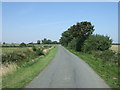
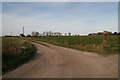
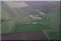
Photos of LN13 9SJ

Area Information
LN13 9SJ is a small residential cluster in England, spanning 54.8 hectares and home to 1,977 residents. With a population density of 28 people per square kilometre, it is a low-density area characterised by a quiet, community-focused atmosphere. The area is predominantly occupied by adults aged 30–64, with a median age of 47, suggesting a stable, mature demographic. Most homes are owner-occupied, reflecting a long-term presence of families and individuals. Daily life here is shaped by proximity to local amenities, though the area’s small size means residents must balance convenience with the need to travel for broader services. The postcode’s compact nature creates a tight-knit community, where familiarity with neighbours is common. However, the area’s flood risk is a critical concern, which prospective buyers should consider alongside its otherwise low crime rates and modest living costs. Living in LN13 9SJ offers a blend of simplicity and practicality, ideal for those prioritising a slower pace of life near essential services.
- Area Type
- Postcode
- Area Size
- 54.8 hectares
- Population
- 1977
- Population Density
- 28 people/km²
The property market in LN13 9SJ is largely owner-occupied, with 78% of homes owned by their residents. This high rate of home ownership indicates a stable, long-term community with limited turnover, which can be appealing to buyers seeking a settled environment. The accommodation type is predominantly houses, suggesting a mix of family homes and single-dwelling properties. Given the area’s small size and low population density, the housing stock is limited, which may mean that properties are more spread out and less densely packed than in larger urban centres. For buyers, this means fewer options but potentially more space per property. The focus on owner-occupation also implies that rental properties are scarce, which could be a consideration for those relying on the private rental market. The area’s compact nature means that property values are closely tied to proximity to local amenities, such as schools and retail, which are within practical reach for most residents.
House Prices in LN13 9SJ
Showing 5 properties
| Address | Type | Beds | Baths | Last Sale Price | Last Sale Date | |
|---|---|---|---|---|---|---|
| Meadow Side, Langham Road, Mumby, LN13 9SJ | Bungalow | - | - | £155,000 | May 2017 | |
| Langham House Farm, Langham Road, Mumby, LN13 9SJ | Bungalow | 3 | - | - | - | |
| Hawnby House, Langham Road, Mumby, LN13 9SJ | Detached | 4 | 1 | - | - | |
| Langham Cottage, Langham Road, Mumby, LN13 9SJ | house | - | - | - | - | |
| Langham House Farm Cottage, Langham Road, Mumby, LN13 9SJ | house | - | - | - | - |
Energy Efficiency in LN13 9SJ
Residents of LN13 9SJ have access to a range of nearby amenities, including five retail outlets such as Spar on Chapel Street, the Lincolnshire Co-operative, and Morrisons Daily. These shops provide essential services for daily living, from groceries to household supplies, reducing the need for long journeys to larger towns. The presence of these venues contributes to a practical, self-contained lifestyle, where basic needs can be met without significant travel. While the data does not specify other amenities like parks or leisure facilities, the retail options suggest a community focused on convenience and local commerce. The area’s small size means that these amenities are likely within walking or short driving distance, enhancing the appeal for those who value ease of access. For buyers, this implies that living in LN13 9SJ offers a balance between residential tranquillity and the availability of necessary services.
Amenities
Schools
The nearest school to LN13 9SJ is St Helena’s Church of England Primary School in Willoughby, which provides primary education for local children. The school has an Ofsted rating of satisfactory, indicating it meets basic standards but may have areas for improvement. As the only named school in the data, it is the primary educational option for families in the area. The presence of a single primary school suggests that parents may need to look further afield for secondary education, though the school’s proximity to the postcode makes it a convenient choice for younger children. The satisfactory rating means that while the school functions adequately, it may not offer the high standards of teaching or facilities found in more highly rated institutions. For families prioritising strong local schools, this could be a limiting factor, though the area’s small size ensures that travel times to other educational institutions are likely manageable.
| Rank | School | Type | Entry gender | Ages |
|---|
Explore more schools in this area
Go to Schools tabDemographics
The community in LN13 9SJ is defined by its age profile and home ownership patterns. With a median age of 47 and 78% of residents owning their homes, the area is predominantly occupied by middle-aged adults, many of whom are likely to be long-term residents. The most common age range, 30–64 years, suggests a population focused on family life or retirement, with fewer young families or students. Home ownership is high, indicating economic stability, though the 22% rental market may reflect younger or transient residents. The predominant ethnic group is White, and the area’s low population density of 28 people per square kilometre points to a spread-out, less congested living environment. This demographic profile shapes a community that values privacy and established routines, with limited diversity in household composition. For buyers, this suggests a neighbourhood where property values may be influenced more by location and condition than by broader market trends.
Household Size
Accommodation Type
Tenure
Ethnic Group
Religion
Household Composition
Age
Household Deprivation
NS-SEC
Explore more demographic insights in this area
Go to Demographics tabPlanning
Planning Constraints
- Flood RiskPremium
- Ramsar Wetland SitesPremium
- Area of Outstanding Natural BeautyPremium
- Protected Nature ReservePremium
- Protected WoodlandPremium