Area Overview for LN13 9TL
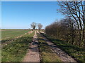
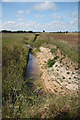
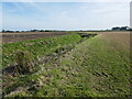
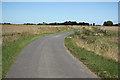
Photos of LN13 9TL
Area Information
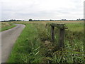
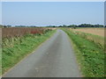
LN13 9TL is a small residential postcode area in England, covering 90.6 hectares and home to 1977 residents. With a population density of 28 people per square kilometre, it is a low-density, spread-out community. The area’s compact size means it is likely to feel quiet and secluded, though its proximity to nearby amenities and services may vary. Daily life here is shaped by its demographic profile: the median age is 47, with most residents falling in the 30-64 age range. This suggests a stable, established community with a focus on family living. The area’s housing stock is predominantly composed of houses, reflecting a traditional, low-rise residential character. While the postcode is small, it is not isolated—residents have access to nearby retail and services, though the broadband connectivity score of 32 indicates limited internet infrastructure. However, mobile coverage is strong, scoring 82, which supports connectivity for daily communication and remote work. The area’s safety profile is mixed: crime risk is low, but flood risk is critical, which may influence long-term considerations for homeowners. For those seeking a quiet, family-oriented environment with a balance of stability and practical amenities, LN13 9TL offers a distinct, manageable footprint of living.
- Area Type
- Postcode
- Area Size
- 90.6 hectares
- Population
- 1977
- Population Density
- 28 people/km²
The property market in LN13 9TL is characterised by high home ownership, with 78% of residents owning their homes. This suggests a stable, long-term market where property is likely to be held by families rather than speculative investors. The accommodation type is predominantly houses, which aligns with the area’s low-density, residential layout. This contrasts with areas where flats or apartments dominate, and may appeal to buyers seeking more space and a traditional home environment. Given the small size of the postcode area, the housing stock is likely limited in volume, which could mean a competitive market for buyers. The high home ownership rate also implies that rental availability may be constrained, though specific data on rental rates or property turnover is not provided. For buyers, this area may offer a sense of permanence and community cohesion, but the limited scale of the area means that immediate surrounding regions may need to be considered for a broader range of options.
House Prices in LN13 9TL
Showing 6 properties
| Address | Type | Beds | Baths | Last Sale Price | Last Sale Date | |
|---|---|---|---|---|---|---|
| Orchard Farmhouse, Thrumber Marsh Lane, Mumby, LN13 9TL | house | 5 | - | £495,000 | Oct 2019 | |
| The Manor, Thrumber Marsh Lane, Mumby, LN13 9TL | Detached | - | - | £281,000 | Jun 2007 | |
| Manor Barn, Thrumber Marsh Lane, Mumby, LN13 9TL | Detached | - | - | - | - | |
| Water Treatment Works, Thrumber Marsh Lane, Mumby, LN13 9TL | Industrial | - | - | - | - | |
| Annexe, Manor Barn, Thrumber Marsh Lane, Mumby, LN13 9TL | Bungalow | - | - | - | - | |
| Field House Farm, Thrumber Marsh Lane, Mumby, LN13 9TL | Detached | - | - | - | - |
Energy Efficiency in LN13 9TL
Residents of LN13 9TL have access to five retail amenities within practical reach, including Spar stores and the Lincolnshire Co-operative Co. These shops provide essential services such as groceries, convenience items, and basic household supplies, reducing the need for long trips to larger centres. The retail options suggest a functional, community-focused approach to shopping, though the absence of detailed data on other amenities like dining, parks, or leisure facilities means the full lifestyle picture remains incomplete. The small scale of the area implies that residents may need to travel further for more specialised services, such as healthcare or entertainment. Nonetheless, the presence of multiple retail outlets indicates a level of convenience for daily needs, supporting a self-contained, practical lifestyle.
Amenities
Schools
The nearest school to LN13 9TL is St Helena’s Church of England Primary School in Willoughby, which serves the primary education needs of local children. The school is rated as satisfactory by Ofsted, indicating it meets basic standards but may have areas for improvement. As a primary school, it is the first step in the educational journey for young residents, though no secondary schools are listed in the data. The presence of a single primary school suggests that families may need to travel to nearby areas for secondary education, which could be a consideration for parents. The school’s rating, while not outstanding, may be sufficient for those prioritising proximity over academic performance. The limited number of schools in the immediate vicinity highlights the need for a broader assessment of educational options beyond the postcode itself.
| Rank | School | Type | Entry gender | Ages |
|---|
Explore more schools in this area
Go to Schools tabDemographics
The community in LN13 9TL is predominantly composed of adults aged 30-64, with a median age of 47. This indicates a mature, settled population, likely with established careers and family ties. Home ownership is high at 78%, suggesting a stable housing market where most residents are long-term property owners. The accommodation type is primarily houses, which aligns with the area’s low-density, residential character. The predominant ethnic group is White, which reflects the broader demographic trends in rural and semi-rural England. The population density of 28 people per square kilometre implies a spacious, less congested environment, which may appeal to those seeking privacy and outdoor space. While no specific data on deprivation or income levels is provided, the high home ownership rate and age profile suggest a community with relatively stable economic conditions. However, the absence of detailed socioeconomic data means that broader quality-of-life factors, such as access to healthcare or leisure, remain unexplored in this context.
Household Size
Accommodation Type
Tenure
Ethnic Group
Religion
Household Composition
Age
Household Deprivation
NS-SEC
Explore more demographic insights in this area
Go to Demographics tabPlanning
Planning Constraints
- Flood RiskPremium
- Ramsar Wetland SitesPremium
- Area of Outstanding Natural BeautyPremium
- Protected Nature ReservePremium
- Protected WoodlandPremium