Area Overview for LN11 9DH
Photos of LN11 9DH
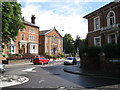

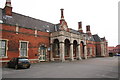
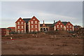

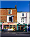


100 photos from this area
Area Information
Key information about the LN11 9DH including its size, population, and administrative classification.
- Area Type
- Postcode
- Area Size
- 6447 m²
- Population
- 1352
- Population Density
- 1213 people/km²
House Prices in LN11 9DH
24
Properties
£116,995
Average Sold Price
£42,000
Lowest Price
£179,995
Highest Price
Showing 24 properties
| Address | Type | Beds | Baths | Last Sale Price | Last Sale Date | |
|---|---|---|---|---|---|---|
| 58 Mount Pleasant Avenue, Louth, LN11 9DH | Terraced | 3 | 1 | £165,000 | Mar 2025 | |
| 55 Mount Pleasant Avenue, Louth, LN11 9DH | house | 3 | - | £179,995 | Feb 2023 | |
| 50 Mount Pleasant Avenue, Louth, LN11 9DH | Terraced | 3 | 1 | £140,000 | Feb 2022 | |
| 59 Mount Pleasant Avenue, Louth, LN11 9DH | house | - | - | £145,000 | Dec 2021 | |
| 44 Mount Pleasant Avenue, Louth, LN11 9DH | Terraced | 3 | - | £120,000 | Apr 2017 | |
| 51 Mount Pleasant Avenue, Louth, LN11 9DH | house | 3 | - | £112,500 | Jul 2016 | |
| 41 Mount Pleasant Avenue, Louth, LN11 9DH | Terraced | 3 | 1 | £110,000 | Aug 2015 | |
| 53 Mount Pleasant Avenue, Louth, LN11 9DH | house | - | - | £70,000 | Feb 2014 | |
| 54 Mount Pleasant Avenue, Louth, LN11 9DH | house | - | - | £96,000 | Nov 2006 | |
| 62 Mount Pleasant Avenue, Louth, LN11 9DH | Terraced | - | - | £106,450 | Apr 2006 |
Page 1 of 3
Energy Efficiency in LN11 9DH
Amenities
Schools
| Rank | School | Type | Entry gender | Ages |
|---|
Explore more schools in this area
Go to Schools tabDemographics
Household Size
Two person
most common
Accommodation Type
Houses
most common
Tenure
66
majority
Ethnic Group
White
most common
Religion
N/A
most common
Household Composition
N/A
most common
Age
47
median
Adults (30-64 years)
most common
Household Deprivation
N/A
with no deprivation
NS-SEC
25
in Lower managerial occupations
Explore more demographic insights in this area
Go to Demographics tabPlanning
Planning Constraints
- Flood RiskPremium
- Ramsar Wetland SitesPremium
- Area of Outstanding Natural BeautyPremium
- Protected Nature ReservePremium
- Protected WoodlandPremium