Area Overview for LN11 9FB
Photos of LN11 9FB
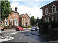

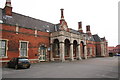
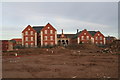

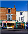

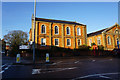
100 photos from this area
Area Information
Key information about the LN11 9FB including its size, population, and administrative classification.
- Area Type
- Postcode
- Area Size
- 1.5 hectares
- Population
- 2329
- Population Density
- 3755 people/km²
House Prices in LN11 9FB
28
Properties
£178,400
Average Sold Price
£62,000
Lowest Price
£375,000
Highest Price
Showing 28 properties
| Address | Type | Beds | Baths | Last Sale Price | Last Sale Date | |
|---|---|---|---|---|---|---|
| 23 Robinson Lane, Louth, LN11 9FB | Detached | 3 | 2 | £305,000 | Nov 2024 | |
| 13 Robinson Lane, Louth, LN11 9FB | Detached | 4 | 3 | £375,000 | Jun 2023 | |
| 14 Robinson Lane, Louth, LN11 9FB | Detached | 4 | 2 | £275,000 | Nov 2021 | |
| 21 Robinson Lane, Louth, LN11 9FB | house | - | - | £262,500 | Aug 2021 | |
| 15 Robinson Lane, Louth, LN11 9FB | Detached | 4 | 2 | £258,000 | Sep 2019 | |
| 2 Robinson Lane, Louth, LN11 9FB | Detached | 4 | - | £265,000 | Feb 2019 | |
| 17 Robinson Lane, Louth, LN11 9FB | Detached | 4 | - | £260,000 | May 2017 | |
| 11 Robinson Lane, Louth, LN11 9FB | Detached | 4 | - | £225,000 | Aug 2015 | |
| 7 Robinson Lane, Louth, LN11 9FB | house | - | - | £146,000 | Jan 2014 | |
| 29 Robinson Lane, Louth, LN11 9FB | Detached | - | - | £230,000 | Oct 2012 |
Page 1 of 3
Energy Efficiency in LN11 9FB
Amenities
Schools
| Rank | School | Type | Entry gender | Ages |
|---|
Explore more schools in this area
Go to Schools tabDemographics
Household Size
One person
most common
Accommodation Type
Houses
most common
Tenure
53
majority
Ethnic Group
White
most common
Religion
N/A
most common
Household Composition
N/A
most common
Age
47
median
Adults (30-64 years)
most common
Household Deprivation
N/A
with no deprivation
NS-SEC
26
in Lower managerial occupations
Explore more demographic insights in this area
Go to Demographics tabPlanning
Planning Constraints
- Flood RiskPremium
- Ramsar Wetland SitesPremium
- Area of Outstanding Natural BeautyPremium
- Protected Nature ReservePremium
- Protected WoodlandPremium