Area Overview for LN11 9DG
Photos of LN11 9DG
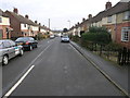
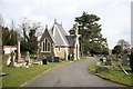
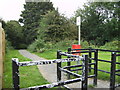
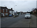
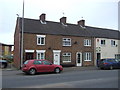
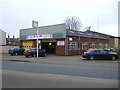
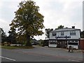
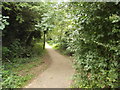
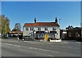

30 photos from this area
Area Information
Key information about the LN11 9DG including its size, population, and administrative classification.
- Area Type
- Postcode
- Area Size
- 1.8 hectares
- Population
- 1352
- Population Density
- 1213 people/km²
House Prices in LN11 9DG
48
Properties
£152,239
Average Sold Price
£45,000
Lowest Price
£395,000
Highest Price
Showing 48 properties
| Address | Type | Beds | Baths | Last Sale Price | Last Sale Date | |
|---|---|---|---|---|---|---|
| 2 Watts Lane, Louth, LN11 9DG | Terraced | 2 | 1 | £157,000 | Jan 2025 | |
| 10 Watts Lane, Louth, LN11 9DG | Terraced | 2 | 1 | £130,000 | May 2024 | |
| 32 Watts Lane, Louth, LN11 9DG | Terraced | 2 | 1 | £140,000 | Apr 2024 | |
| 52 Watts Lane, Louth, LN11 9DG | Bungalow | 2 | 1 | £250,000 | Jan 2024 | |
| 8 Watts Lane, Louth, LN11 9DG | Terraced | 2 | 1 | £125,000 | Nov 2023 | |
| 49 Watts Lane, Louth, LN11 9DG | Terraced | 3 | 2 | £160,000 | May 2023 | |
| 50 Watts Lane, Louth, LN11 9DG | Retail | 3 | 1 | £275,000 | Jul 2022 | |
| 20 Watts Lane, Louth, LN11 9DG | Detached | 5 | 3 | £395,000 | Dec 2021 | |
| 14 Watts Lane, Louth, LN11 9DG | house | - | - | £275,000 | Jun 2021 | |
| 43 Watts Lane, Louth, LN11 9DG | Semi-detached | 4 | 1 | £160,500 | Mar 2021 |
Page 1 of 5
Energy Efficiency in LN11 9DG
Amenities
Schools
| Rank | School | Type | Entry gender | Ages |
|---|
Explore more schools in this area
Go to Schools tabDemographics
Household Size
Two person
most common
Accommodation Type
Houses
most common
Tenure
66
majority
Ethnic Group
White
most common
Religion
N/A
most common
Household Composition
N/A
most common
Age
47
median
Adults (30-64 years)
most common
Household Deprivation
N/A
with no deprivation
NS-SEC
25
in Lower managerial occupations
Explore more demographic insights in this area
Go to Demographics tabPlanning
Planning Constraints
- Flood RiskPremium
- Ramsar Wetland SitesPremium
- Area of Outstanding Natural BeautyPremium
- Protected Nature ReservePremium
- Protected WoodlandPremium